
MyTopo
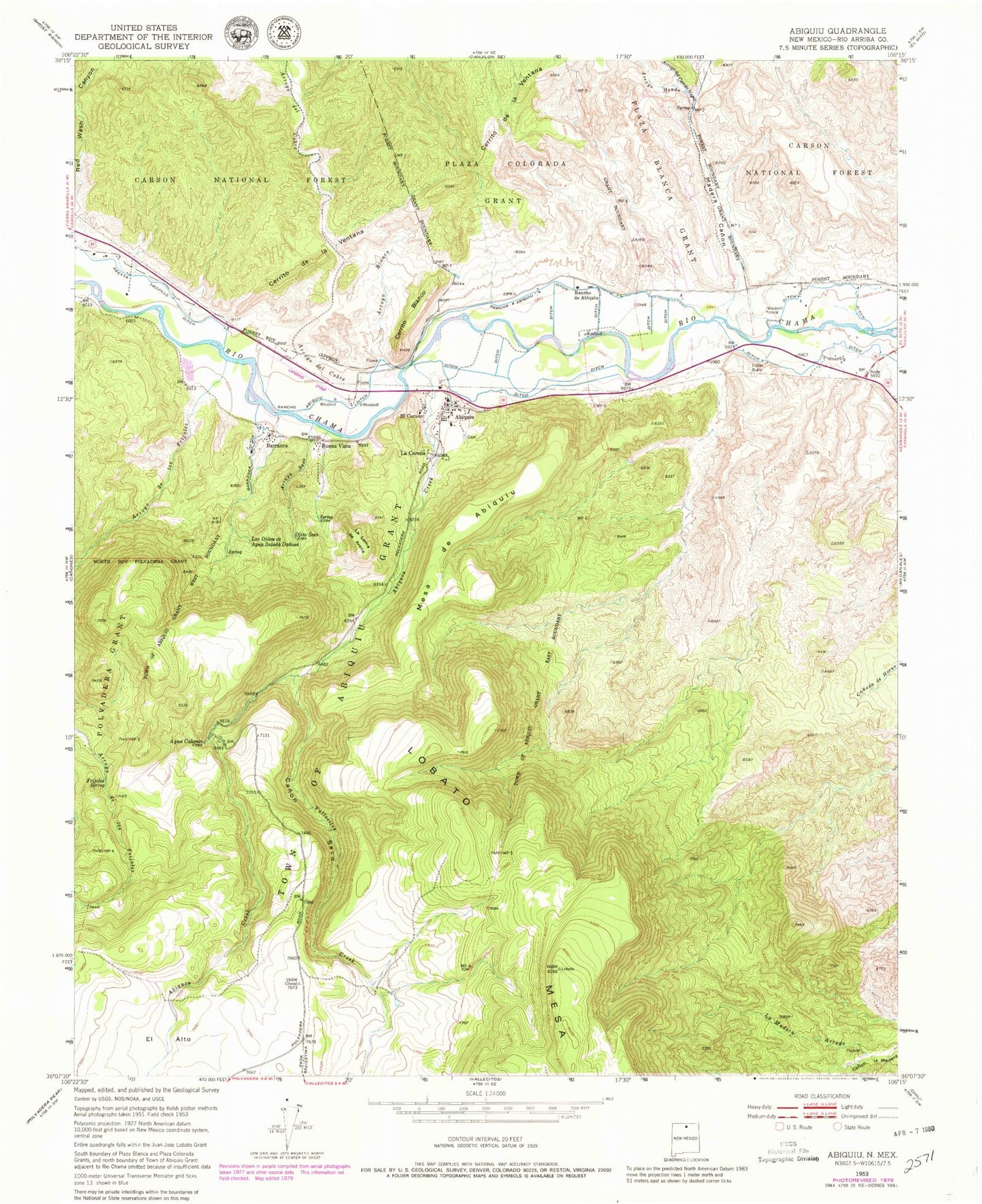
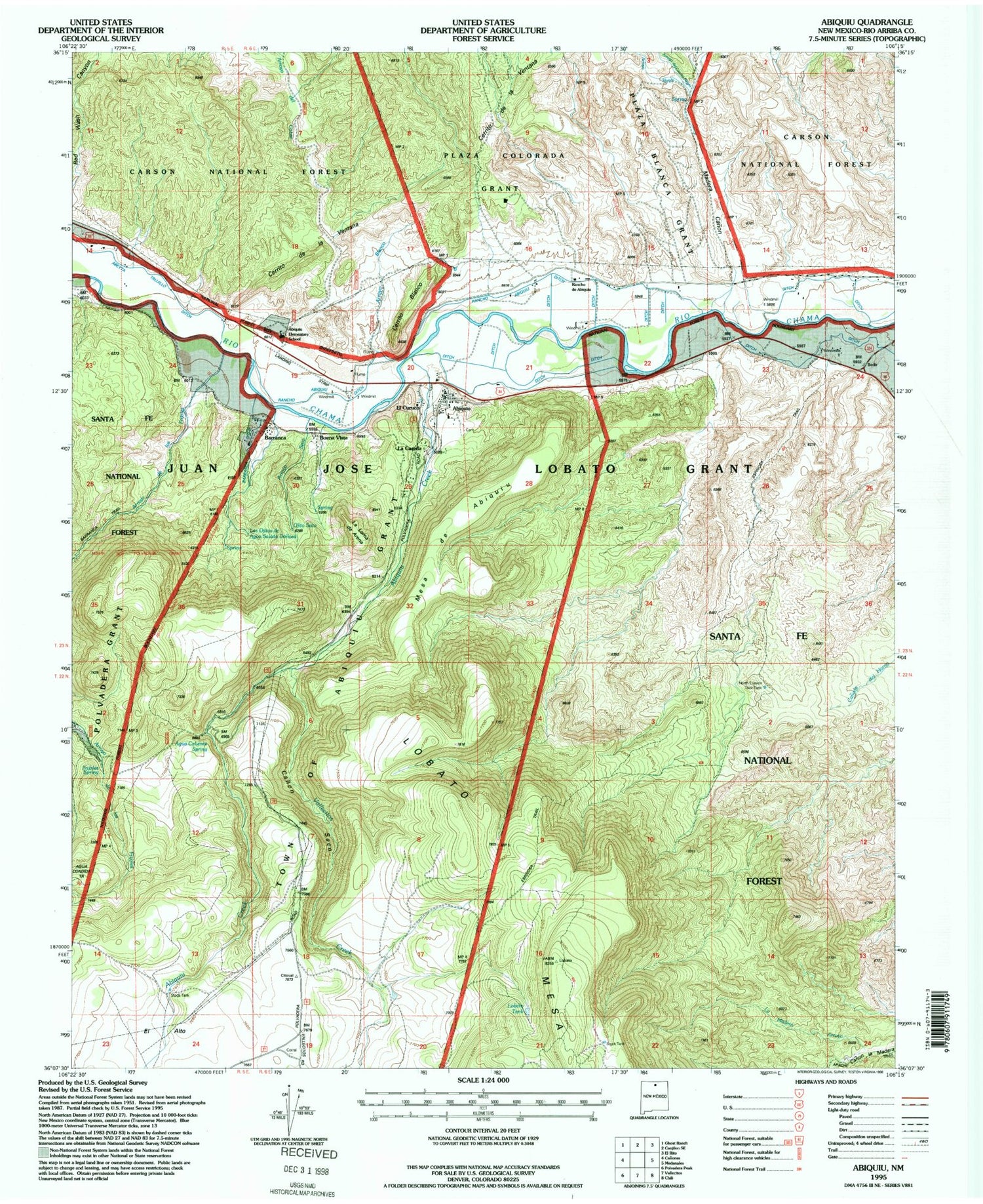
Classic USGS Abiquiu New Mexico 7.5'x7.5' Topo Map
Couldn't load pickup availability
Historical USGS topographic quad map of Abiquiu in the state of New Mexico. Map scale may vary for some years, but is generally around 1:24,000. Print size is approximately 24" x 27"
This quadrangle is in the following counties: Rio Arriba.
The map contains contour lines, roads, rivers, towns, and lakes. Printed on high-quality waterproof paper with UV fade-resistant inks, and shipped rolled.
Contains the following named places: Abeyta Trujillo Ditch, Abiquiu, Abiquiu Catholic Cemetery, Abiquiu Census Designated Place, Abiquiu Creek, Abiquiu Historical Marker, Abiquiu Post Office, Agua Caliente, Arroyo Blanco, Arroyo de los Frijoles, Arroyo del Cerrito Negro, Arroyo del Cobre, Arroyo Hondo, Arroyo Seco, Barranca, Barranca Ditch, Barranca Post Office, Barranca Trail, Buena Vista, Canon Seco, Cerrito Blanco, Cerrito de la Ventana, Cerrito Recreation Site, Dominguez-Velez de Escalente Trail Historical Marker, East Morada at Abiquiu Historic Site, El Curuco, Espinosa Trail, Frijoles Spring, Haqiqah Osrah School, La Careda, La Careda Census Designated Place, La Loma de Arena, La Madera Arroyo, Lily Belle, Lobato Tank, Los Ojitos de Agua Salada Danosa, Madera Canon, Mesa de Abiquiu, North Erosion Trick Tank, Ojito Seco, Old Spanish Trail Historical Marker, Rancho Abiquiu Ditch, Rancho de Abiquiu, RG-5971 Water Well, Santa Rosa de Lima de Abiquiu, Tawid School, Town of Abiquiu Grant, Vallecitos Creek, White Deposit