MyTopo
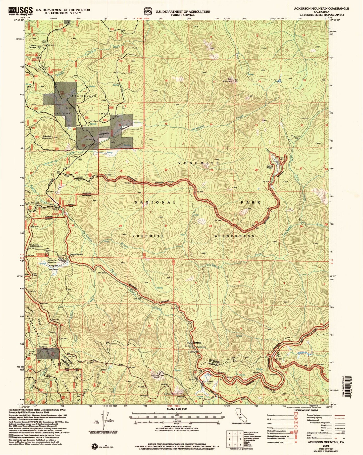
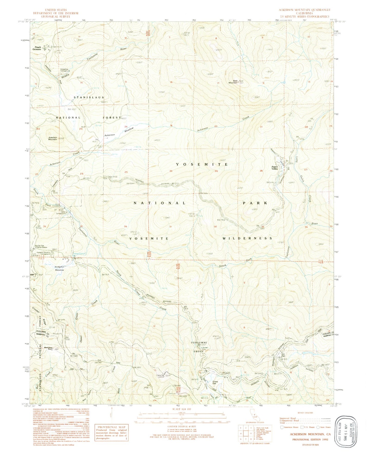
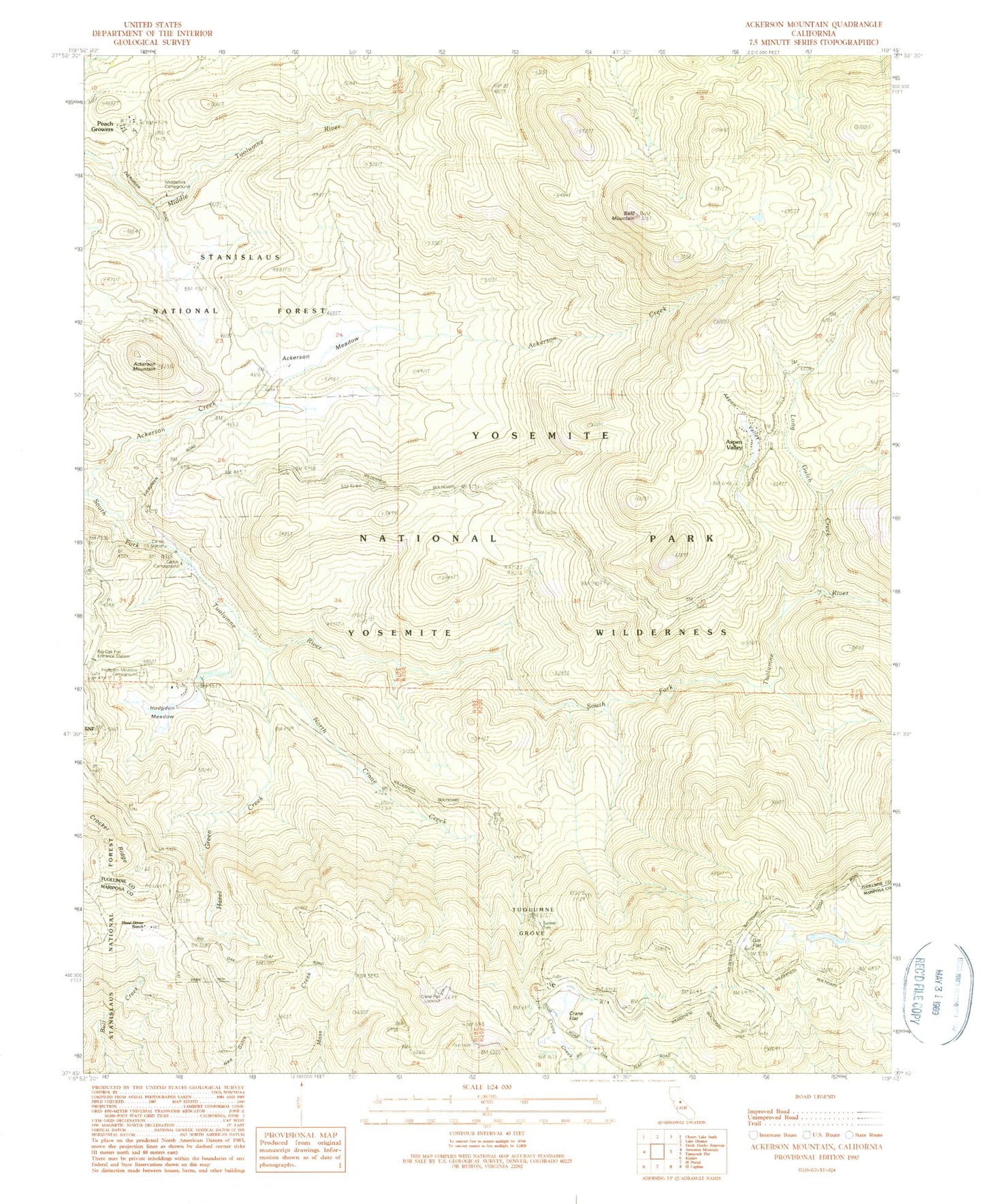
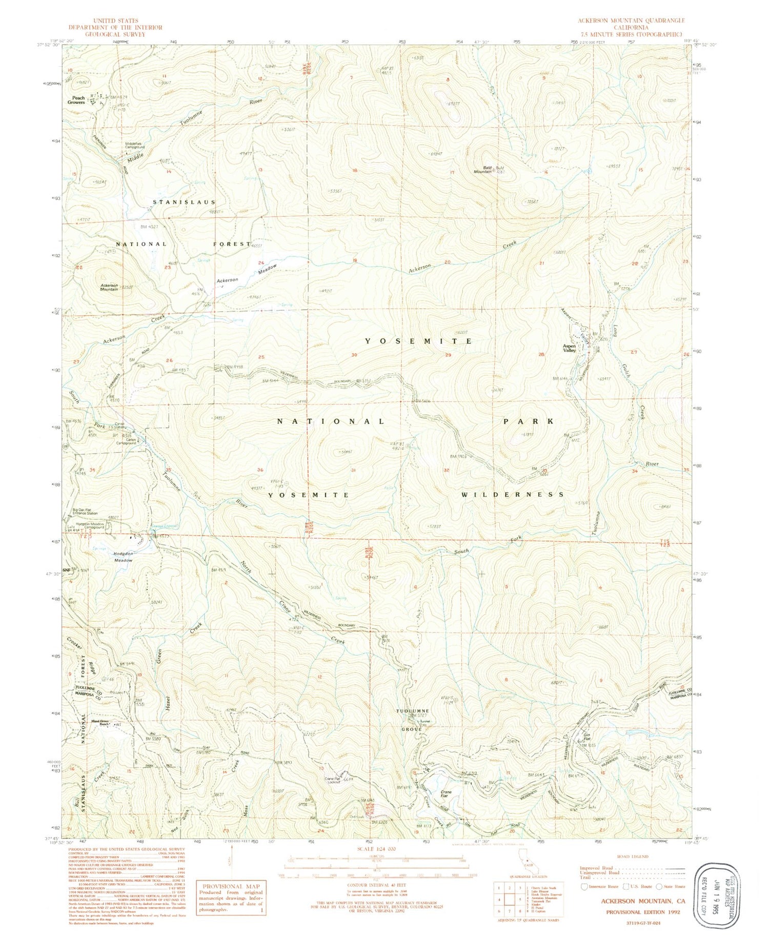
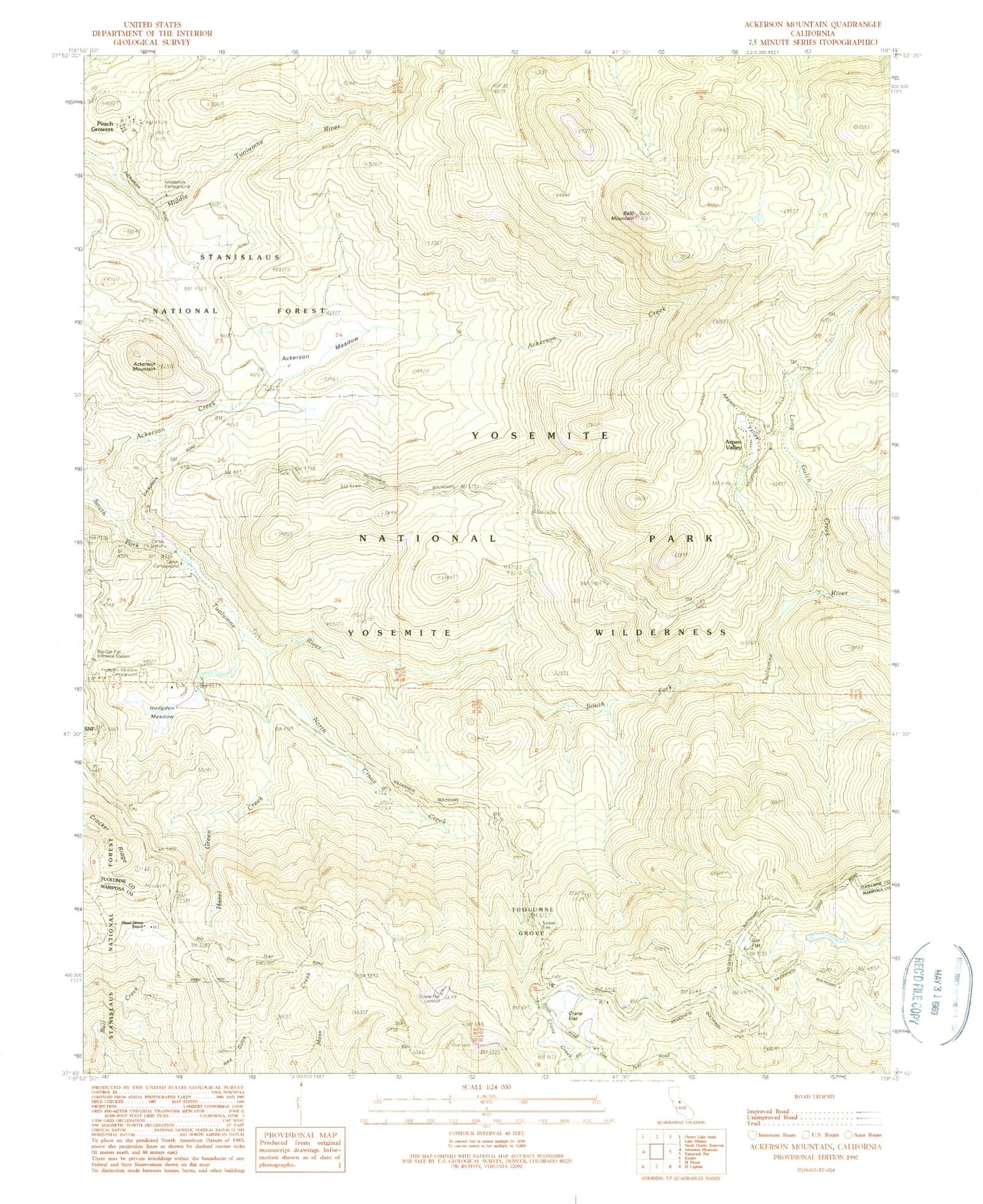
Classic USGS Ackerson Mountain California 7.5'x7.5' Topo Map
Couldn't load pickup availability
Historical USGS topographic quad map of Ackerson Mountain in the state of California. Typical map scale is 1:24,000, but may vary for certain years, if available. Print size: 24" x 27"
This quadrangle is in the following counties: Mariposa, Tuolumne.
The map contains contour lines, roads, rivers, towns, and lakes. Printed on high-quality waterproof paper with UV fade-resistant inks, and shipped rolled.
Contains the following named places: Crane Flat, Hodgdon Meadow, Carlon Campground, Peach Growers, Ackerson Meadow, Ackerson Mountain, Aspen Valley, Bald Mountain, Crane Flat Lookout, Crocker Ridge, Gin Flat, Hazel Green Creek, Hazel Green Ranch, Hodgdon Ranch (historical), North Crane Creek, Tunnel Tree, Tuolumne Grove, Diamond O Boy Scout Camp, Carlon Station, Middlefork Campground, Long Gulch, Crane Flat Ranger Station (historical), Aspen Valley, Big Oak Flat District Ranger Office, Hodgdon Meadow Campground, Long Gulch Creek, Crane Flat, Hodgdon Meadow, Carlon Campground, Peach Growers, Ackerson Meadow, Ackerson Mountain, Aspen Valley, Bald Mountain, Crane Flat Lookout, Crocker Ridge, Gin Flat, Hazel Green Creek, Hazel Green Ranch, Hodgdon Ranch (historical), North Crane Creek, Tunnel Tree, Tuolumne Grove, Diamond O Boy Scout Camp, Carlon Station, Middlefork Campground, Long Gulch, Crane Flat Ranger Station (historical), Aspen Valley, Big Oak Flat District Ranger Office, Hodgdon Meadow Campground, Long Gulch Creek