
MyTopo
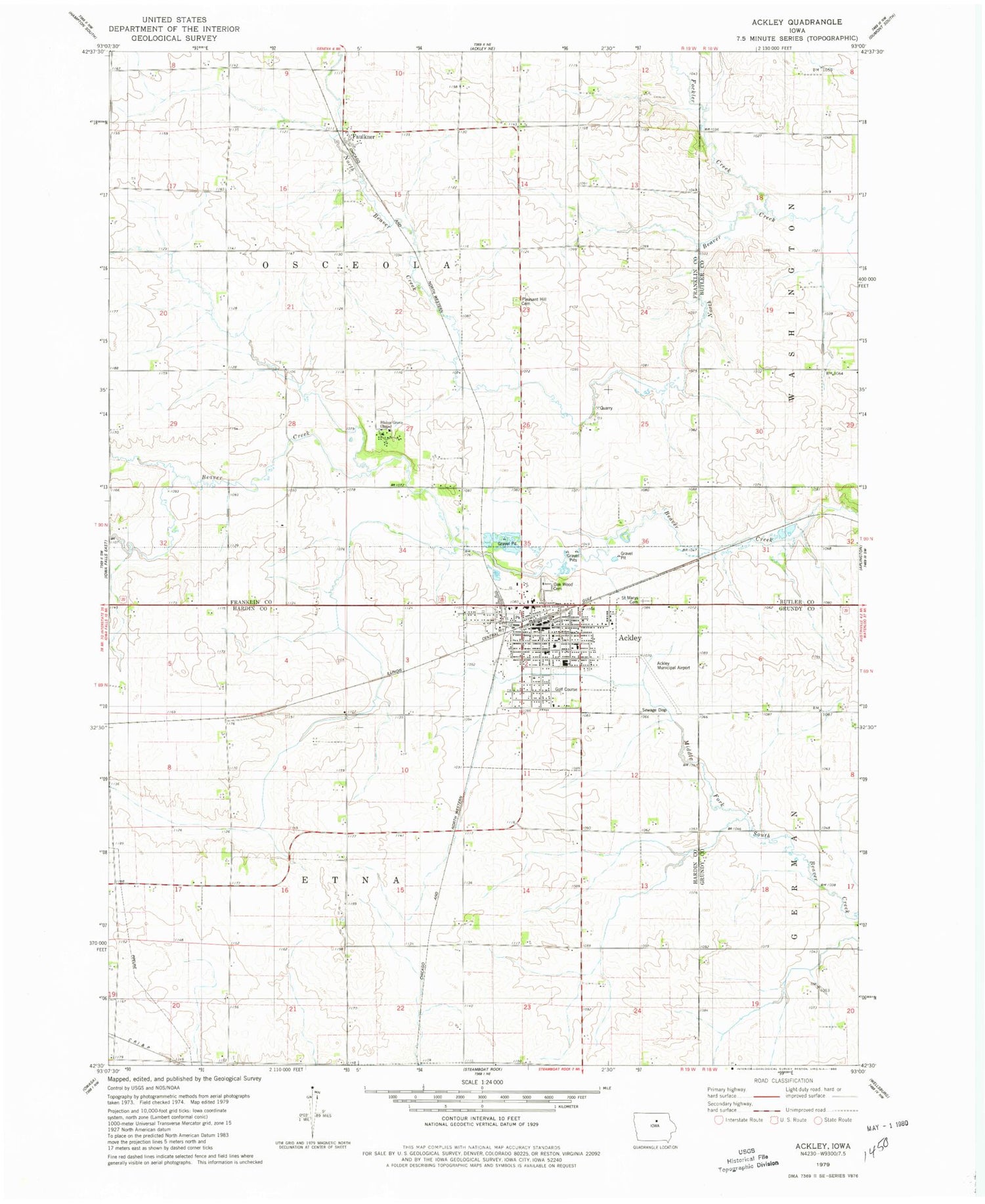
Classic USGS Ackley Iowa 7.5'x7.5' Topo Map
Couldn't load pickup availability
Historical USGS topographic quad map of Ackley in the state of Iowa. Map scale may vary for some years, but is generally around 1:24,000. Print size is approximately 24" x 27"
This quadrangle is in the following counties: Butler, Franklin, Grundy, Hardin.
The map contains contour lines, roads, rivers, towns, and lakes. Printed on high-quality waterproof paper with UV fade-resistant inks, and shipped rolled.
Contains the following named places: Ackley, Ackley Country Club, Ackley Heritage Center, Ackley Municipal Airport, Ackley Post Office, Ackley Public Library, Ackley Volunteer Ambulance Service, Ackley Volunteer Fire Department, AGWSR Elementary School, AGWSR High School, Blake's Grove Chapel, City of Ackley, Clutterville School, Farmers Cooperative Elevator, Faulkner, Faulkner Post Office, First Presbyterian Church, Fockler Creek, Mercy Family Clinic, Oak Wood Cemetery, Our Saviour's Lutheran Church, Pleasant Hill Cemetery, Prairie Bridges Park, Presbyterian Village, Saint John's United Church, Saint Mary's Catholic Church, Saint Mary's Cemetery, Township of Etna, Township of Osceola, United Methodist Church, Y's Motel and Campground, ZIP Code: 50601


