MyTopo
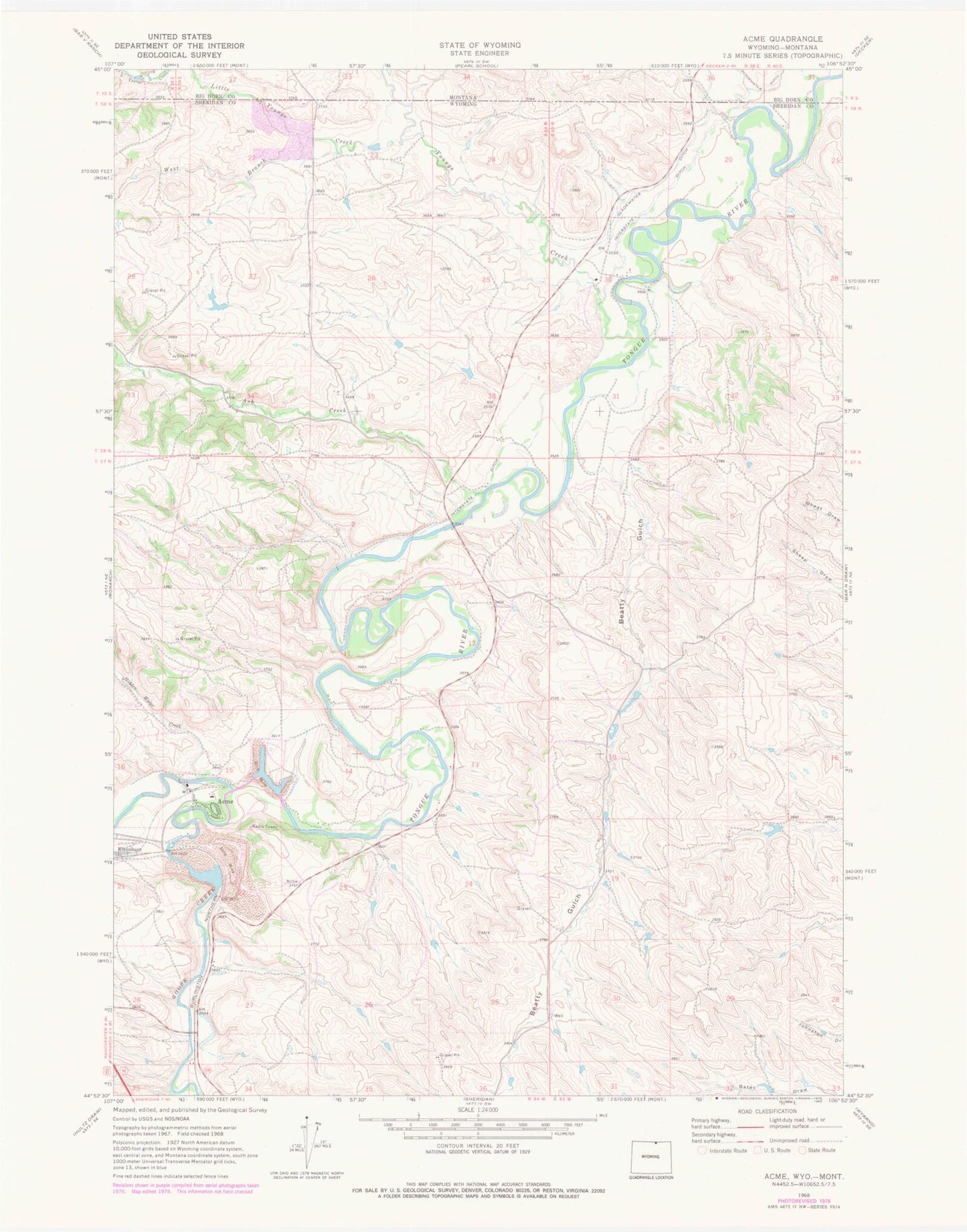
Classic USGS Acme Wyoming 7.5'x7.5' Topo Map
Couldn't load pickup availability
Historical USGS topographic quad map of Acme in the states of Wyoming, Montana. Map scale may vary for some years, but is generally around 1:24,000. Print size is approximately 24" x 27"
This quadrangle is in the following counties: Big Horn, Sheridan.
The map contains contour lines, roads, rivers, towns, and lakes. Printed on high-quality waterproof paper with UV fade-resistant inks, and shipped rolled.
Contains the following named places: 09S39E32CDAD01 Well, 09S39E33DDCC01 Well, 09S39E33DDCC02 Well, 09S39E33DDCD01 Well, 09S39E33DDDD01 Well, 09S39E34CCCC01 Well, 09S39E34CDCD01 Well, 58N84W23ABBC01 Well, 58N84W23BBCB01 Well, 58N84W23BBCB02 Well, Acme, Acme Number Forty-two Mine, Acme Number Two Mine, Ash Creek, Beatty Gulch, Big Horn Mine, Big Horn Number One Mine, Bighorn Mine, Dietz Number Five and Eight Mine, Evans Mine, Gladewater Ditch, Goose Creek, Hidden Water Creek, Hotchkiss Number Two Mine, Interstate Ditch, Little Youngs Creek, New Acme Mine, PSO Number One Mine, Roland Mine, Tongue River Stone Company Mine, Welch Number One North Mine, Welch Number One South Mine, Welch Number Two Mine, West Branch Little Youngs Creek, Whitney Mine, Youngs Creek, Youngs Creek Mine, Zowada Pit and Plachet Pit Mine