
MyTopo
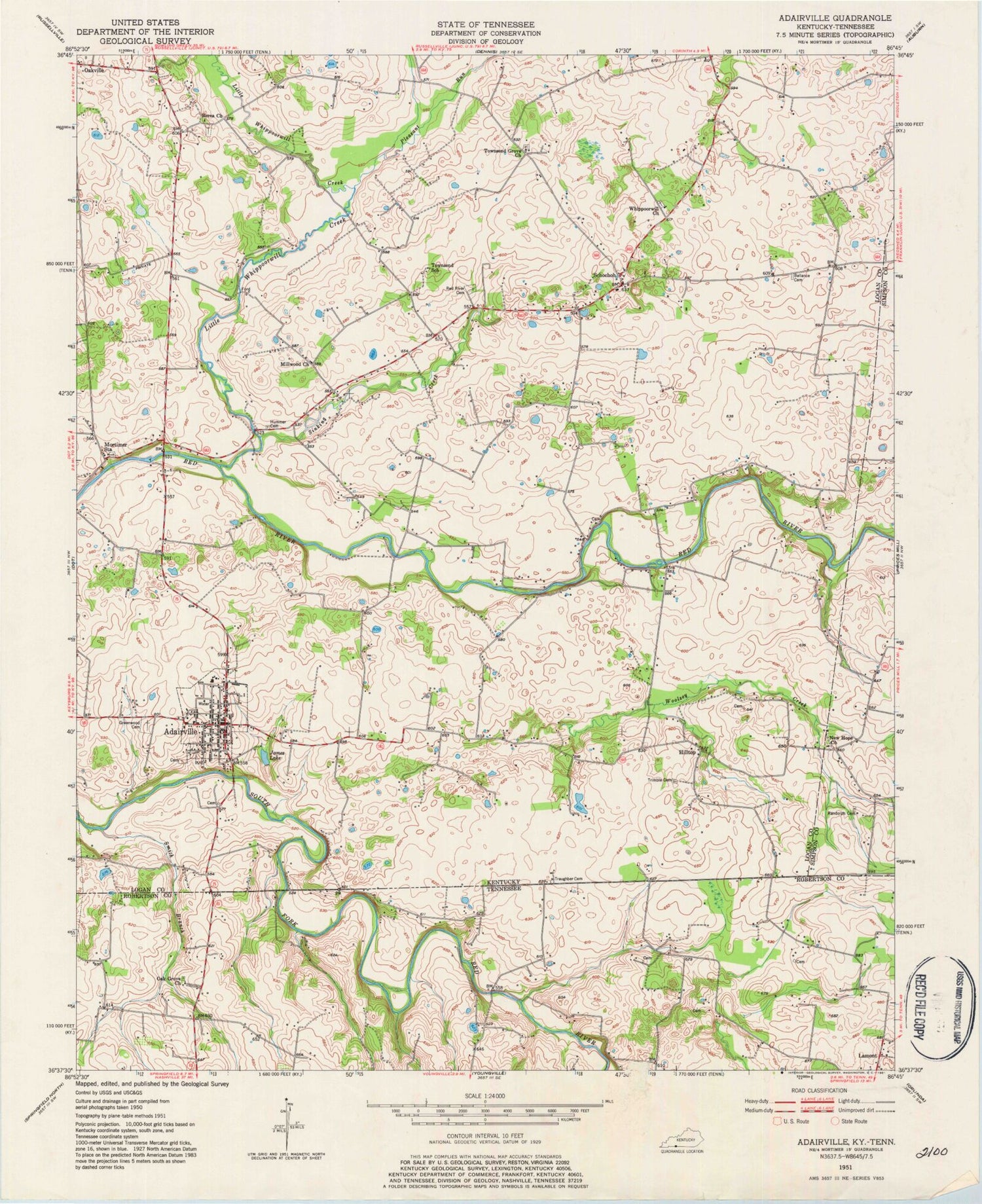
Classic USGS Adairville Kentucky 7.5'x7.5' Topo Map
Couldn't load pickup availability
Historical USGS topographic quad map of Adairville in the states of Kentucky, Tennessee. Map scale may vary for some years, but is generally around 1:24,000. Print size is approximately 24" x 27"
This quadrangle is in the following counties: Logan, Robertson, Simpson.
The map contains contour lines, roads, rivers, towns, and lakes. Printed on high-quality waterproof paper with UV fade-resistant inks, and shipped rolled.
Contains the following named places: Adairville, Adairville Police Department, Adairville Post Office, Adairville Volunteer Fire Department, Antioch, Ballance Cemetery, Berea Church, Chapman Cemetery, City of Adairville, Cook Cemetery, Farthing Cemetery, Greenwood Cemetery, Hilltop, Hummer Cemetery, James Lake, Little Whippoorwill Creek, Millwood Church, Moore Cemetery, Mortimer Station, New Hope Church, Oak Grove Baptist Church, Oak Grove Cemetery, Pearson Cemetery, Pleasant Run, Randolph Cemetery, Red River Cemetery, Schochoh, Scoggins-Gorham Cemetery, Sinking Creek, Smith Branch, Townsend Grove, Townsend Grove Church, Townsend School, Traughber Memorial Cemetery, Trimble Cemetery, Whippoorwill Church, Woolsey Creek, ZIP Code: 42202


