
MyTopo
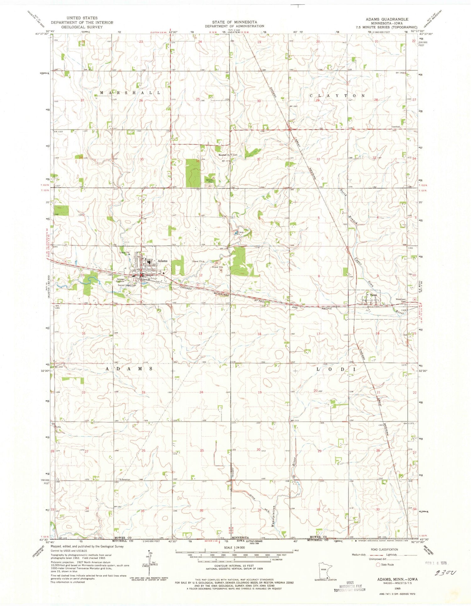
Classic USGS Adams Minnesota 7.5'x7.5' Topo Map
Couldn't load pickup availability
Historical USGS topographic quad map of Adams in the state of Minnesota. Map scale may vary for some years, but is generally around 1:24,000. Print size is approximately 24" x 27"
This quadrangle is in the following counties: Mitchell, Mower.
The map contains contour lines, roads, rivers, towns, and lakes. Printed on high-quality waterproof paper with UV fade-resistant inks, and shipped rolled.
Contains the following named places: Adams, Adams Area Ambulance Service, Adams Clinic, Adams Health Care Center, Adams Police Department, Adams Post Office, Adams Volunteer Fire Department, Cedar River Country Club, City of Adams, City of Taopi, East Willow Creek Dam, Gilgenbachs Airport, Judicial Ditch Number Six, Little Cedar Lutheran Church, Marshall Church Cemetery, Marshall Lutheran Church, Sacred Heart Cemetery, Sacred Heart Church, Sacred Heart School, Southland High School, Taopi, Taopi Post Office, Township of Adams, Township of Lodi, Woodlawn Cemetery, ZIP Codes: 55909, 55977


