
MyTopo
Classic USGS Addieville Illinois 7.5'x7.5' Topo Map
Couldn't load pickup availability
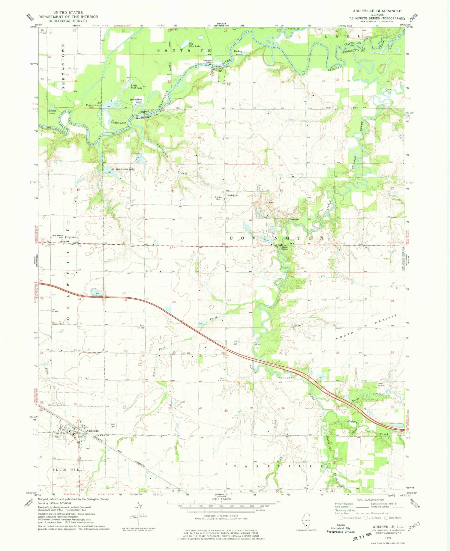
Historical USGS topographic quad map of Addieville in the state of Illinois. Map scale may vary for some years, but is generally around 1:24,000. Print size is approximately 24" x 27"
This quadrangle is in the following counties: Clinton, Washington.
The map contains contour lines, roads, rivers, towns, and lakes. Printed on high-quality waterproof paper with UV fade-resistant inks, and shipped rolled.
Contains the following named places: Addieville, Addieville Community Fire Protection District, Addieville Post Office, Beaver Pond Creek, Big Flat Lake, Big Forked Lake, Buckingham Branch, Carson School, Coon Creek, Covington, Covington Bridge, Crooked Creek, Frogtown, Going School, Grottendick School, Hogshead School, Horseshoe Lake, Little Crooked Creek, Little Flat Lake, Lively Cemetery, Lunte Creek, Middle Creek, Nashville Creek, North Creek, Old Zion Cemetery, Olive Branch Cemetery, Olive Branch Lutheran Church, RC Kremmers Lake, Round Lake, Saint Lukes Cemetery, Township of Covington, Turkey Lake, Village of Addieville, Wildcat Lake, Willow Creek, Zion Cemetery, Zion United Church of Christ


