MyTopo
Classic USGS Adna Washington 7.5'x7.5' Topo Map
Couldn't load pickup availability
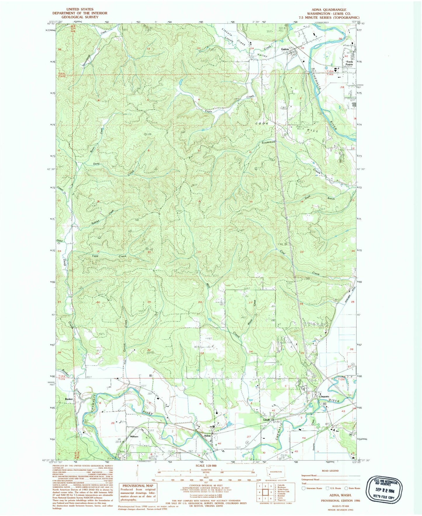
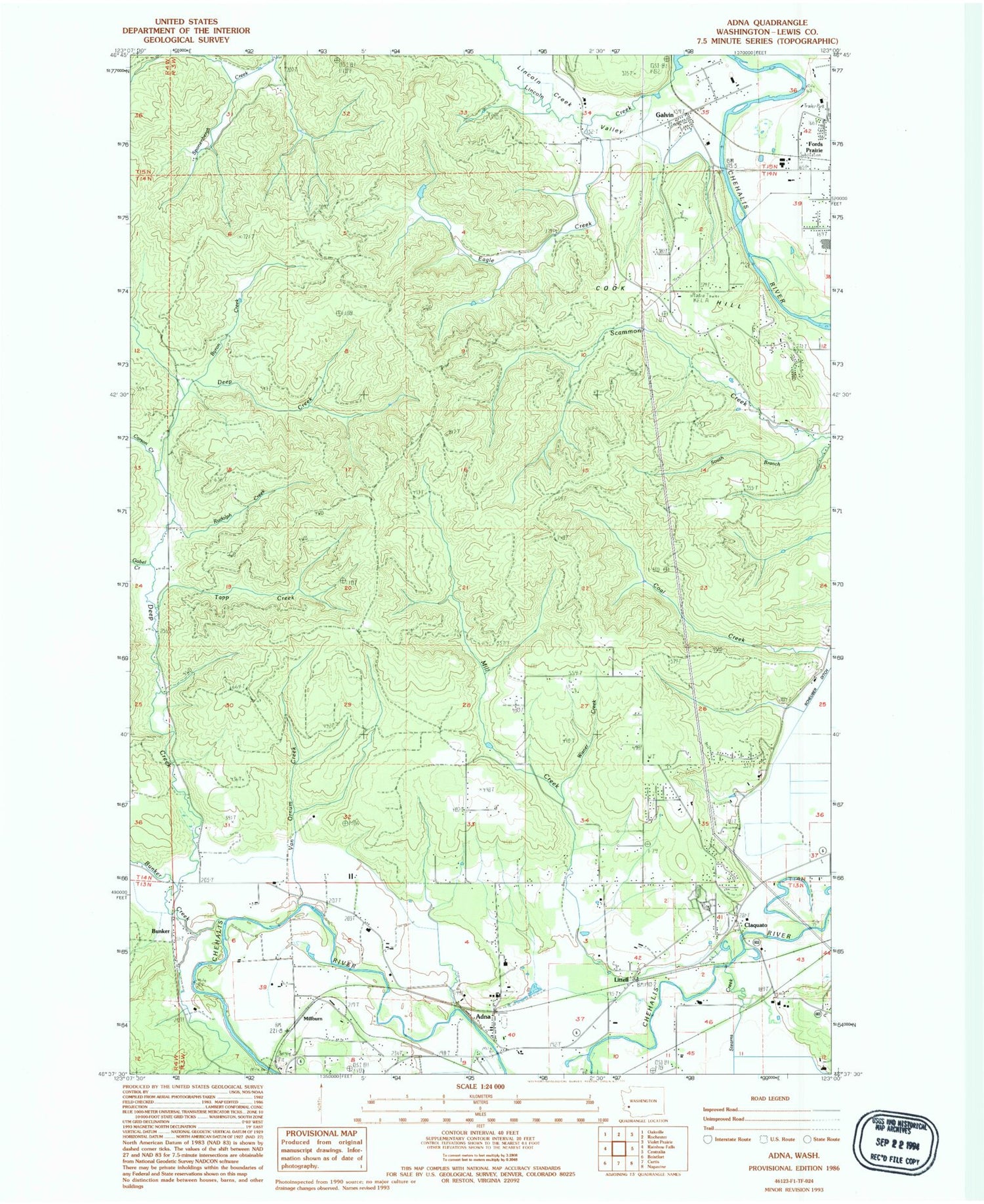
Historical USGS topographic quad map of Adna in the state of Washington. Map scale may vary for some years, but is generally around 1:24,000. Print size is approximately 24" x 27"
This quadrangle is in the following counties: Lewis.
The map contains contour lines, roads, rivers, towns, and lakes. Printed on high-quality waterproof paper with UV fade-resistant inks, and shipped rolled.
Contains the following named places: Adna, Adna Elementary School, Adna Middle - High School, Adna Post Office, Bunker, Bunker Creek, Byron Creek, Carson Creek, Centralia High School, Claquato, Claquato Cemetery, Cook Hill, Deep Creek, Eagle Creek, Eagle Creek Dam, Fayette, Fords Prairie Census Designated Place, Gabel Creek, Galvin, Galvin Post Office, Lewis County Adventist School, Lewis County Fire District 12 Riverside Fire Authority Station 5, Lewis County Fire District 6 Adna Station 62, Lincoln Creek, Lincoln Creek Valley, Littell, Mill Creek, Millburn, Rudolph Creek, Scammon Creek, South Branch Scammon Creek, Stearns Creek, Tapp Creek, Van Ornum Creek, Wisner Creek, ZIP Codes: 98532, 98544