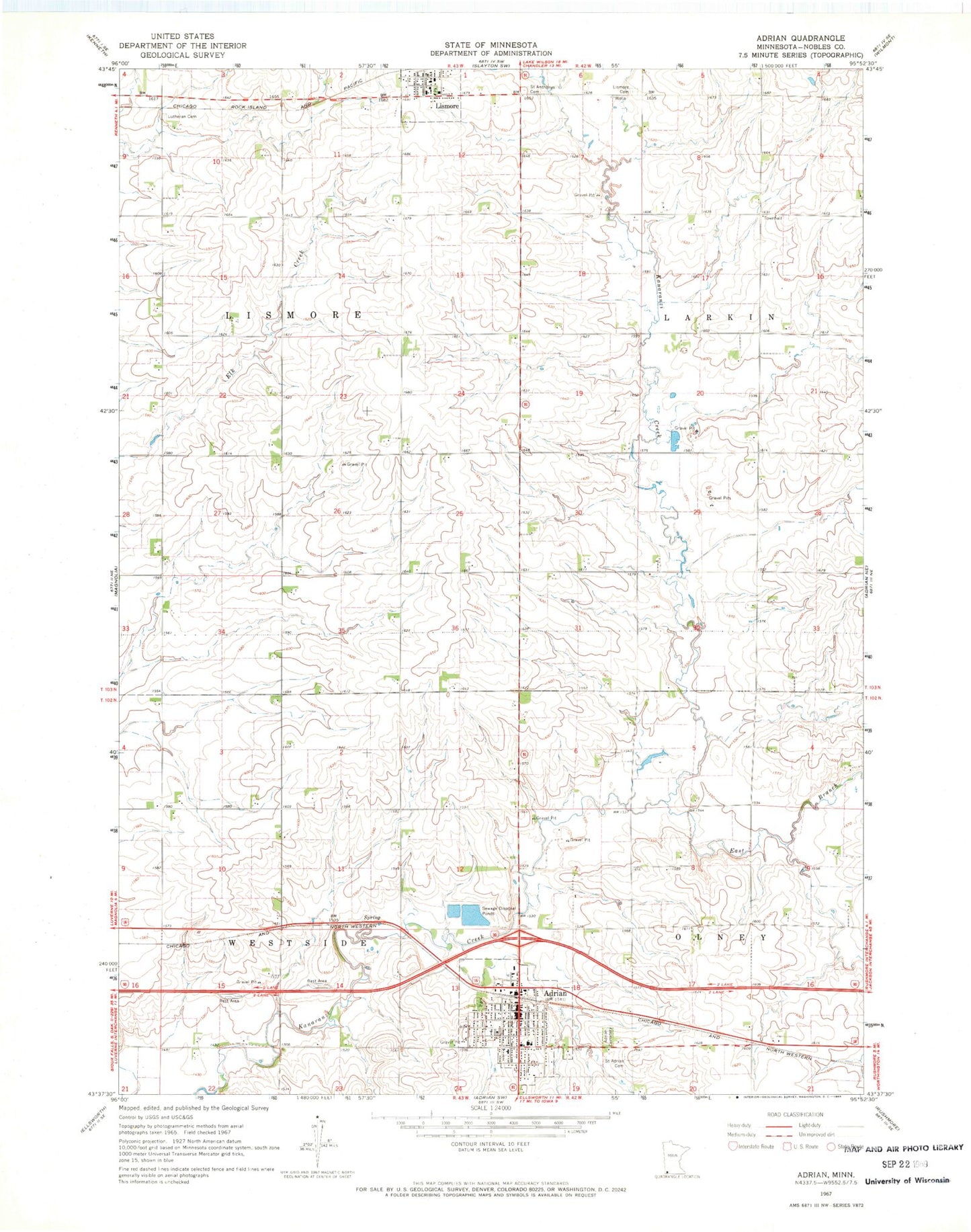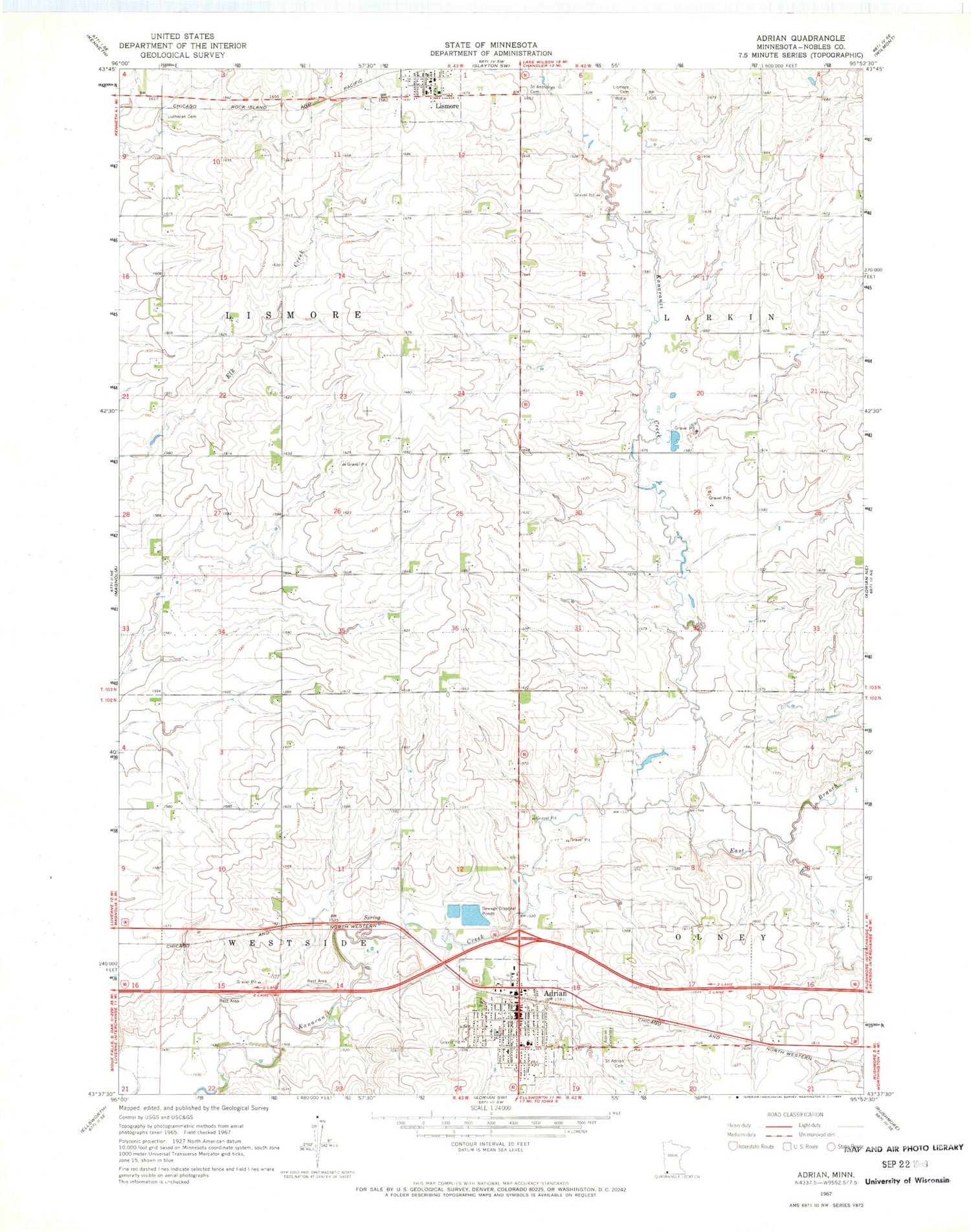
MyTopo
Classic USGS Adrian Minnesota 7.5'x7.5' Topo Map
Couldn't load pickup availability
Historical USGS topographic quad map of Adrian in the state of Minnesota. Map scale may vary for some years, but is generally around 1:24,000. Print size is approximately 24" x 27"
This quadrangle is in the following counties: Nobles.
The map contains contour lines, roads, rivers, towns, and lakes. Printed on high-quality waterproof paper with UV fade-resistant inks, and shipped rolled.
Contains the following named places: Adrian, Adrian Care Center, Adrian Cemetery, Adrian City Hall, Adrian Country Club, Adrian Elementary School, Adrian High School, Adrian Library, Adrian Municipal Campground, Adrian Police Department, Adrian Post Office, Adrian Spring County Park, Adrian United Methodist Church, Adrian Volunteer Fire Department and Volunteer Ambulance Service, City of Adrian, City of Lismore, East Branch Kanaranzi Creek, First Baptist Church, First Presbyterian Church, Grove Park, Lismore, Lismore Cemetery, Lismore City Park, Lismore Fire Department, Lismore Post Office, Lower Park, Midway County Park, Norwegian Lutheran Cemetery, Prairie Winds Zoo, Saint Adrian Catholic Church, Saint Adrian Cemetery, Saint Anthony's Catholic Church, Saint Anthonys Cemetery, Township of Lismore, Township of Westside, Zion Lutheran Church