MyTopo
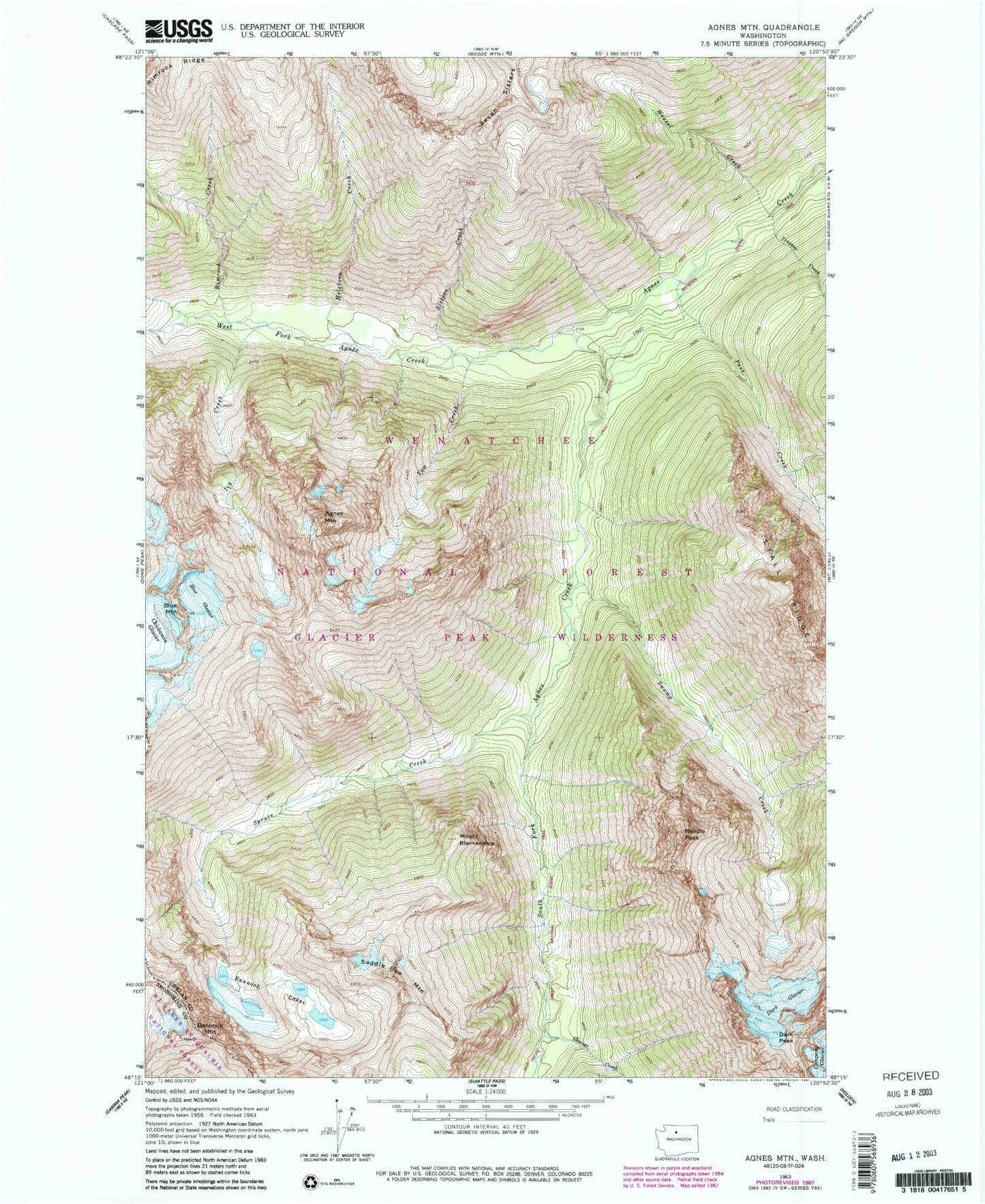
Classic USGS Agnes Mountain Washington 7.5'x7.5' Topo Map
Couldn't load pickup availability
Historical USGS topographic quad map of Agnes Mountain in the state of Washington. Map scale may vary for some years, but is generally around 1:24,000. Print size is approximately 24" x 27"
This quadrangle is in the following counties: Chelan, Snohomish.
The map contains contour lines, roads, rivers, towns, and lakes. Printed on high-quality waterproof paper with UV fade-resistant inks, and shipped rolled.
Contains the following named places: Agnes Mountain, Bannock Lakes, Bannock Mountain, Blue Glacier, Cedar Camp, Dark Glacier, Dark Peak, Fivemile Camp, Glacier Creek, Gunsight Peak, Helebore Creek, Hemlock Camp, Icy Creek, Lyall Ridge, Mount Blankenship, Needle Peak, Pass Creek, Rimrock Creek, Saddle Bow Mountain, Sisters Creek, South Fork Agnes Creek, Spruce Creek, Swamp Creek, Swamp Creek Camp, Trapper Creek, Weasel Creek, West Fork Agnes Creek, Yellow Creek