
MyTopo
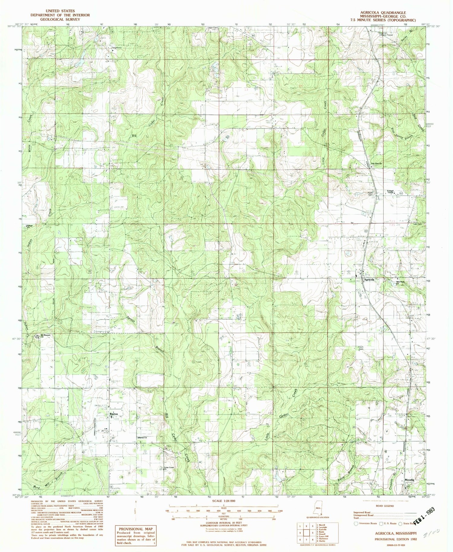
Classic USGS Agricola Mississippi 7.5'x7.5' Topo Map
Couldn't load pickup availability
Historical USGS topographic quad map of Agricola in the state of Mississippi. Map scale may vary for some years, but is generally around 1:24,000. Print size is approximately 24" x 27"
This quadrangle is in the following counties: George.
The map contains contour lines, roads, rivers, towns, and lakes. Printed on high-quality waterproof paper with UV fade-resistant inks, and shipped rolled.
Contains the following named places: Agricola, Agricola Baptist Church, Agricola Cemetery, Agricola Census Designated Place, Agricola High School, Agricola Volunteer Fire Department, Barton, Barton Baptist Church, Barton Cemetery, Barton Church, Barton Volunteer Fire Department, Basin Temple Church of God, Blue Spring Branch, Bond Lake Dam, Cedar Creek Air Ranch Airport, Cedar Creek Church, E W Smith Lake Dam, Evangel Temple, Farmco Field, Finch Cemetery, Heritage Baptist Church, James Farmer Lake Dam, Lee Cemetery, Lucedale Country Club, Lucedale Country Club Lake Dam, Marshall Smith Lake Dam, Mount Pleasant Cemetery, Mount Pleasant Church, Movella, Movella Assembly Of God Cemetery, Movella Missionary Baptist Church, Movella Volunteer Fire Department, New Hope Missionary Baptist Church, New Hope Missionary Baptist Church Cemetery, Old Mount Pleasant Cemetery, Old Mount Pleasant Methodist Church, Parker Lookout, Pine View Cemetery, Pine View Missionary Baptist Church, Refuge Church, Refuge Methodist Church Cemetery, Shipman Lookout Tower, Sky Landings, Sprout Branch, Union Cemetery, Vaughan, Vernon Howell Lake Dam, Ward, Ward School, Ward Volunteer Fire Department, White Creek School, ZIP Code: 39452


