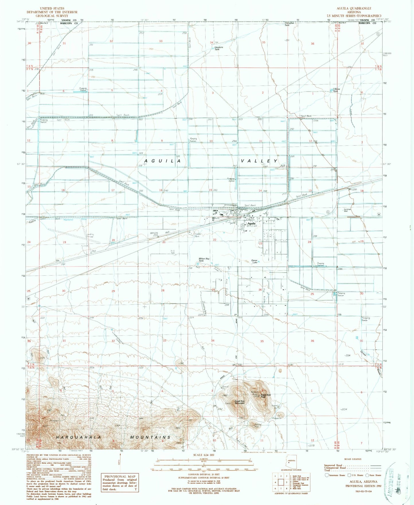
MyTopo
Classic USGS Aguila Arizona 7.5'x7.5' Topo Map
Couldn't load pickup availability
Historical USGS topographic quad map of Aguila in the state of Arizona. Map scale may vary for some years, but is generally around 1:24,000. Print size is approximately 24" x 27"
This quadrangle is in the following counties: Maricopa, Yavapai.
The map contains contour lines, roads, rivers, towns, and lakes. Printed on high-quality waterproof paper with UV fade-resistant inks, and shipped rolled.
Contains the following named places: Aguila, Aguila Census Designated Place, Aguila Elementary School, Aguila Post Office, Aguila Railroad Station, Aguila Substation, Aguila Volunteer Fire Department, Eagle Eye Cemetery, Eagle Eye Mountain, Eagle Eye Peak, Eagle Eye Ranch, Eagle Roost Airpark, Goose Lake, Grass Wash, Haydons Tank, Hillair Dirt Strip Airport, Hultman Well, Lapham Tank, Maricopa County Library District Aguila Branch, Milton Ray Tank, Natural Arch, Sampley's Airport, T-Bone Tank, The Eagles Beak, Tom Walder Memorial Park, ZIP Code: 85320