
MyTopo
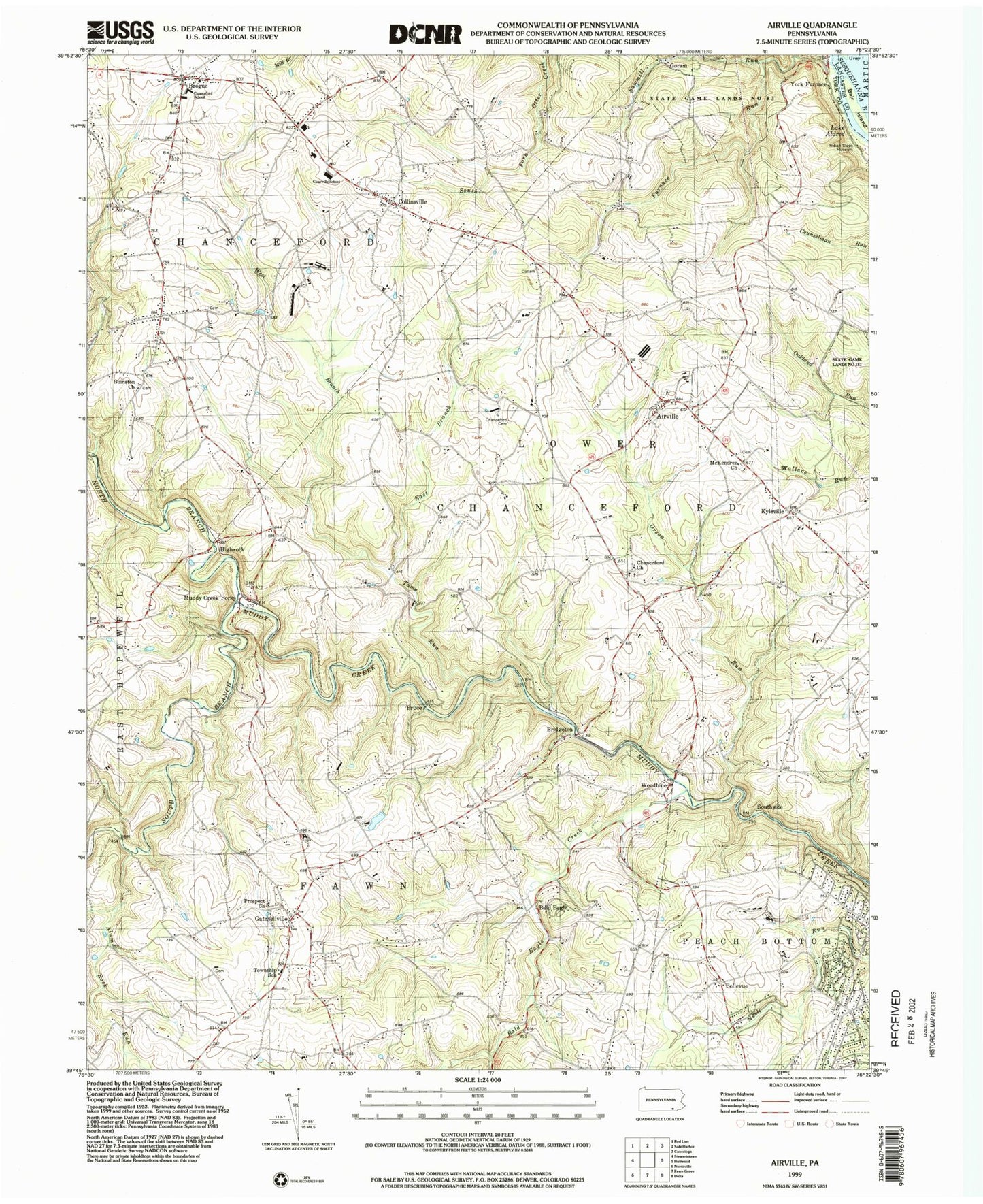
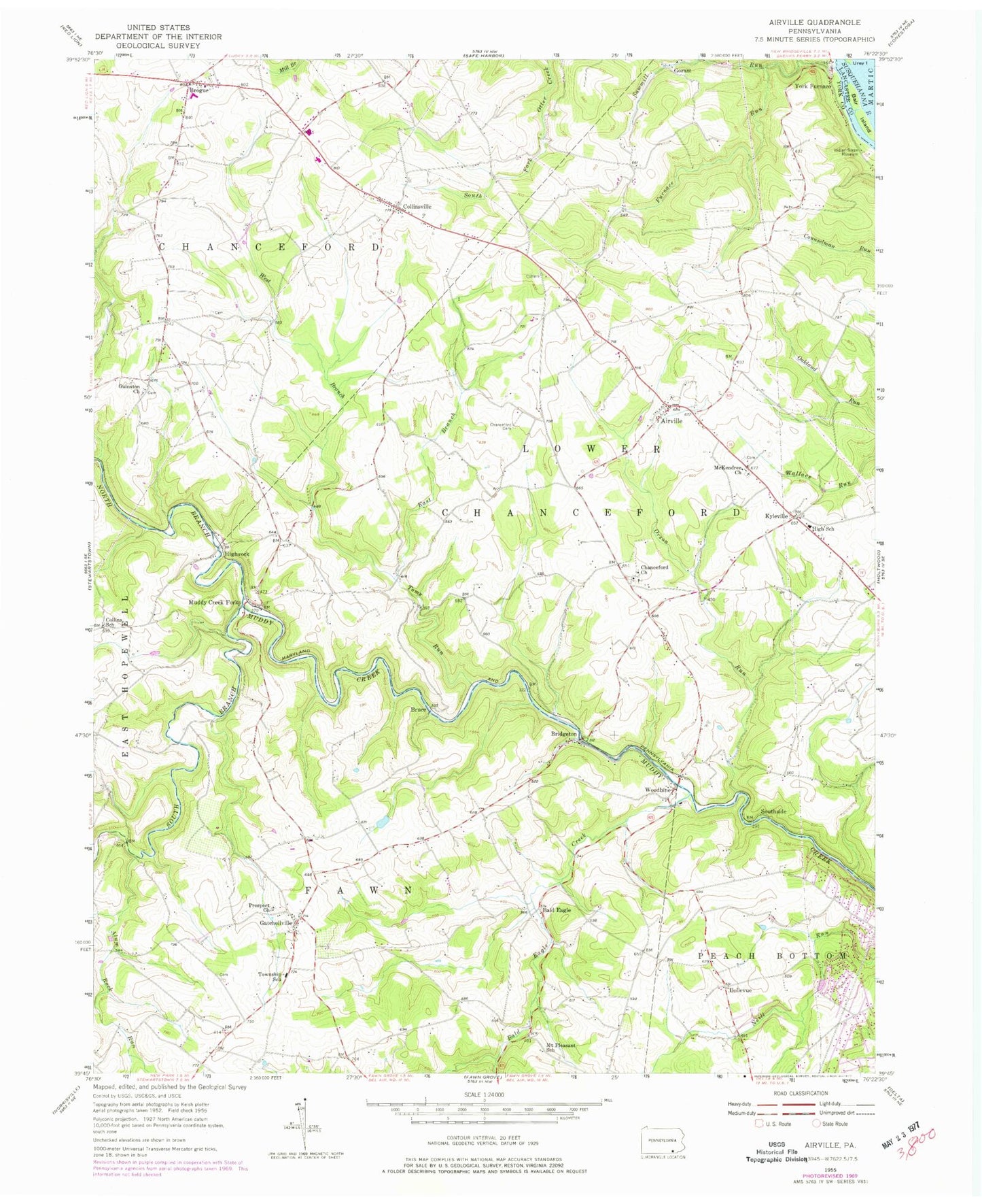
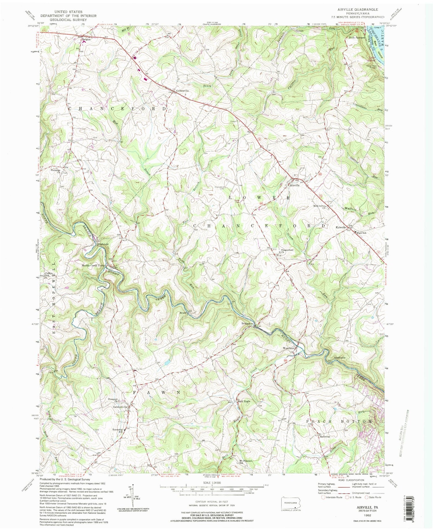
Classic USGS Airville Pennsylvania 7.5'x7.5' Topo Map
Couldn't load pickup availability
Historical USGS topographic quad map of Airville in the state of Pennsylvania. Map scale may vary for some years, but is generally around 1:24,000. Print size is approximately 24" x 27"
This quadrangle is in the following counties: Lancaster, York.
The map contains contour lines, roads, rivers, towns, and lakes. Printed on high-quality waterproof paper with UV fade-resistant inks, and shipped rolled.
Contains the following named places: Airville, Airville Volunteer Fire Company, Alta Vista Farm, Alum Rock Run, Bair Island, Bald Eagle, Bald Eagle Creek, Baublitz Commercial Airport, Belleview School, Bellevue, Bridgeton, Brogue, Brogue Ambulance 39, Brogue Post Office, Bruce, Chanceford Cemetery, Chanceford Church, Clarkford Farms, Collins School, Collinsville, Collinsville Community Library, Daneker Seven Springs Farm, Downs Farm, East Branch Toms Run, Eichelberger Farms, Furnace Run, Gatchellville, Glatview Farms, Goram, Guinston Church, Hickorymey Farms, Hidden Bluff Farm, Highrock, Hollenthal Farm, Indian Steps Museum, Jordan Century Farms, Keeney Farms, Kyleville, Maple Springs Farm, McKendree Church, Mount Pleasant School, Muddy Creek Forks, Nick of Time Farm, North Branch Muddy Creek, Orson Run, Pleasant Grove, Prospect Church, Sawmill Run, South Branch Muddy Creek, Southside, State Game Lands Number 83, Toms Run, Township of Fawn, Township of Lower Chanceford, Twin Good Farms, Urey Islands, West Branch Toms Run, Woodbine, Woodbine Farms, York Furnace, ZIP Codes: 17302, 17309, 17352