MyTopo
Classic USGS Ajax Ranch Montana 7.5'x7.5' Topo Map
Regular price
$16.95
Regular price
Sale price
$16.95
Unit price
per
Couldn't load pickup availability
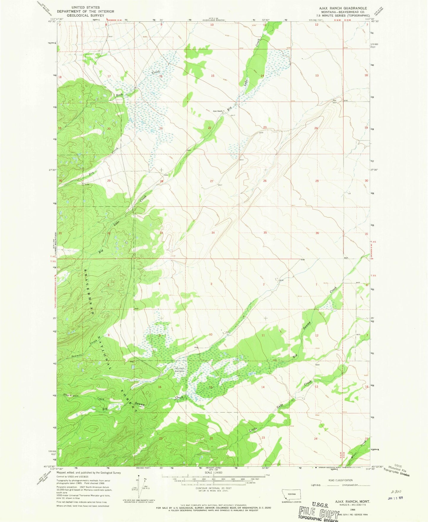
Historical USGS topographic quad map of Ajax Ranch in the state of Montana. Map scale may vary for some years, but is generally around 1:24,000. Print size is approximately 24" x 27"
This quadrangle is in the following counties: Beaverhead.
The map contains contour lines, roads, rivers, towns, and lakes. Printed on high-quality waterproof paper with UV fade-resistant inks, and shipped rolled.
Contains the following named places: 04S15W30CBCD01 Well, 05S16W16ABBA01 Well, Ajax Ranch, Big Hole Ranch, Big Swamp Creek, Dry Creek, Honen Ranch, Lugar Ranch, Peterson Ranch, Sawmill Creek, Slag-a-melt Creek, Twin Lakes Cow Camp, Zebarth Ranch