
MyTopo
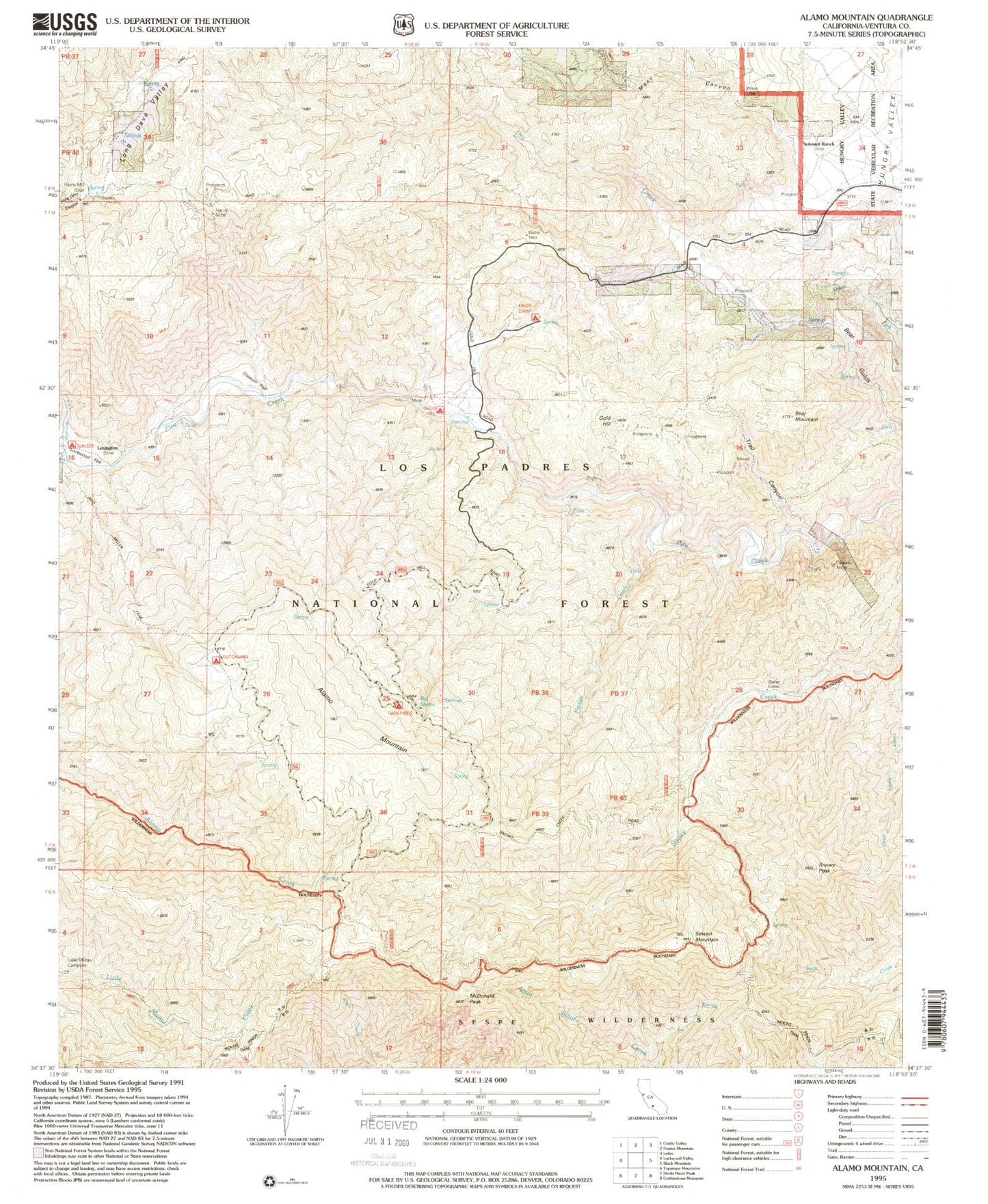
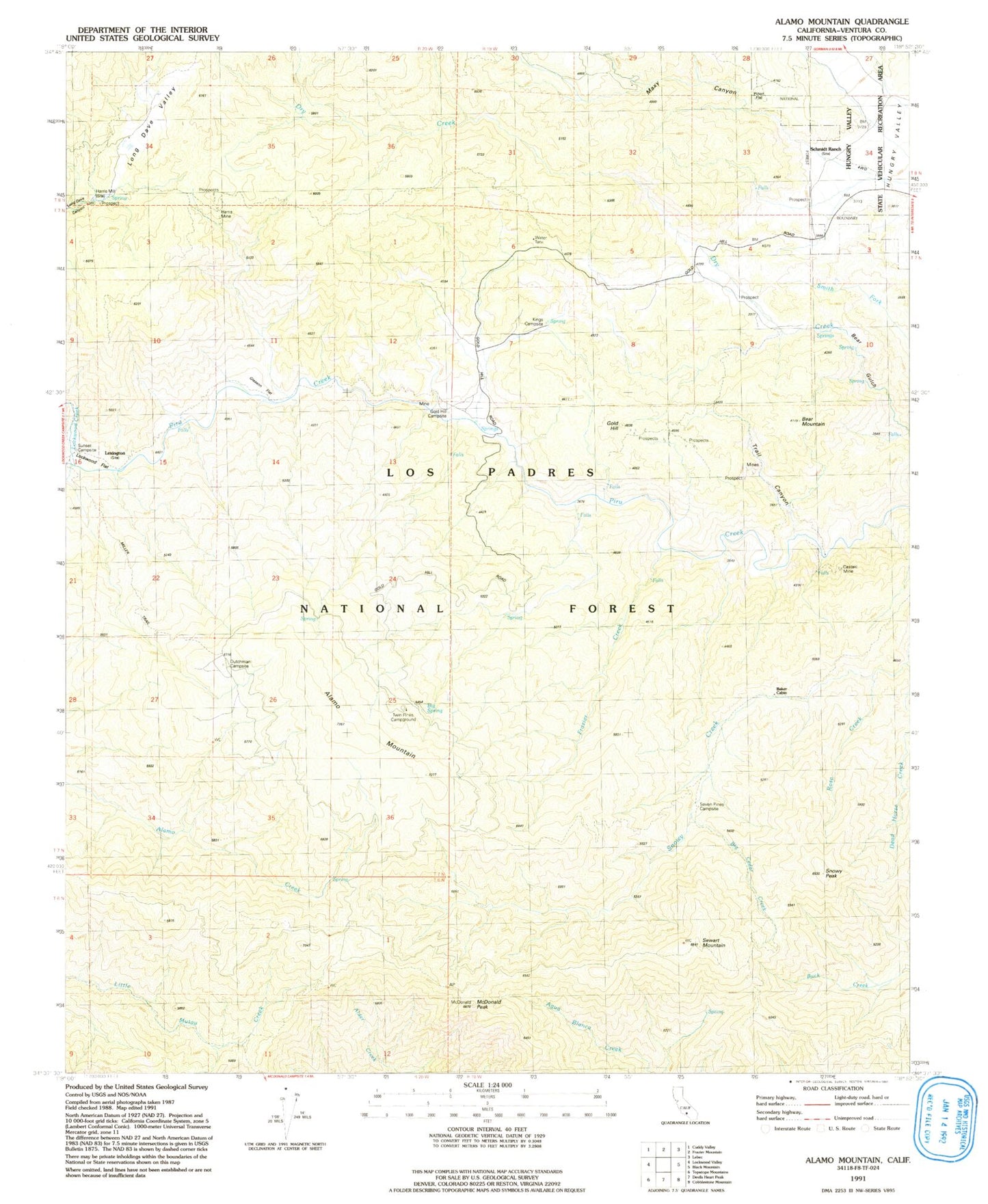
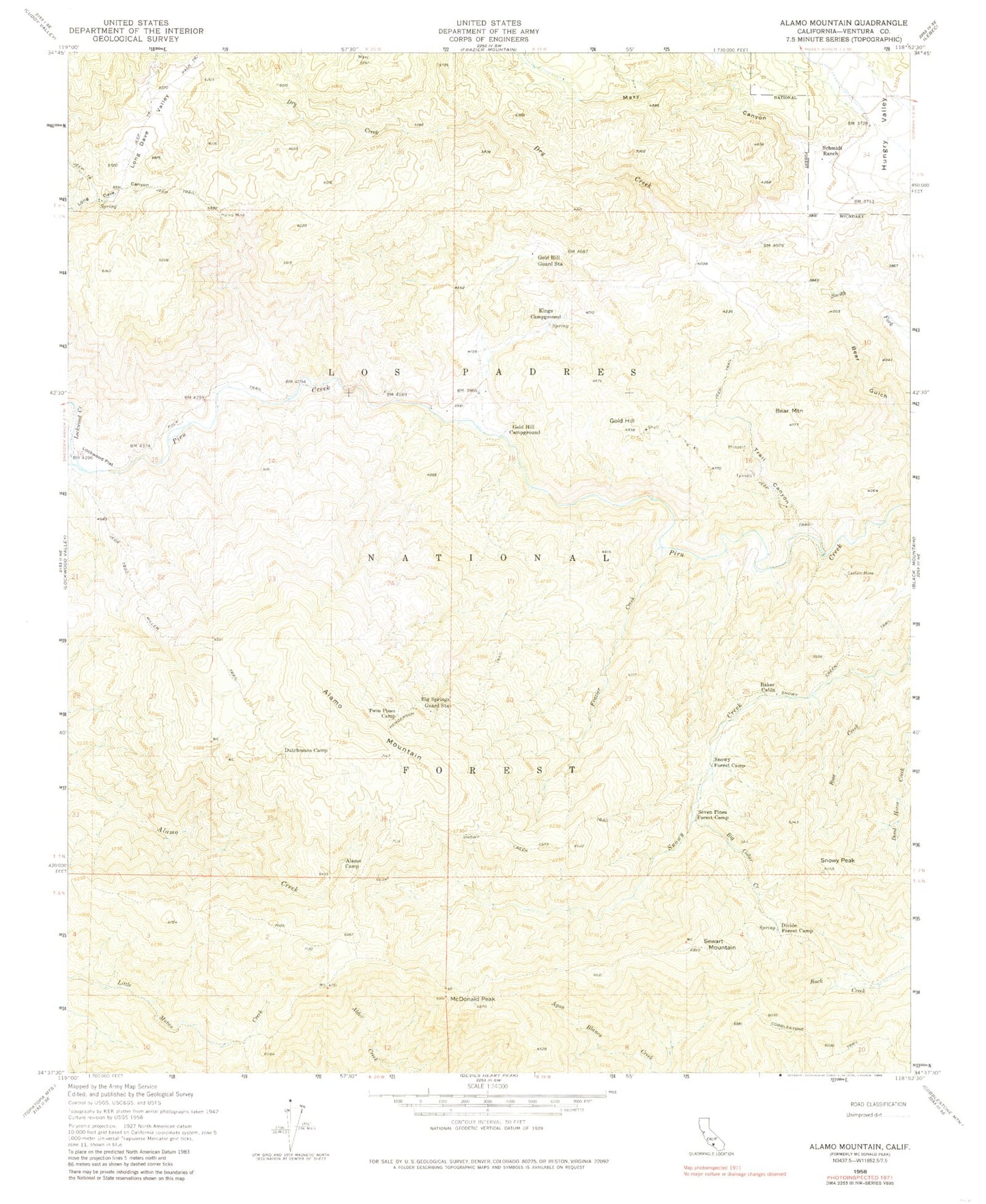
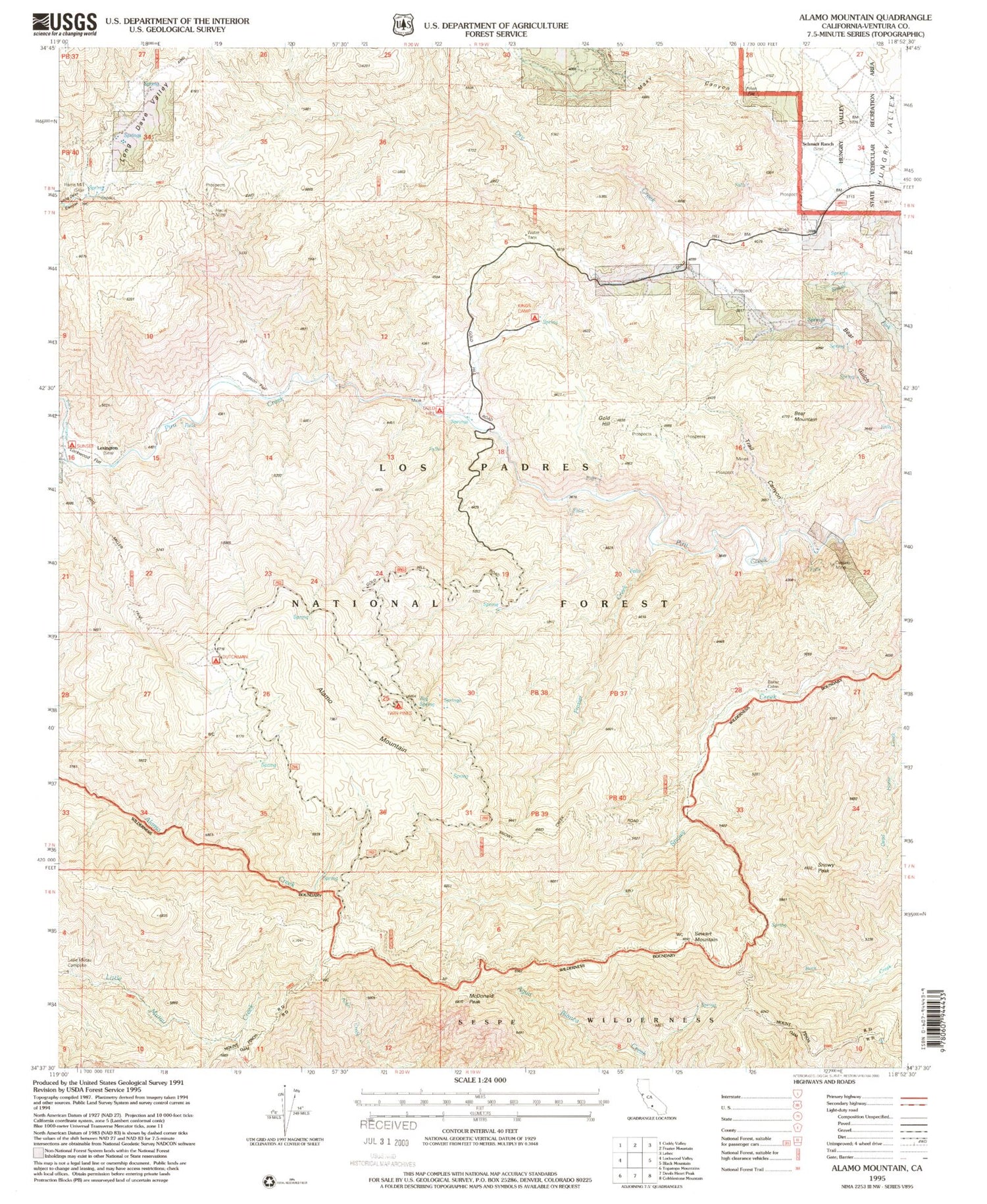
Classic USGS Alamo Mountain California 7.5'x7.5' Topo Map
Couldn't load pickup availability
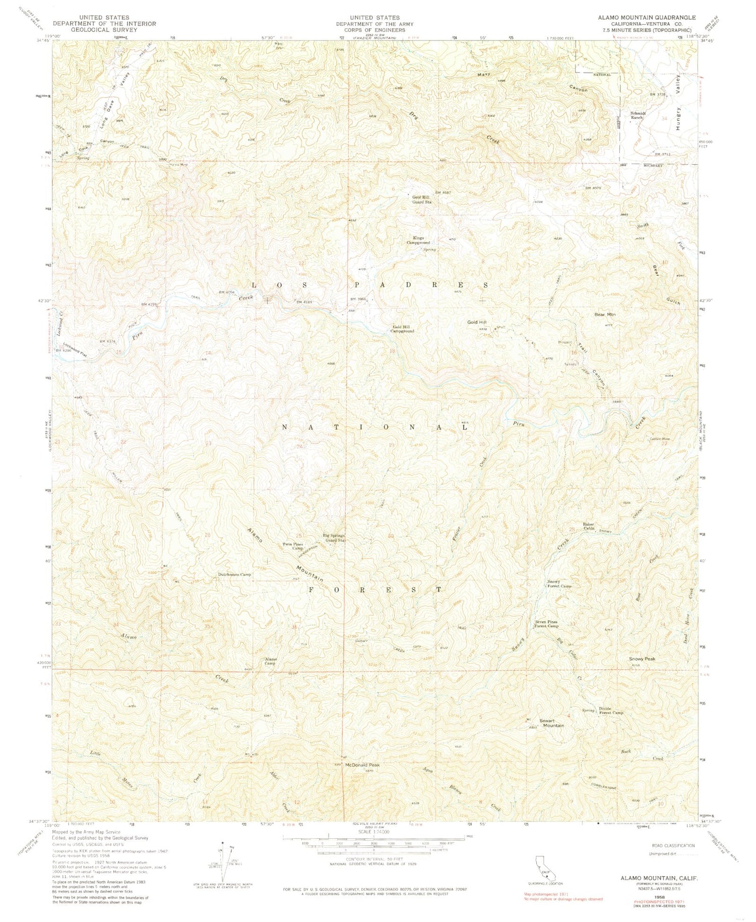
Historical USGS topographic quad map of Alamo Mountain in the state of California. Typical map scale is 1:24,000, but may vary for certain years, if available. Print size: 24" x 27"
This quadrangle is in the following counties: Ventura.
The map contains contour lines, roads, rivers, towns, and lakes. Printed on high-quality waterproof paper with UV fade-resistant inks, and shipped rolled.
Contains the following named places: Big Spring, Pinon Flat, Harris Mill, Lexington, Gleason Flat, Gold Hill Campsite, Dutchman Campsite, Alamo Camp, Baker Cabin, Bear Mountain, Big Cedar Creek, Big Springs Guard Station (historical), Castaic Mine, Dead Horse Creek, Divide Forest Camp, Dutchmans Camp (historical), Frazier Creek, Gold Hill, Gold Hill Campground (historical), Gold Hill Guard Station (historical), Harris Mine, Henderson Trail, Kings Campsite, Lockwood Creek, Lockwood Flat, Long Dave Valley, Maxy Canyon, McDonald Peak, Miller Trail, Rose Creek, Schmidt Ranch, Seven Pines Campsite, Sewart Mountain, Snowy Creek Trail, Snowy Forest Camp, Snowy Peak, Trail Canyon, Twin Pines Campground, Little Mutau Campground, Dutchman Campground, Gold Hill Administrative Site Campground, Sunset Campground, Alamo Mountain, Tatavium Cultural Preserve, Big Spring, Pinon Flat, Harris Mill, Lexington, Gleason Flat, Gold Hill Campsite, Dutchman Campsite, Alamo Camp, Baker Cabin, Bear Mountain, Big Cedar Creek, Big Springs Guard Station (historical), Castaic Mine, Dead Horse Creek, Divide Forest Camp, Dutchmans Camp (historical), Frazier Creek, Gold Hill, Gold Hill Campground (historical), Gold Hill Guard Station (historical), Harris Mine, Henderson Trail, Kings Campsite, Lockwood Creek, Lockwood Flat, Long Dave Valley, Maxy Canyon, McDonald Peak, Miller Trail, Rose Creek, Schmidt Ranch, Seven Pines Campsite, Sewart Mountain, Snowy Creek Trail, Snowy Forest Camp, Snowy Peak, Trail Canyon, Twin Pines Campground, Little Mutau Campground, Dutchman Campground, Gold Hill Administrative Site Campground, Sunset Campground, Alamo Mountain, Tatavium Cultural Preserve