
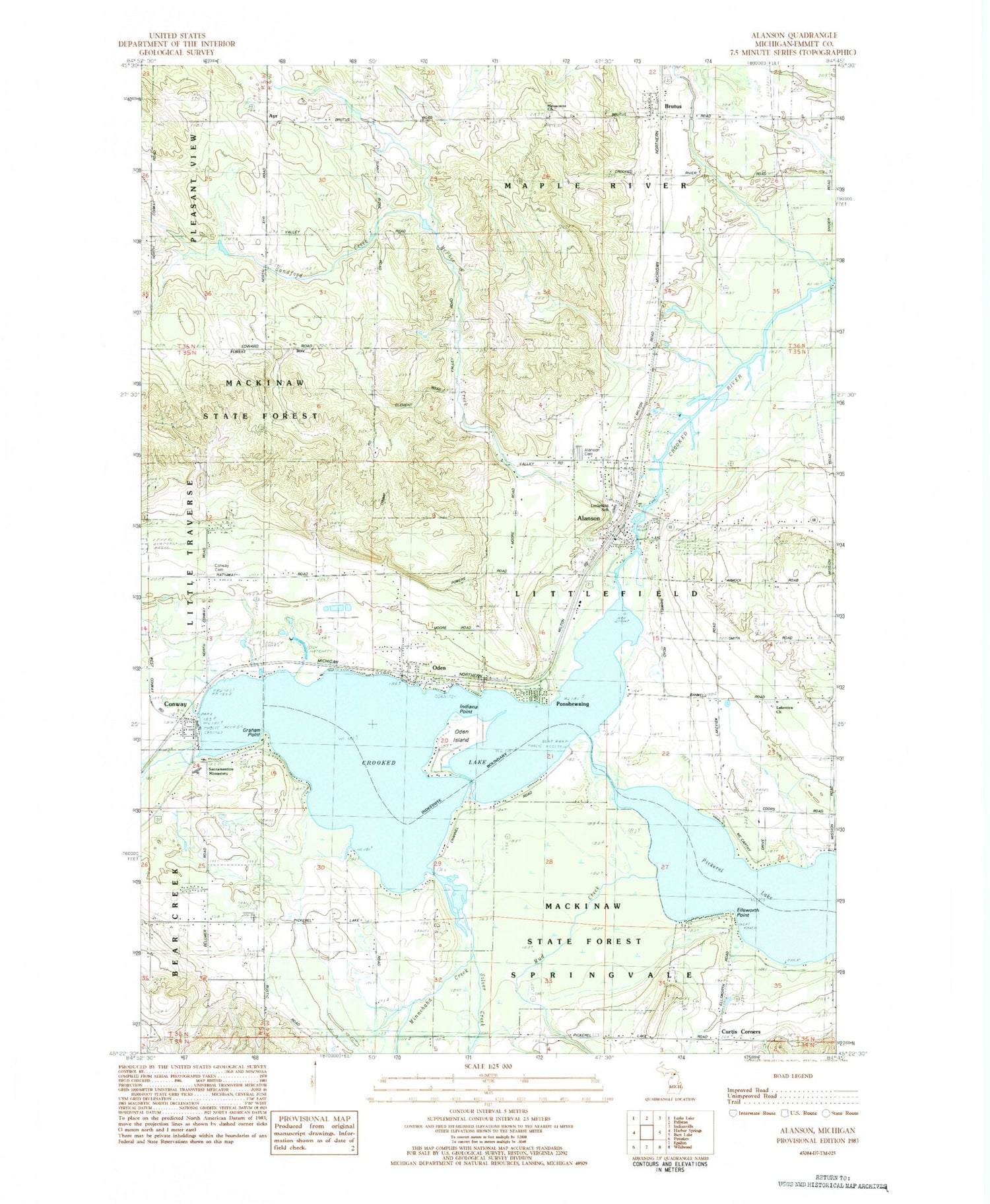
MyTopo
Classic USGS Alanson Michigan 7.5'x7.5' Topo Map
Couldn't load pickup availability
Historical USGS topographic quad map of Alanson in the state of Michigan. Typical map scale is 1:24,000, but may vary for certain years, if available. Print size: 24" x 27"
This quadrangle is in the following counties: Emmet.
The map contains contour lines, roads, rivers, towns, and lakes. Printed on high-quality waterproof paper with UV fade-resistant inks, and shipped rolled.
Contains the following named places: Alanson, Brutus, Conway, Conway Cemetery, Crooked Lake, Ellsworth Point, Graham Point, Indiana Point, McPhee Creek, Mennonite Church, Minnehaha Creek, Mud Creek, Oden, Oden Island, Pickerel Lake, Ponshewaing, Silver Creek, Whites Creek, Ayr, Township of Littlefield, Oden Post Office (historical), Curtis Corners, Lakeview Church, Sacramentine Monastery, Littlefield School, Alanson Cemetery, McPhee Creek, Conway Post Office, Conway Station (historical), Church of the Pines, Brutus Station (historical), Brutus Post Office, Calvary Baptist Church, Crooked River RV Park, Alanson Station (historical), Alanson United Methodist Church, Eagle Beach Golf Course, Church of the Nazarene, Oden Station (historical), Oden Community Church, Alanson Village Park, Alanson Littlefield Fire Department, Alanson Area Public Library, LTPC Walk-In Medical Center, Alanson Post Office, Oden State Fish Hatchery, Ayr Post Office (historical), Sacramentine Monastery Cemetery, Mennonite Cemetery, Emmet County Poor Farm Cemetery, Bear Creek Cemetery, Passenger Pigeons Historical Marker, W W Fairbairn Historical Marker, Chalet Estates, Village of Alanson, Brutus Census Designated Place, Conway Census Designated Place, Oden Census Designated Place, Ponshewaing Census Designated Place, Brutus Sand Pit, Oden Post Office


