MyTopo
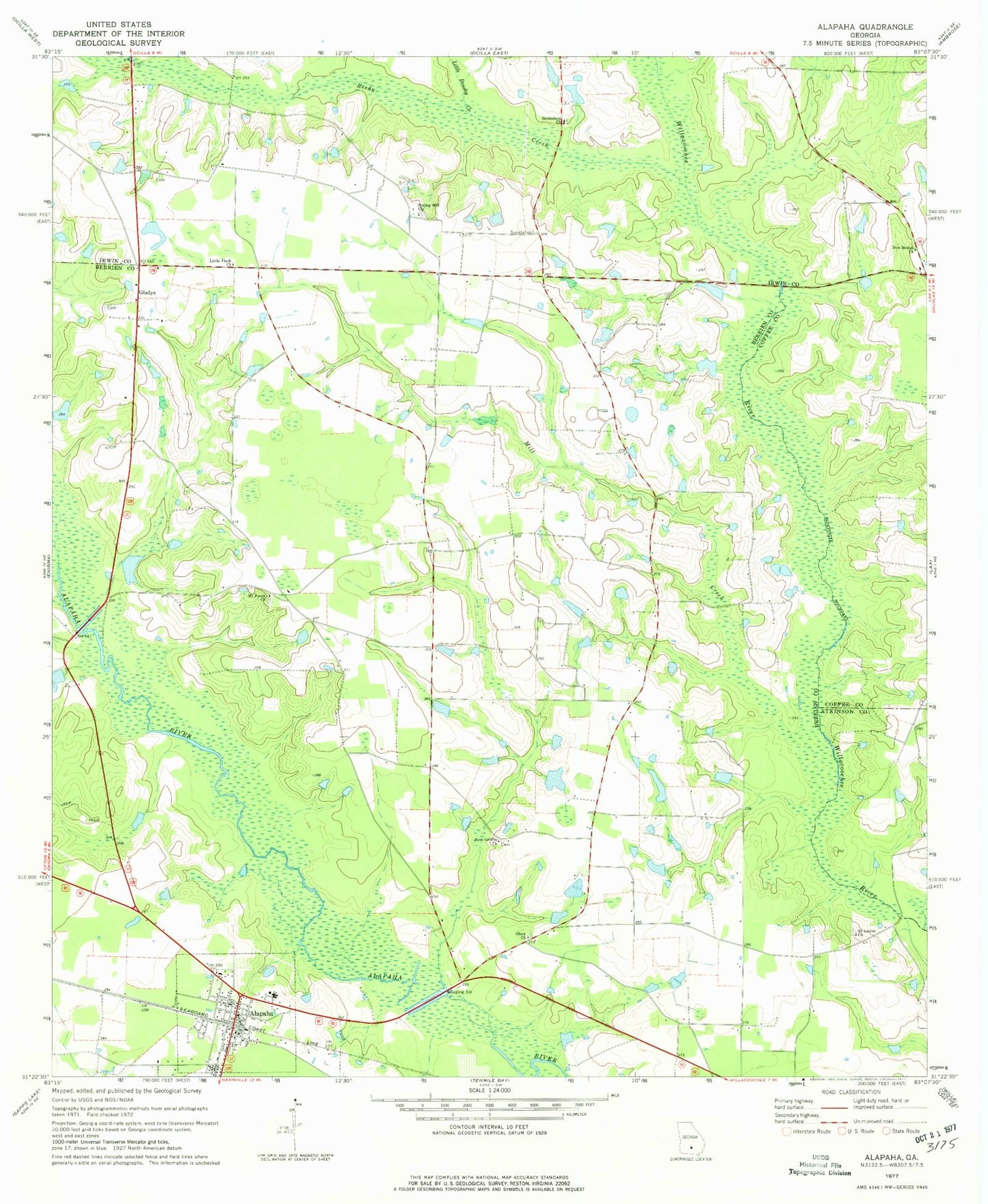
Classic USGS Alapaha Georgia 7.5'x7.5' Topo Map
Couldn't load pickup availability
Historical USGS topographic quad map of Alapaha in the state of Georgia. Map scale may vary for some years, but is generally around 1:24,000. Print size is approximately 24" x 27"
This quadrangle is in the following counties: Atkinson, Berrien, Coffee, Irwin.
The map contains contour lines, roads, rivers, towns, and lakes. Printed on high-quality waterproof paper with UV fade-resistant inks, and shipped rolled.
Contains the following named places: Alapaha, Alapaha Division, Alapaha Elementary School, Alapaha Police Department, Alapaha Post Office, Alapaha Volunteer Fire Department, Bethlehem Cemetery, Bethlehem Church, Fletcher Cemetery, Gladys, Glory Church, Golpher Hill Cemetery, Little Brushy Creek, Little Flock Church, Luke Cemetery, Mill Creek, Mount Paran Church, Mount Paron Cemetery, New Bethel Church, New Griffin Church, Reedy Creek, Saint Lukes Church, Spring Hill Church, Springhill Cemetery, Town of Alapaha, Tucker Lake, Tucker Lake Dam, ZIP Code: 31622