MyTopo
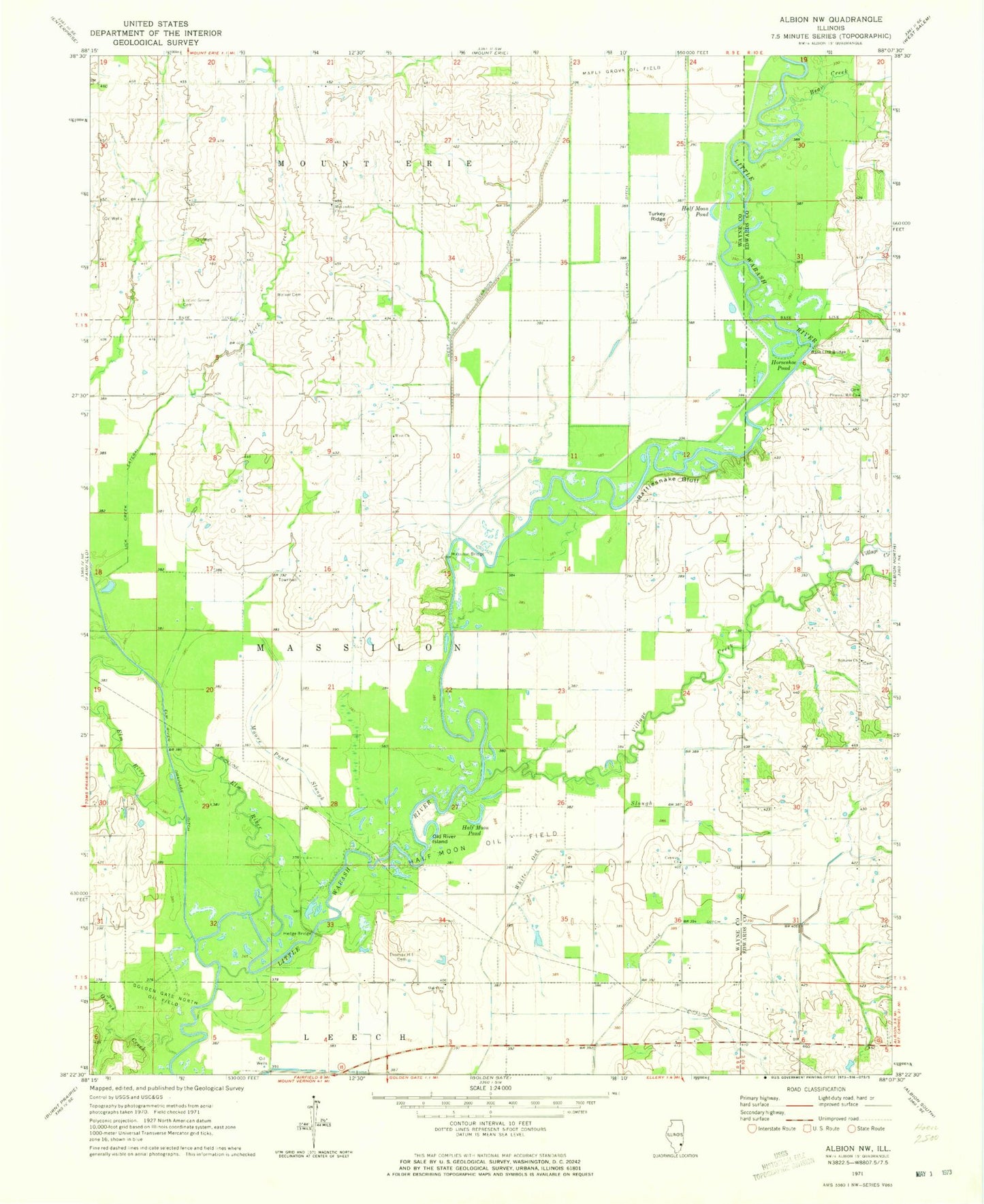
Classic USGS Albion NW Illinois 7.5'x7.5' Topo Map
Couldn't load pickup availability
Historical USGS topographic quad map of Albion NW in the state of Illinois. Map scale may vary for some years, but is generally around 1:24,000. Print size is approximately 24" x 27"
This quadrangle is in the following counties: Edwards, Wayne.
The map contains contour lines, roads, rivers, towns, and lakes. Printed on high-quality waterproof paper with UV fade-resistant inks, and shipped rolled.
Contains the following named places: Ash Slough, Base Line Bridge, Bear Creek, Bond School, Burnt Prairie, Clear Pond Ditch, Clear Pond Slough, Conway Church, Conway School, Elm River, Gerber School, Golden Gate North Oil Field, Gum Corner School, Half Moon Oil Field, Half Moon Pond, Hedge Bridge, Horseshoe Pond, Lick Creek, Lick Creek Lateral, Locust Grove Cemetery, Massilon Bridge, Massilon Townhall, McKendree Cemetery, McKendree Chapel, Moore Pond Slough, New Massillon, Number 4 School, Number 7 School, Oakwood Church, Oakwood School, Old River Island, Owens Creek, Pleasant Hill Cemetery, Pleasant Hill Congregational Church, Pleasant View School, Rattlesnake Bluff, Samaria Cemetery, Samaria Missionary Baptist Church, Thomas Hill Cemetery, Township of Massilon, Turkey Ridge, Union Drainage Ditch, Vandaveer School, Village Creek, Walker Cemetery, West Church, West School, West Side Diversion Ditch, West Village Creek, ZIP Code: 62843