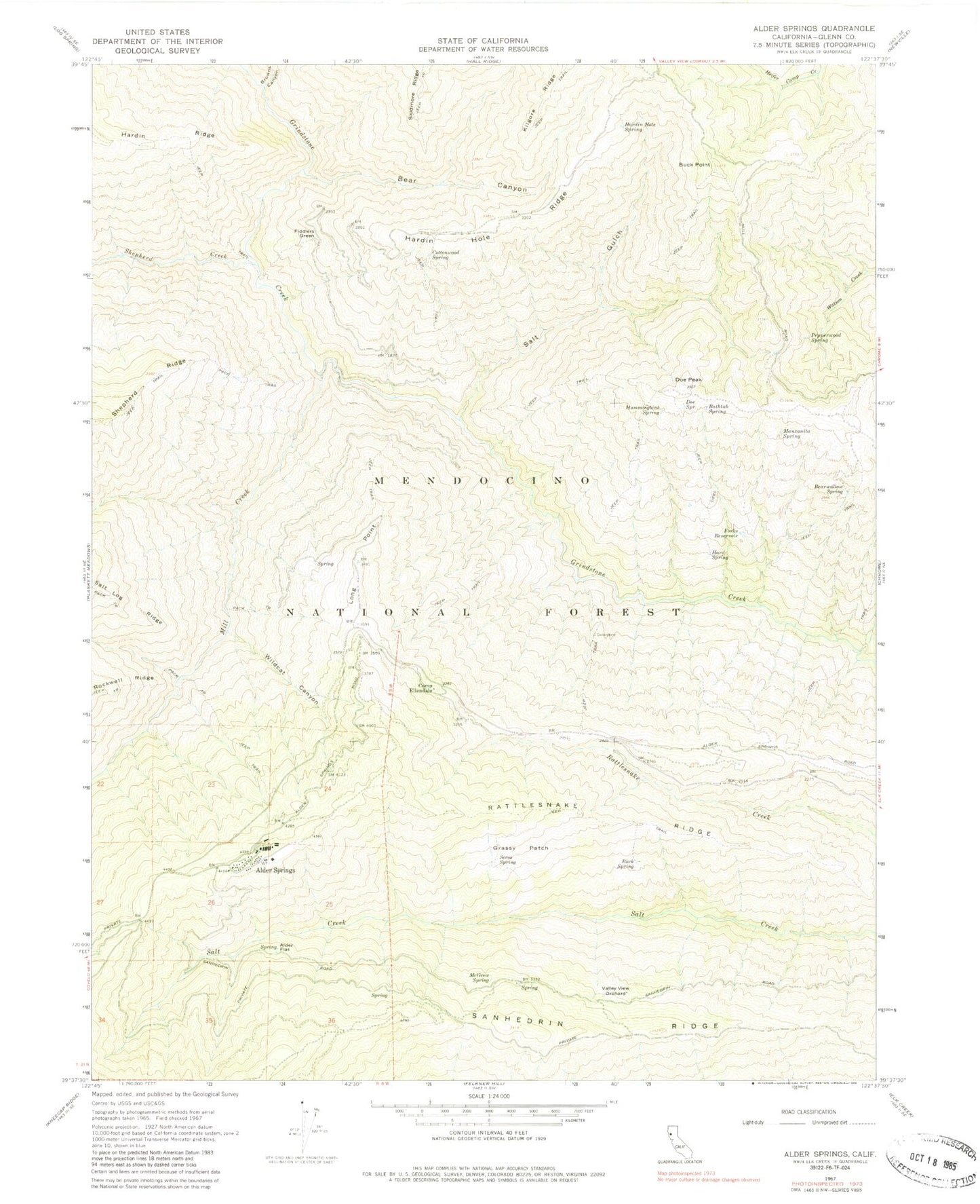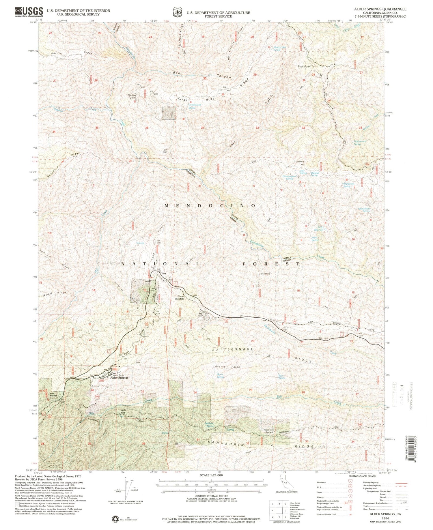
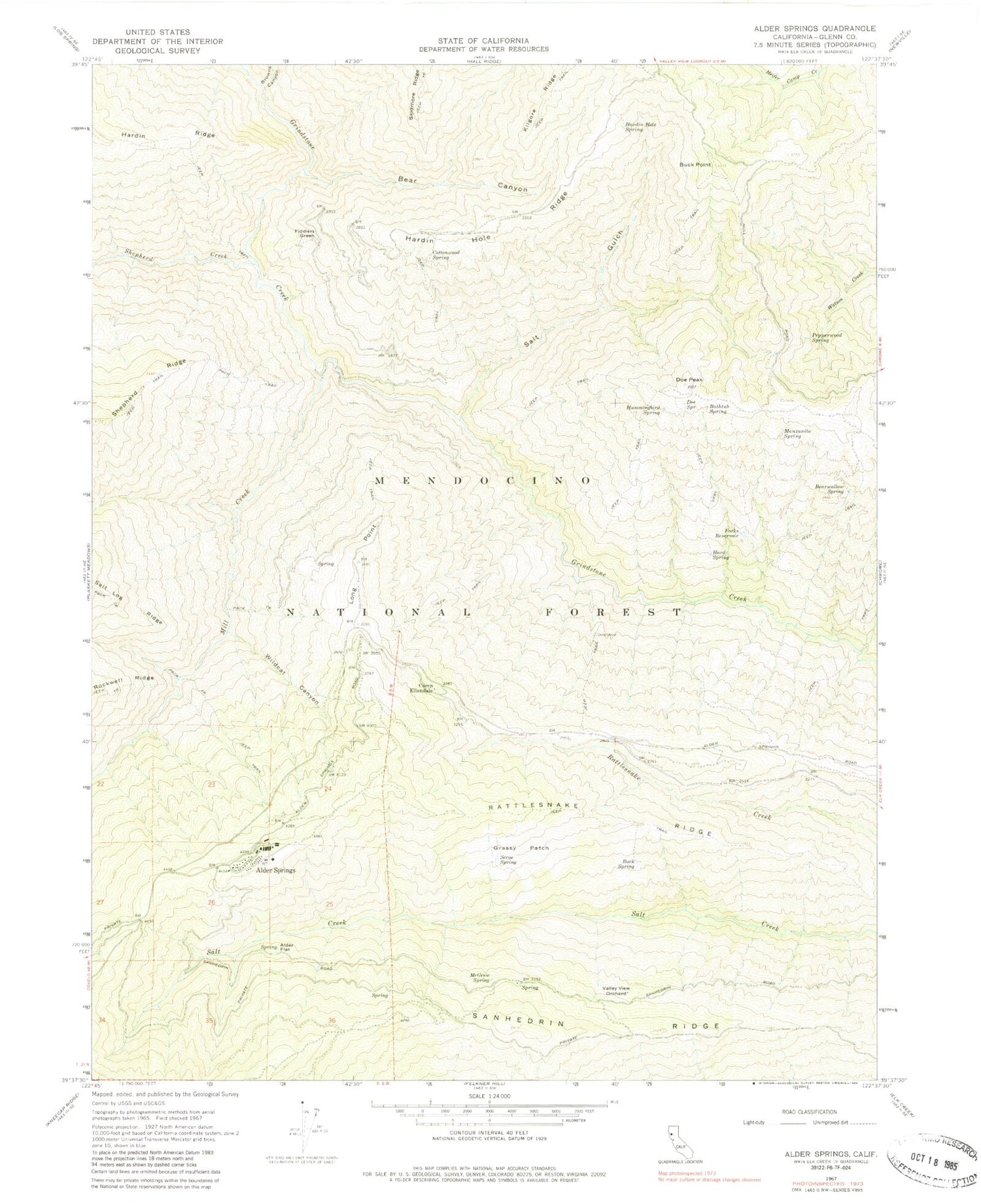
MyTopo
Classic USGS Alder Springs California 7.5'x7.5' Topo Map
Couldn't load pickup availability
Historical USGS topographic quad map of Alder Springs in the state of California. Map scale may vary for some years, but is generally around 1:24,000. Print size is approximately 24" x 27"
This quadrangle is in the following counties: Glenn.
The map contains contour lines, roads, rivers, towns, and lakes. Printed on high-quality waterproof paper with UV fade-resistant inks, and shipped rolled.
Contains the following named places: Alder Flat, Alder Junction, Alder Springs, Alder Springs Forest Service Facility, Alder Springs Post Office, Bathtub Spring, Bear Canyon, Bearwallow Spring, Browns Canyon, Buck Point, Buck Spring, Camp Ellendale, Cottonwood Spring, Doe Peak, Doe Spring, Drew Cabin, Fiddlers Green, Forks Reservoir, Grassy Patch, Hard Spring, Hardin Hole Ridge, Hardin Hole Spring, Hummingbird Spring, Long Point, Long Point Lookout, Manzanita Spring, McGrew Spring, Mill Creek, Pepperwood Spring, Rattlesnake Ridge, Reynolds Place, Salt Gulch, Sanhedrin Ridge, Seros Spring, Shepherd Creek, United States Forest Service Mendocino National Forest Alder Springs Work Center Fire Company, Valley View Orchard, Wildcat Canyon