MyTopo
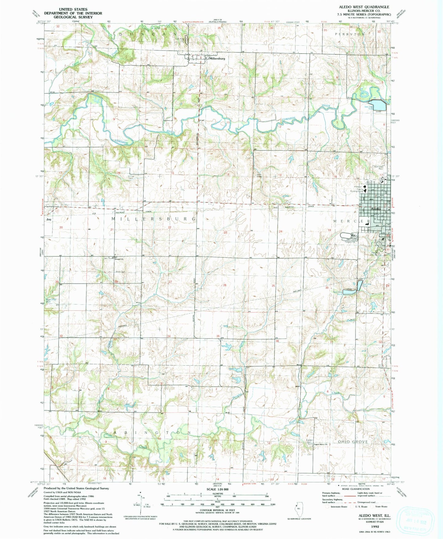
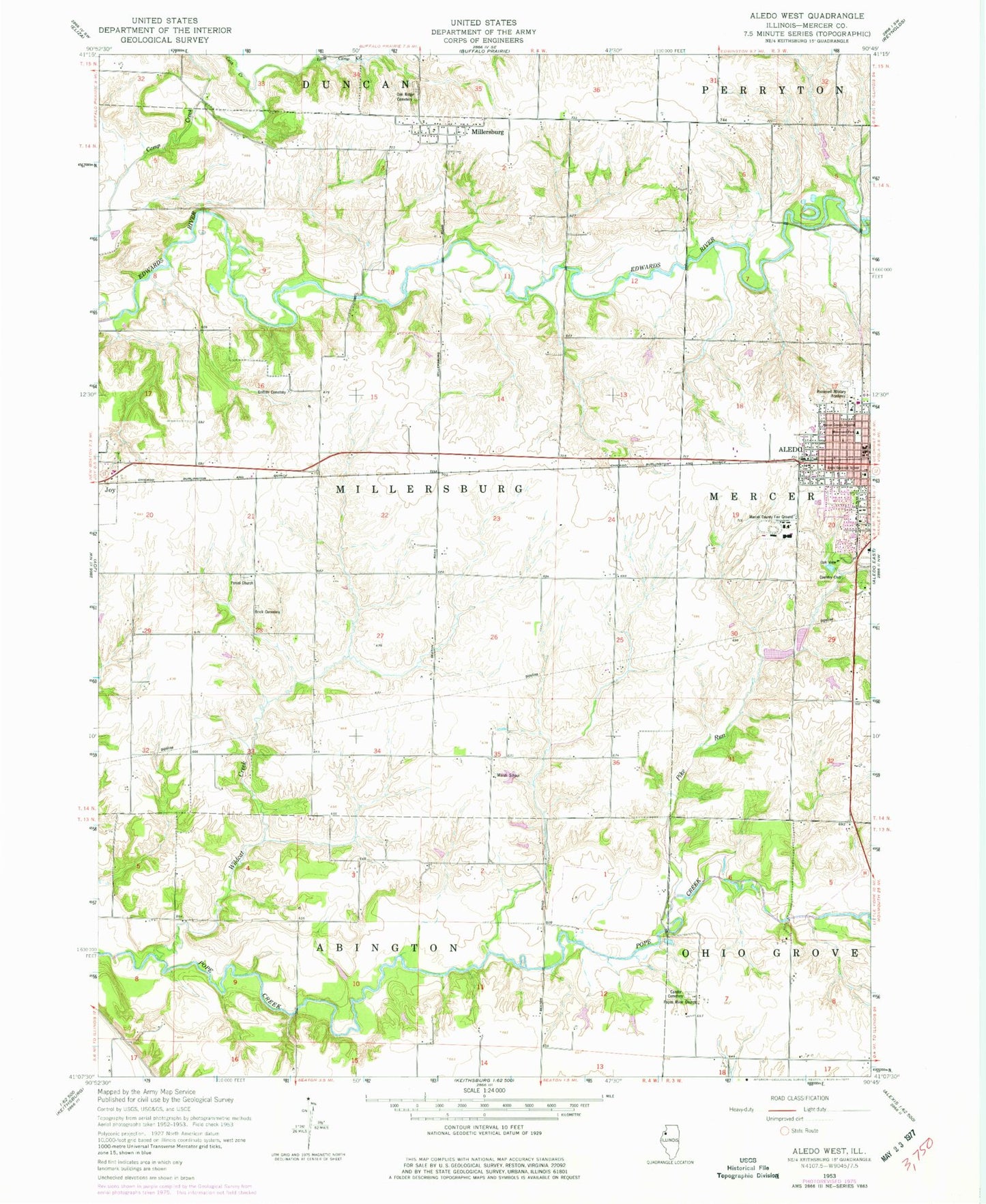
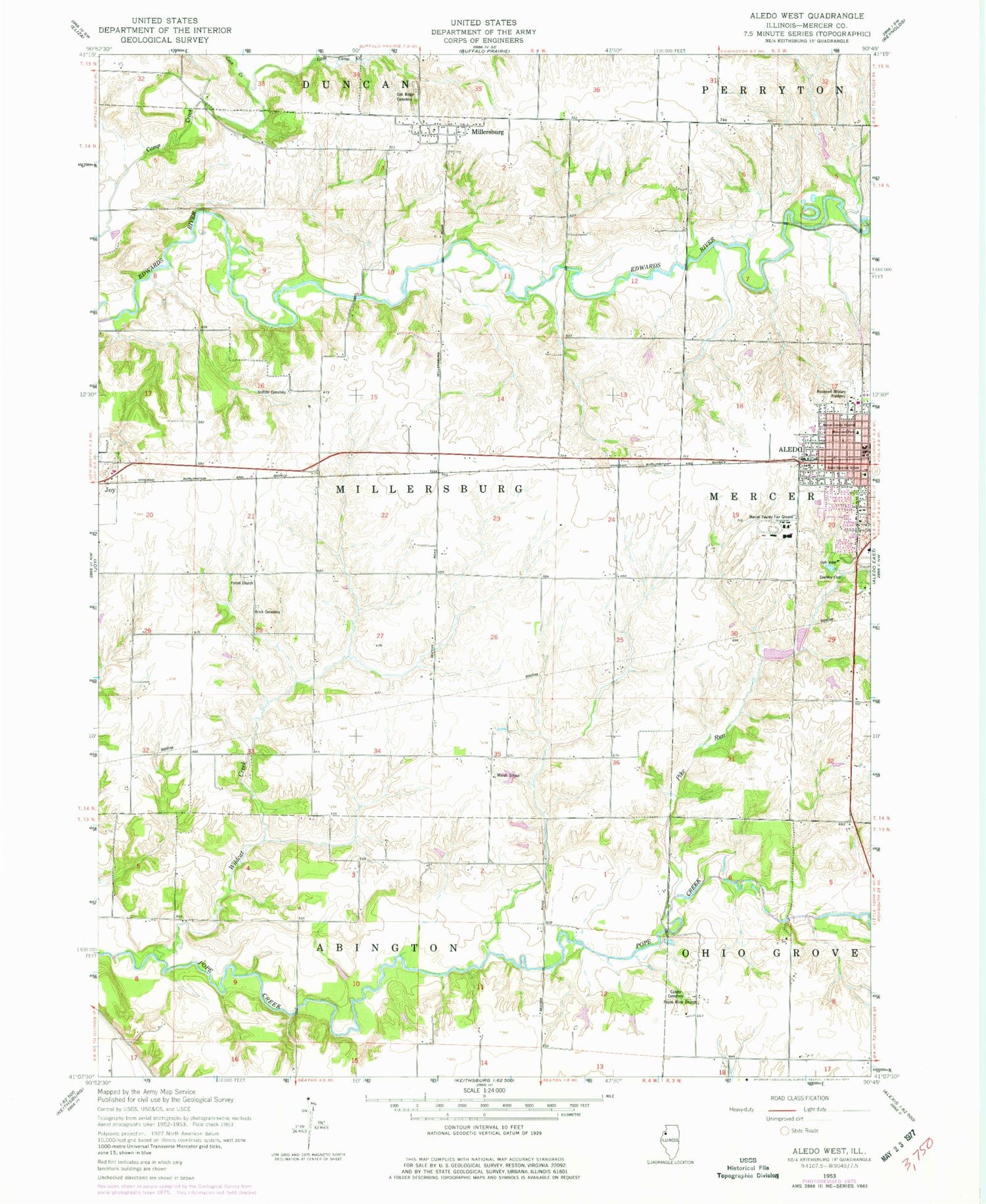
Classic USGS Aledo West Illinois 7.5'x7.5' Topo Map
Couldn't load pickup availability
Historical USGS topographic quad map of Aledo West in the state of Illinois. Map scale may vary for some years, but is generally around 1:24,000. Print size is approximately 24" x 27"
This quadrangle is in the following counties: Mercer.
The map contains contour lines, roads, rivers, towns, and lakes. Printed on high-quality waterproof paper with UV fade-resistant inks, and shipped rolled.
Contains the following named places: Adams School, Aledo Gospel Center, Aledo Grammar School, Aledo School Number 1, Ambulance Service Advanced Medical Transport Central Illinois, Apollo Elementary School, Army Ford, Brick Cemetery, Candor Cemetery, Cash Creek, Douglas Creek, Downey Bridge, Duff School, Genesis Medical Center Aledo, Griffith Cemetery, Kimmel School, Lee School, Little Camp Creek, Marsh School, McCaw Pond, McCaw Pond Dam, Mercer County Fair Ground, Mercer County Hospital Heliport, Mercer County Sheriff's Office, Millersburg, Millersburg Census Designated Place, Monument Park, Nazarene Church, Niles Hall, Northside Park, Oak Ridge Cemetery, Oak View Country Club, Peniel Cemetery, Peniel Church, Pike Run, Popes River Church, Roosevelt Military Academy, Township of Millersburg, Trinity Presbyterian Church, Wildcat Creek, WRMJ-FM (Aledo)