MyTopo
Classic USGS Alexander Springs Florida 7.5'x7.5' Topo Map
Couldn't load pickup availability
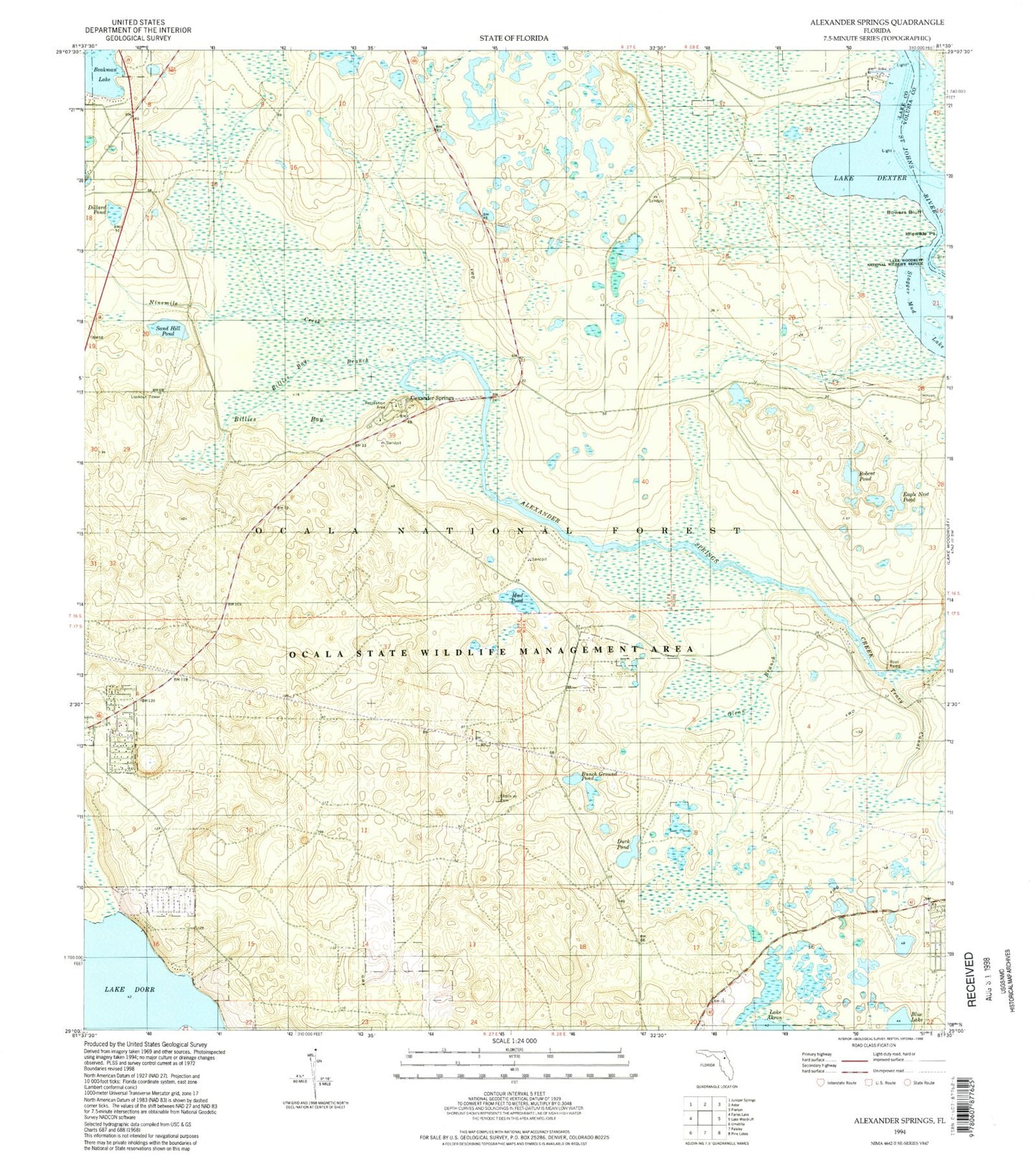
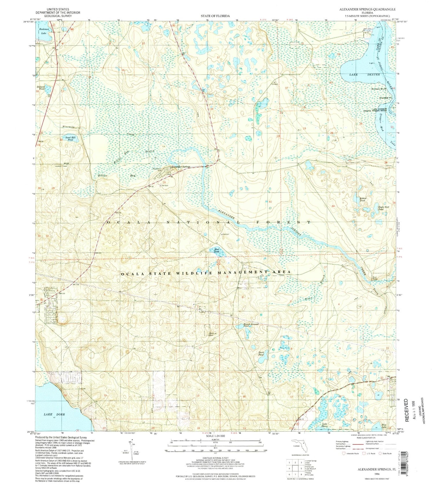
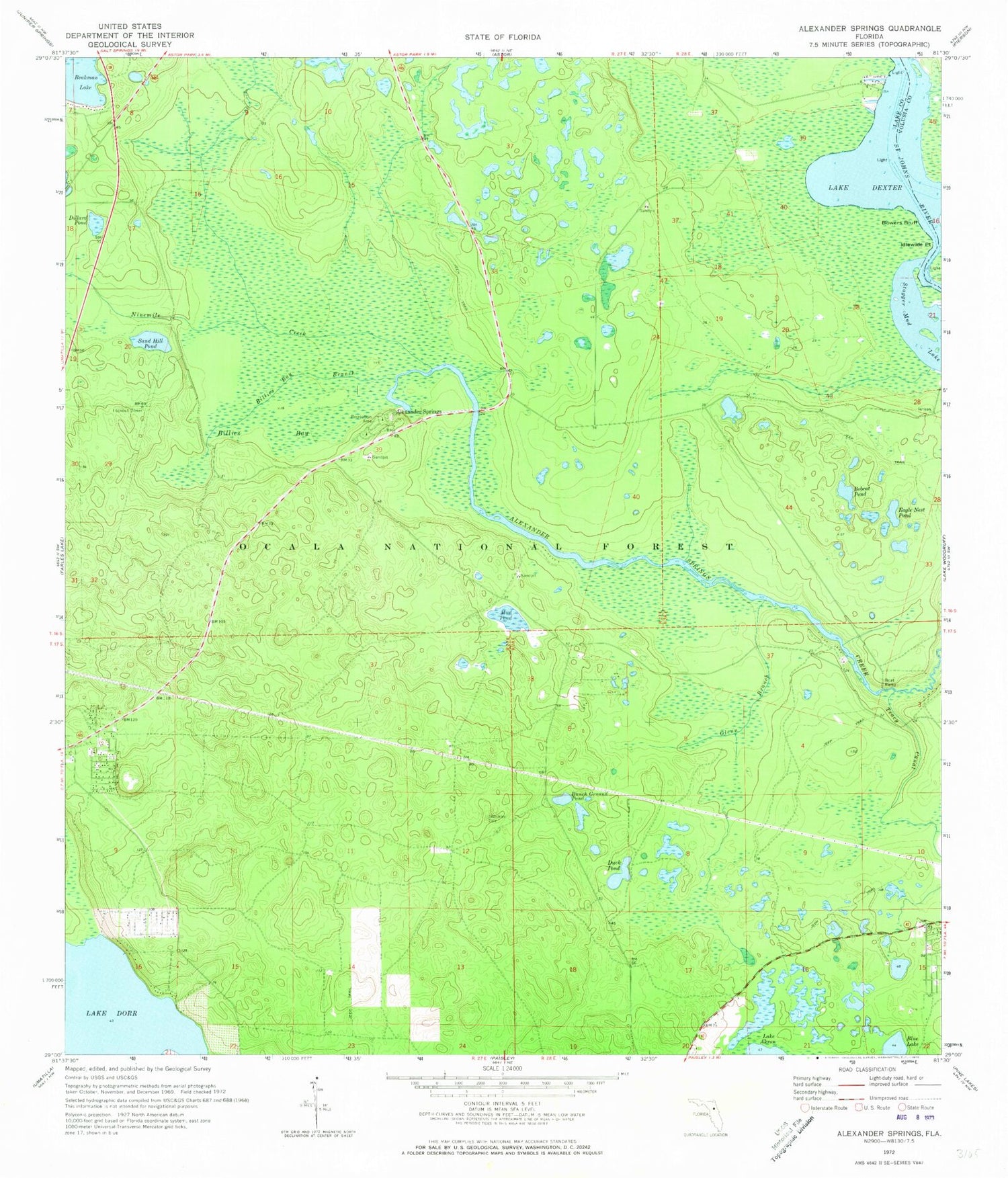
Historical USGS topographic quad map of Alexander Springs in the state of Florida. Typical map scale is 1:24,000, but may vary for certain years, if available. Print size: 24" x 27"
This quadrangle is in the following counties: Lake, Volusia.
The map contains contour lines, roads, rivers, towns, and lakes. Printed on high-quality waterproof paper with UV fade-resistant inks, and shipped rolled.
Contains the following named places: Alexander Springs, Billies Bay, Billies Branch, Blue Lake, Bobcat Pond, Bowers Bluff, Bunch Ground Pond, Dillard Pond, Lake Dorr, Duck Pond, Eagle Nest Pond, Glenn Branch, Idlewilde Point, Mud Pond, Ninemile Creek, Sand Hill Pond, Shockley Cemetery, Stagger Mud Lake, Tracy Canal, F J Advice Grant, Francis Marin Grant, Moses E Levy Grant, Alexander Springs Recreation Area, Alco Dock, Flatwoods Trail, Sellers Lake Boat Ramp, Billies Bay Wilderness, Lakeview Park, Scrub Jay Pond, Astor Landing Marina, Powells Campground Mobile Home Park