MyTopo
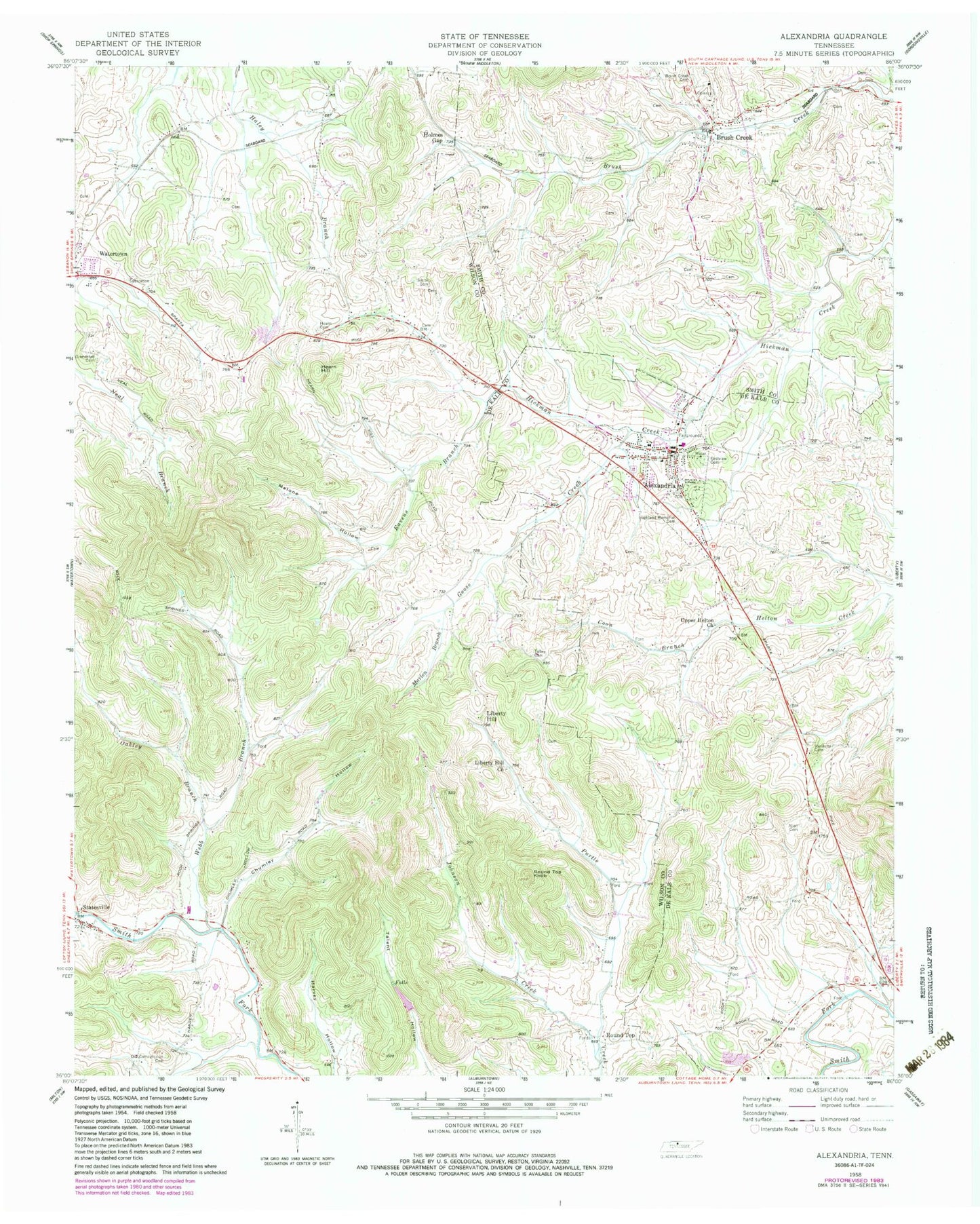
Classic USGS Alexandria Tennessee 7.5'x7.5' Topo Map
Couldn't load pickup availability
Historical USGS topographic quad map of Alexandria in the state of Tennessee. Map scale may vary for some years, but is generally around 1:24,000. Print size is approximately 24" x 27"
This quadrangle is in the following counties: DeKalb, Smith, Wilson.
The map contains contour lines, roads, rivers, towns, and lakes. Printed on high-quality waterproof paper with UV fade-resistant inks, and shipped rolled.
Contains the following named places: Alexandria, Alexandria African Methodist Episcopal Church, Alexandria Church of Christ, Alexandria Colored School, Alexandria Eastview Colored Cemetery, Alexandria Fire Department, Alexandria Police Department, Alexandria Post Office, Alexandria School, Allen Cemetery, Bowers Cemetery, Brush Creek, Brush Creek Baptist Church, Brush Creek Cemetery, Brush Creek Post Office, Brush Creek School, Chumley Hollow, Cleaver Creek, Commissioner District 9, Coon Branch, District 1, District 13, Eastview Cemetery, Eavens Branch, Ervin Cemetery, Estes Cemetery, Goose Creek, Grandstaff Cemetery, Hearn Hill, Hearn Hill Cemetery, Hicks Cemetery, Highland Memorial Cemetery, Holmes Gap, Johnson Creek, Liberty Hill, Liberty Hill Church, Liberty Hill School, Mahone, Malone Hollow, Marlen Branch, Oakley Branch, Old Campground Cemetery, Rocky Springs School, Round Top, Round Top Knob, Round Top School, Smith Cemetery, Statesville, Statesville Census Designated Place, Statesville Methodist Church, Talley Cemetery, Town of Alexandria, Upper Helton Missionary Baptist Church, Vandatta Cemetery, Walkers Chapel Primitive Baptist Church, Webb Branch, West Main Baptist Church, ZIP Code: 37012