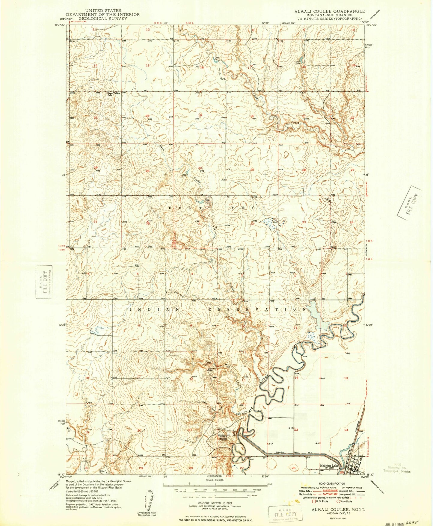
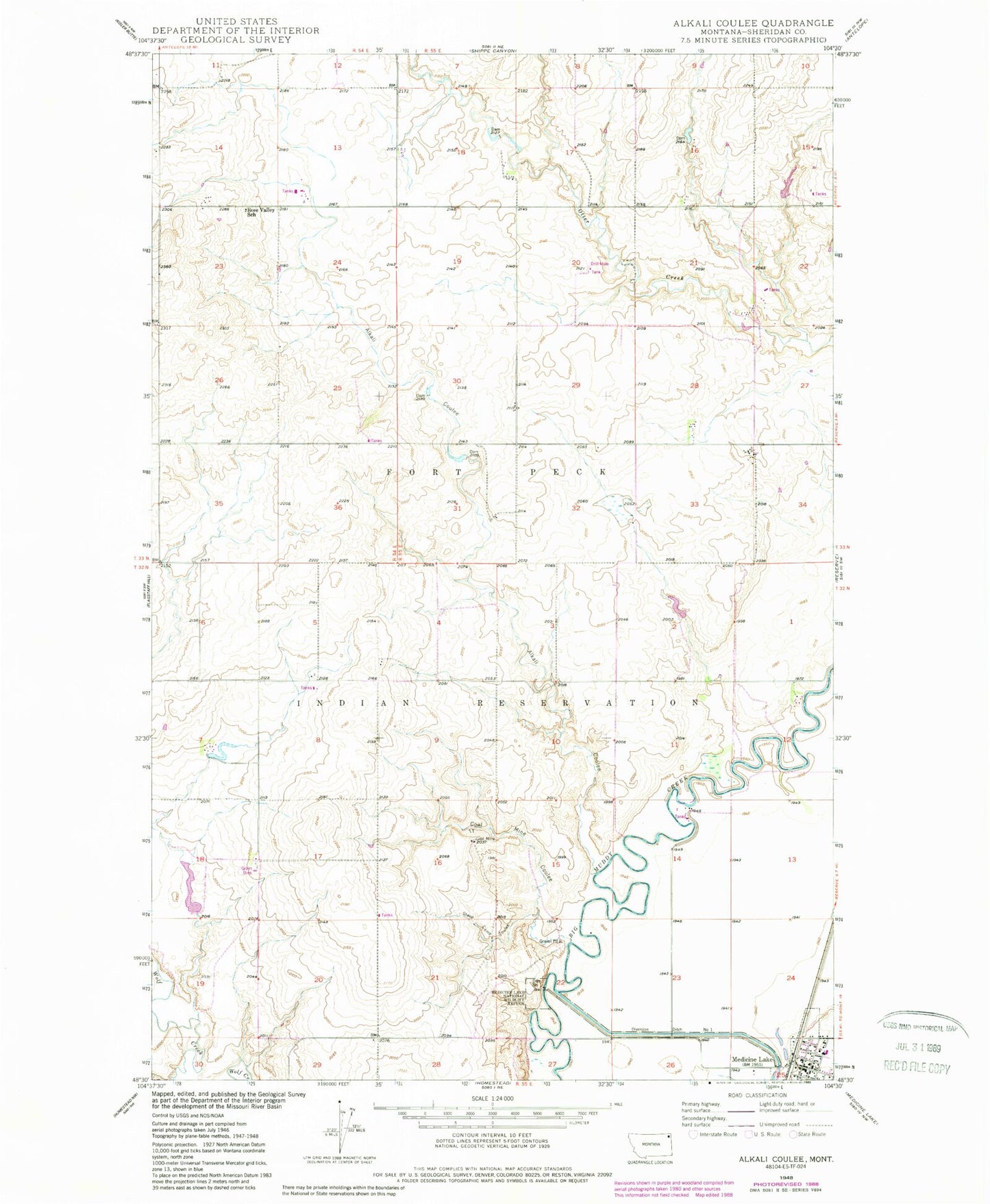
MyTopo
Classic USGS Alkali Coulee Montana 7.5'x7.5' Topo Map
Couldn't load pickup availability
Historical USGS topographic quad map of Alkali Coulee in the state of Montana. Map scale may vary for some years, but is generally around 1:24,000. Print size is approximately 24" x 27"
This quadrangle is in the following counties: Sheridan.
The map contains contour lines, roads, rivers, towns, and lakes. Printed on high-quality waterproof paper with UV fade-resistant inks, and shipped rolled.
Contains the following named places: 32N55E18ADDD01 Well, 32N55E25ABCB01 Well, 33N54E13CDCC01 Well, 33N55E18DDAA01 Well, 33N55E27BBBA01 Well, 33N56E28DAAD01 Well, 59247, Alkali Coulee, Dam Number 1, Diversion Ditch Number One, Engstrom Dam, Medicine Lake, Medicine Lake Lutheran Church, Medicine Lake Post Office, Medicine Lake School, Medicine Lake Volunteer Fire Department, Mine Coulee, Olson Trading, Rose Valley, Saint Patricks Catholic Church, Sheep Camp Coulee, Town of Medicine Lake, Union Congregational Church