MyTopo
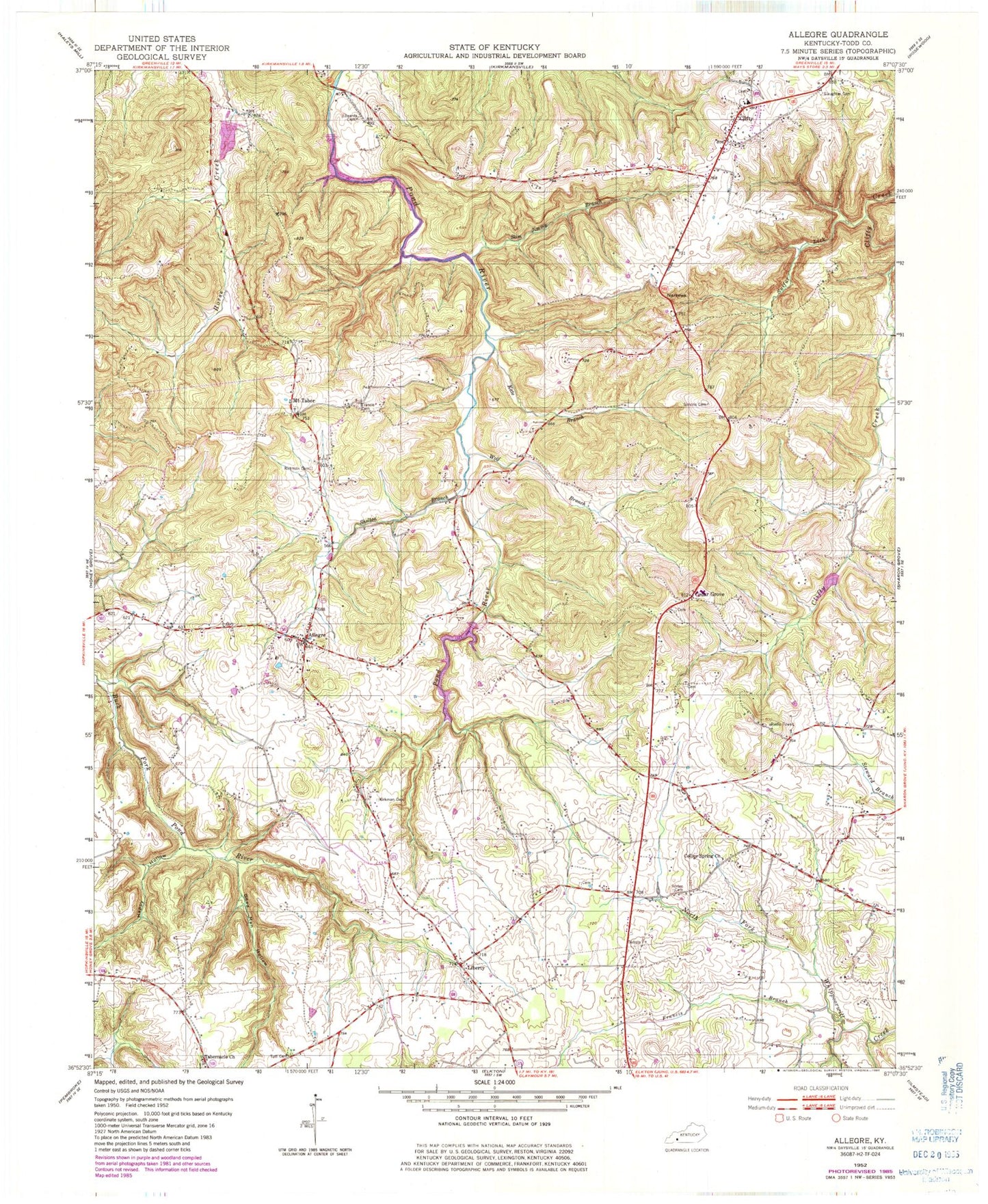
Classic USGS Allegre Kentucky 7.5'x7.5' Topo Map
Couldn't load pickup availability
Historical USGS topographic quad map of Allegre in the state of Kentucky. Map scale may vary for some years, but is generally around 1:24,000. Print size is approximately 24" x 27"
This quadrangle is in the following counties: Todd.
The map contains contour lines, roads, rivers, towns, and lakes. Printed on high-quality waterproof paper with UV fade-resistant inks, and shipped rolled.
Contains the following named places: Allegre, Allegre Volunteer Fire Department, Cedar Grove, Clifty, Clifty Post Office, Clifty Volunteer Fire Department, Collier Spring, Collier Spring General Baptist Church, Dead Man Hollow, Edwards Cemetery, Francis Branch, Francis Cemetery, Happy Hollow, Kate Branch, Kirkman Cemetery, Kirkmansville Division, Liberty, Mount Tabor, Narrows, Porter Cemetery, Powell Lake, Shelton Branch, Simons Cemetery, Slaughter Cemetery, Slim Jimmy Branch, Sulfur Lick, Tabernacle Church, Tutt Cemetery, Wolf Branch, ZIP Code: 42220