MyTopo
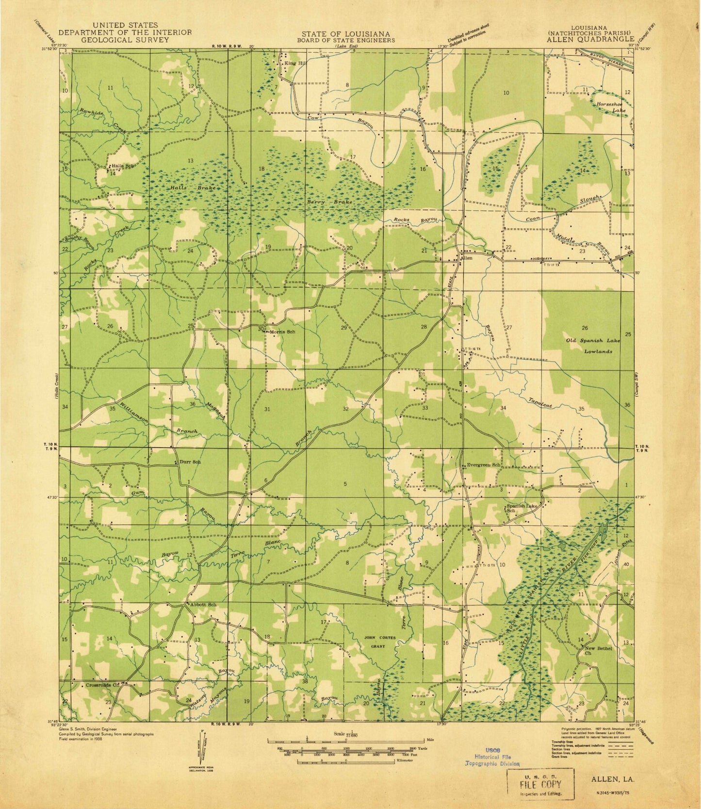
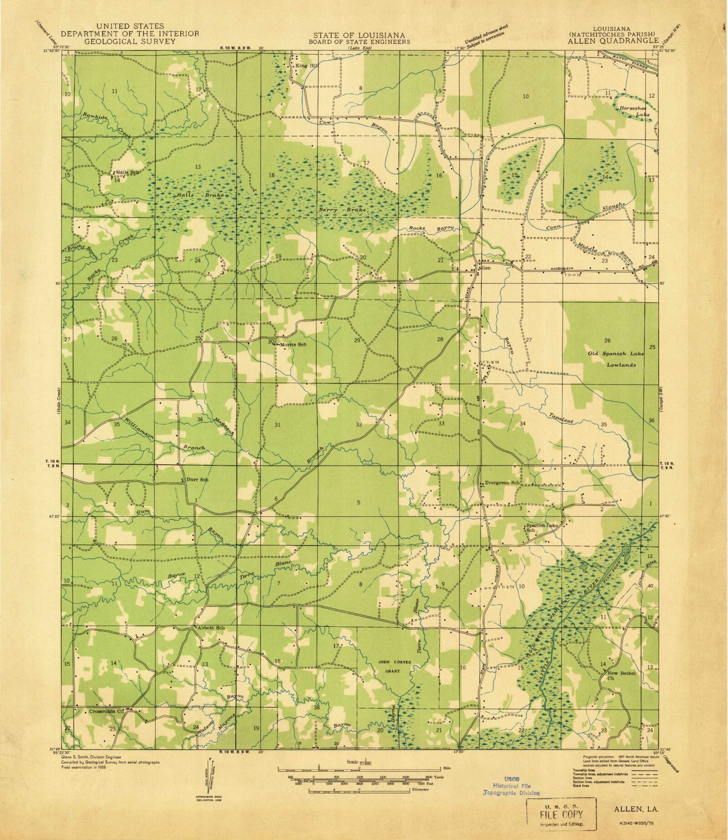
Classic USGS Allen Louisiana 7.5'x7.5' Topo Map
Couldn't load pickup availability
Historical USGS topographic quad map of Allen in the state of Louisiana. Map scale may vary for some years, but is generally around 1:24,000. Print size is approximately 24" x 27"
This quadrangle is in the following counties: Natchitoches.
The map contains contour lines, roads, rivers, towns, and lakes. Printed on high-quality waterproof paper with UV fade-resistant inks, and shipped rolled.
Contains the following named places: Allen, Anthony Church, Bayou Terre Blanc, Berry Brake, Brushy Bayou, Cow Bayou, Cross Roads Church, Evergreen Church, Fish Pond, Gum Bayou, Halls Brake, Horseshoe Lake, King Hill, Kings Hill Gas Field, Magason Branch, Mallard Bayou, Mayous Bayou, Morris Church, Natchitoches Parish Fire Protection District 7 Station 3, Parish Governing Authority District 9, Rawhide Creek, Rocks Bayou, Rocks Creek, Saint Annes Cemetery, Saint Annes Church, Tapalcat Bayou, Watson Bayou, Williamson Branch