MyTopo
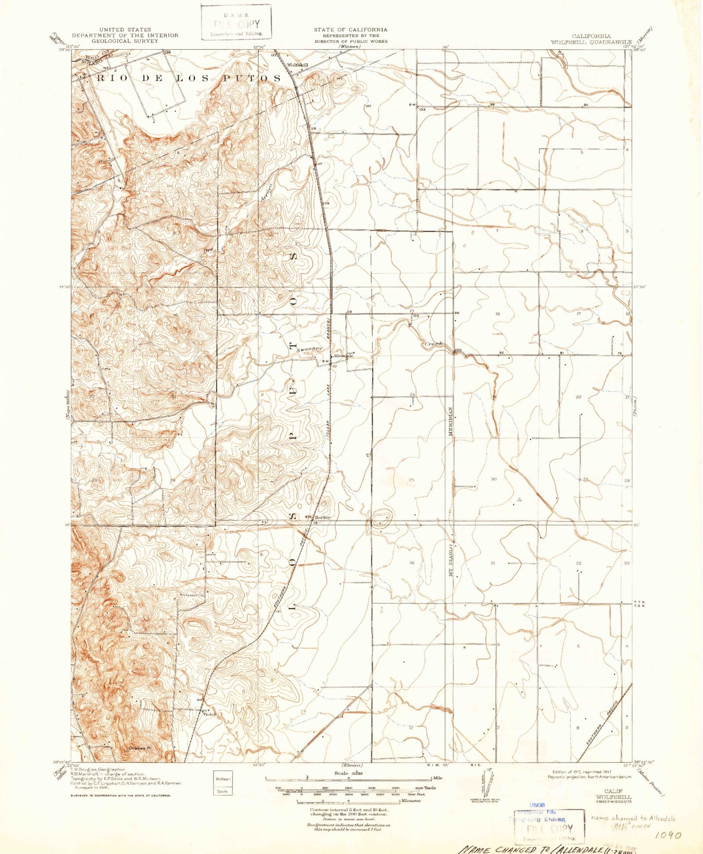
Classic USGS Allendale California 7.5'x7.5' Topo Map
Couldn't load pickup availability
Historical USGS topographic quad map of Allendale in the state of California. Map scale may vary for some years, but is generally around 1:24,000. Print size is approximately 24" x 27"
This quadrangle is in the following counties: Solano, Yolo.
The map contains contour lines, roads, rivers, towns, and lakes. Printed on high-quality waterproof paper with UV fade-resistant inks, and shipped rolled.
Contains the following named places: Allendale, Allendale Census Designated Place, Allendale Fire Station, Browns Valley Elementary School, Casbar Farms, Drakes Point, Dry Arroyo, Eldridge Farm, English Creek, Grant School, Green Tree Golf Course, Hartley, Hartley Census Designated Place, Los Putos, McCune Creek, Nut Tree Airport, Olive School, Pleasant Creek, Putah South Canal, Union Chapel, Vaca Dixon Substation, Vaca Valley Raceway, Vaca-Dixon Gliderport, Vacaville Fire Department Station 73, Vacaville Fire Protection District Station 64, Vacaville Fire Protection District Station 67, Violet