MyTopo
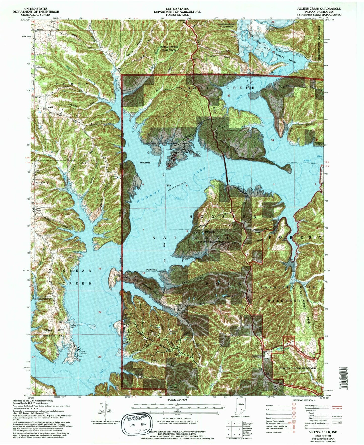
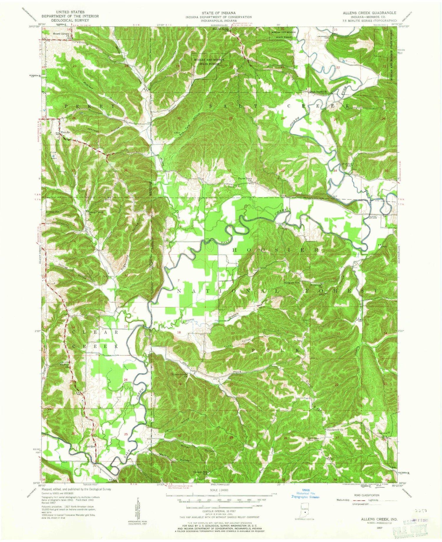
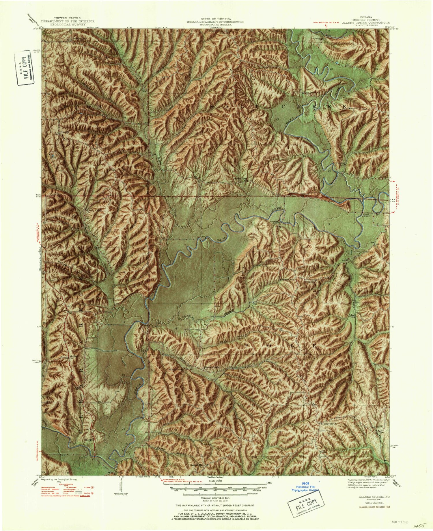
Classic USGS Allens Creek Indiana 7.5'x7.5' Topo Map
Couldn't load pickup availability
Historical USGS topographic quad map of Allens Creek in the state of Indiana. Typical map scale is 1:24,000, but may vary for certain years, if available. Print size: 24" x 27"
This quadrangle is in the following counties: Monroe.
The map contains contour lines, roads, rivers, towns, and lakes. Printed on high-quality waterproof paper with UV fade-resistant inks, and shipped rolled.
Contains the following named places: Baxter Branch, Blackwell Church, Allens Creek, Allens Creek State Recreation Area, Burgoon Church Cemetery, Butcher Branch, Butcher Hollow, Chapel Hill School, Dutch Ridge, Dutch Ridge Lookout Tower, Eads Hollow, Fairfax State Recreation Area, Friendship Cemetery, Frog Pond Ridge, Handy, Hardin Ridge, Hardin Ridge Recreation Area, Hayes Hollow, Holland Ridge, Jacobs Hollow, Jarrell Hollow, Johnson Hollow, Knight Ridge School, Lucas Cemetery, Martin Hollow, Middle Fork Salt Creek, Miller Hollow, Monroe Lake, Moore Creek, Mount Calvary Church, Mount Ebal Church, New Paynetown Church, North Fork Salt Creek, Pate Hollow, Paynetown State Recreation Area, Phillipe Hollow, Pine Grove Church, Pine Ridge, Ramp Creek, Rush Ridge, Saddle Creek, Sherril Hollow, Shiloh Temple, Siscoe Branch, Todd Cemetery, Blackwell Lake, Lake Monroe Airport, North Fork State Wildlife Refuge, Ransburg Boy Scout Reservation, Hardin Ridge Recreation Site, Blackwell Pond Campground, Fairfax, South Granger Post Office (historical), Allens Creek Post Office (historical), Township of Polk, Township of Salt Creek, Baxter Branch, Blackwell Church, Allens Creek, Allens Creek State Recreation Area, Burgoon Church Cemetery, Butcher Branch, Butcher Hollow, Chapel Hill School, Dutch Ridge, Dutch Ridge Lookout Tower, Eads Hollow, Fairfax State Recreation Area, Friendship Cemetery, Frog Pond Ridge, Handy, Hardin Ridge, Hardin Ridge Recreation Area, Hayes Hollow, Holland Ridge, Jacobs Hollow, Jarrell Hollow, Johnson Hollow, Knight Ridge School, Lucas Cemetery, Martin Hollow, Middle Fork Salt Creek, Miller Hollow, Monroe Lake, Moore Creek, Mount Calvary Church, Mount Ebal Church, New Paynetown Church, North Fork Salt Creek, Pate Hollow, Paynetown State Recreation Area, Phillipe Hollow, Pine Grove Church, Pine Ridge, Ramp Creek, Rush Ridge, Saddle Creek, Sherril Hollow, Shiloh Temple, Siscoe Branch, Todd Cemetery, Blackwell Lake, Lake Monroe Airport, North Fork State Wildlife Refuge, Ransburg Boy Scout Reservation, Hardin Ridge Recreation Site, Blackwell Pond Campground, Fairfax, South Granger Post Office (historical), Allens Creek Post Office (historical), Township of Polk, Township of Salt Creek