MyTopo
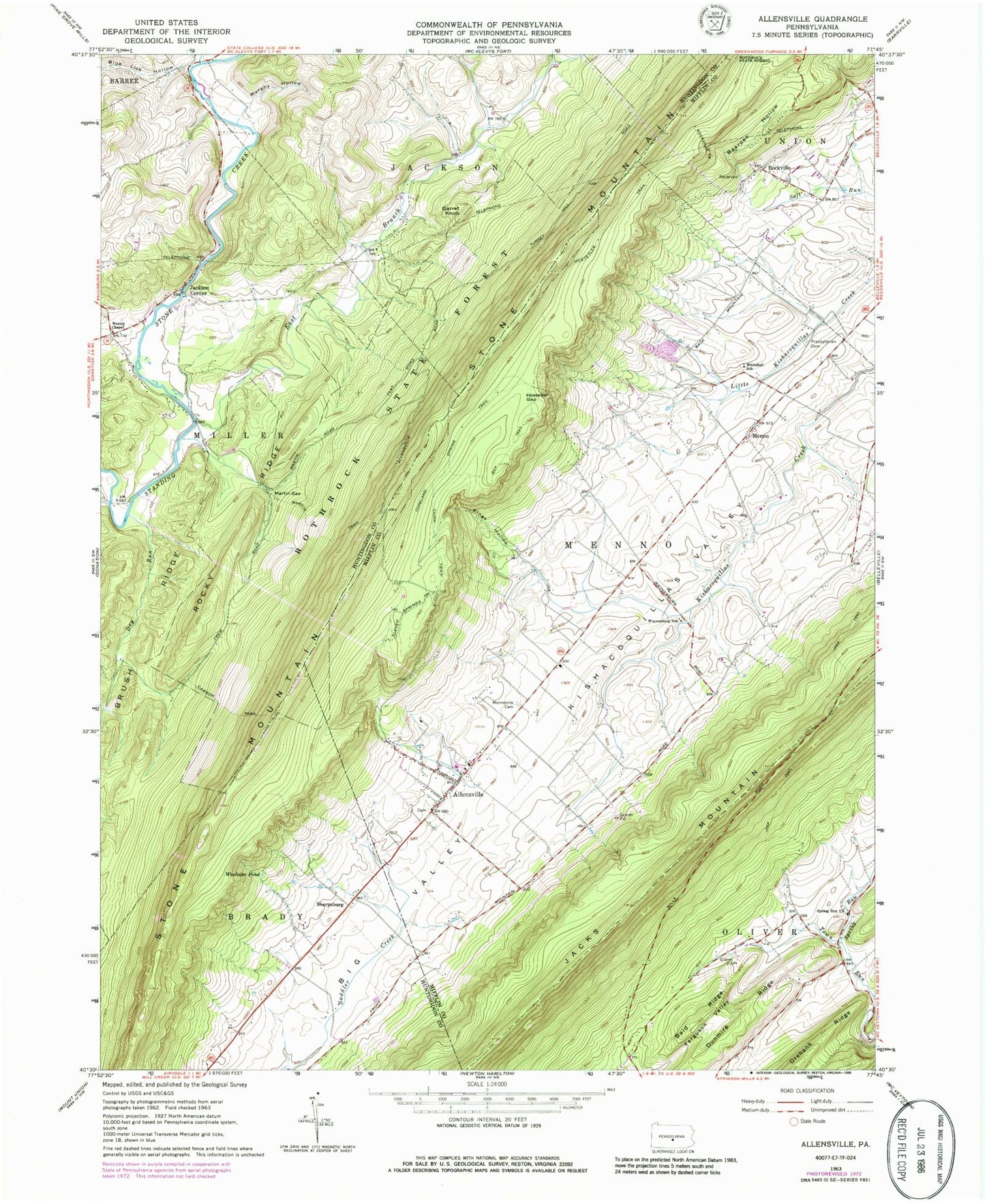
Classic USGS Allensville Pennsylvania 7.5'x7.5' Topo Map
Couldn't load pickup availability
Historical USGS topographic quad map of Allensville in the state of Pennsylvania. Map scale may vary for some years, but is generally around 1:24,000. Print size is approximately 24" x 27"
This quadrangle is in the following counties: Huntingdon, Mifflin.
The map contains contour lines, roads, rivers, towns, and lakes. Printed on high-quality waterproof paper with UV fade-resistant inks, and shipped rolled.
Contains the following named places: Allensville, Allensville Census Designated Place, Allensville Mennonite and Amish Cemetery, Allensville Post Office, Allensville Presbyterian Cemetery, Allensville Volunteer Fire Department Station 25, Bald Ridge, Bearpen Hollow, Big Valley, Blue Lick Hollow, Brush Ridge, Carbon Trail, Chipp Trail, Concord School, Copeland Spring Trail, Detweiler Cemetery, Dry Run, Dunmire Ridge, East Branch Standing Stone Creek, Eleven Springs Trail, Fleming Poultry Farm, Garret Knob, Geisler Run, Glick Cemetery, Herod Run, Hostetler Gap, Hostetler Trail, Huey Airport, Jackson Corner, King School, Kings Hollow, Martin Gap, Martin Gap CCC Camp, Martin Trail, McDowell Cemetery, Menno, Murphy Hollow, Old Methodist Cemetery, Prayer Rock, Rockville, Rockville Trail, Rocky Ridge, Saint Paul Evangelical Lutheran Church Cemetery, Sample School, School Number 6, Sharpsburg, Spring Run, Spring Run Brethren Cemetery, Spring Run Church, Spruce Run, Stone Mountain, Swarey Spring, Township of Menno, Township of Miller, Waynesburg School, Wesley Chapel, West Kishacoquillas Presbyterian Cemetery, Westover Pond, Whitehall Cemetery, Whitehall School, ZIP Code: 17002