MyTopo
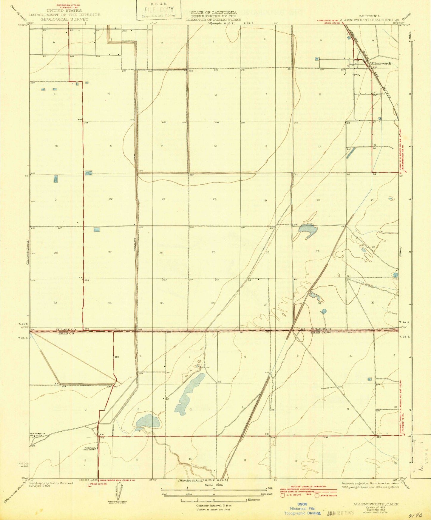
Classic USGS Allensworth California 7.5'x7.5' Topo Map
Couldn't load pickup availability
Historical USGS topographic quad map of Allensworth in the state of California. Map scale may vary for some years, but is generally around 1:24,000. Print size is approximately 24" x 27"
This quadrangle is in the following counties: Kern, Tulare.
The map contains contour lines, roads, rivers, towns, and lakes. Printed on high-quality waterproof paper with UV fade-resistant inks, and shipped rolled.
Contains the following named places: Allensworth, Allensworth Census Designated Place, Allensworth Elementary School, Alpaugh Irrigation District Canal, Angelus Gun Club, Colonel Allensworth State Historic Park, Old Channel Poso Creek, Pintail Duck Club, San Joaquin Gun Club, Tulare Basin Wildlife Management Area, Tulare Gun Club, Twenty-Eight Gun Club, Visalia Gun Club, Widgeon Gun Club