MyTopo
Classic USGS Alma Kansas 7.5'x7.5' Topo Map
Couldn't load pickup availability
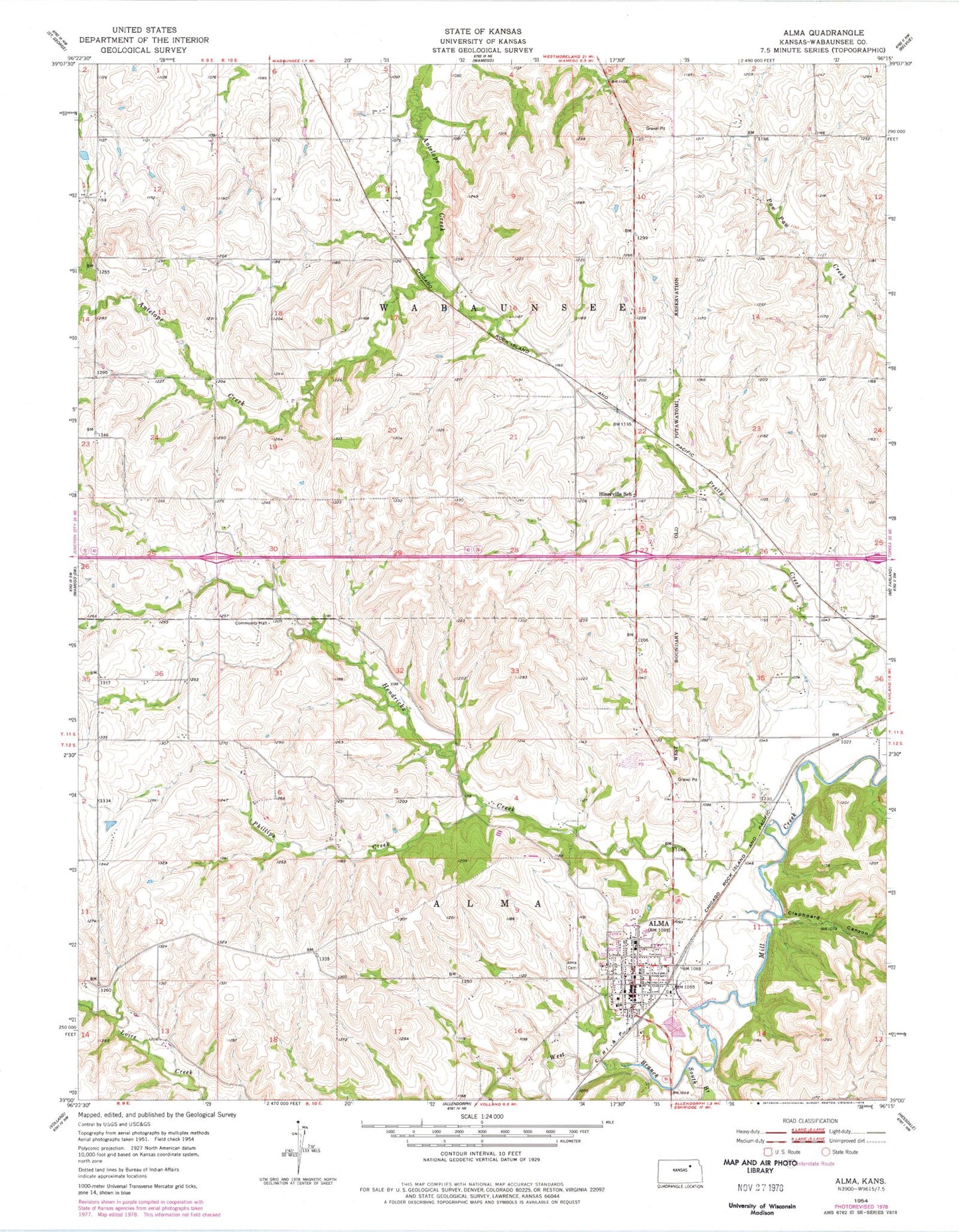
Historical USGS topographic quad map of Alma in the state of Kansas. Map scale may vary for some years, but is generally around 1:24,000. Print size is approximately 24" x 27"
This quadrangle is in the following counties: Wabaunsee.
The map contains contour lines, roads, rivers, towns, and lakes. Printed on high-quality waterproof paper with UV fade-resistant inks, and shipped rolled.
Contains the following named places: Alma, Alma Baptist Church, Alma Cemetery, Alma City Hall, Alma Co - Operative Oil Association Grain Elevator Number 1, Alma Fire Department, Alma Grade School, Alma Peace United Church of Christ, Alma Police Department, Alma Post Office, Alma Sewer Treatment Plant, Alma United Methodist Church, American Medical Response Alma, City of Alma, Clapboard Canyon, Fairfield, Hendricks Creek, Hinerville School, Holy Family Catholic Church, Interstate 70 Weigh Station 21W, Interstate 70 Weigh Station 22W, Mill Creek Valley Unified School District Office, Phillips Creek, Pottawatomie Wabaunsee Regional Library Alma Branch, Saint John Lutheran Church, Saint John Lutheran School, South Branch Mill Creek, Township of Alma, Township of Wabaunsee, Wabaunsee County Courthouse, Wabaunsee County Fairgrounds, Wabaunsee County Health Department, Wabaunsee County Jail, Wabaunsee County Sheriff's Office, Wabaunsee Senior High School, Wabaunsee Township Fire District 6, West Branch Mill Creek