MyTopo
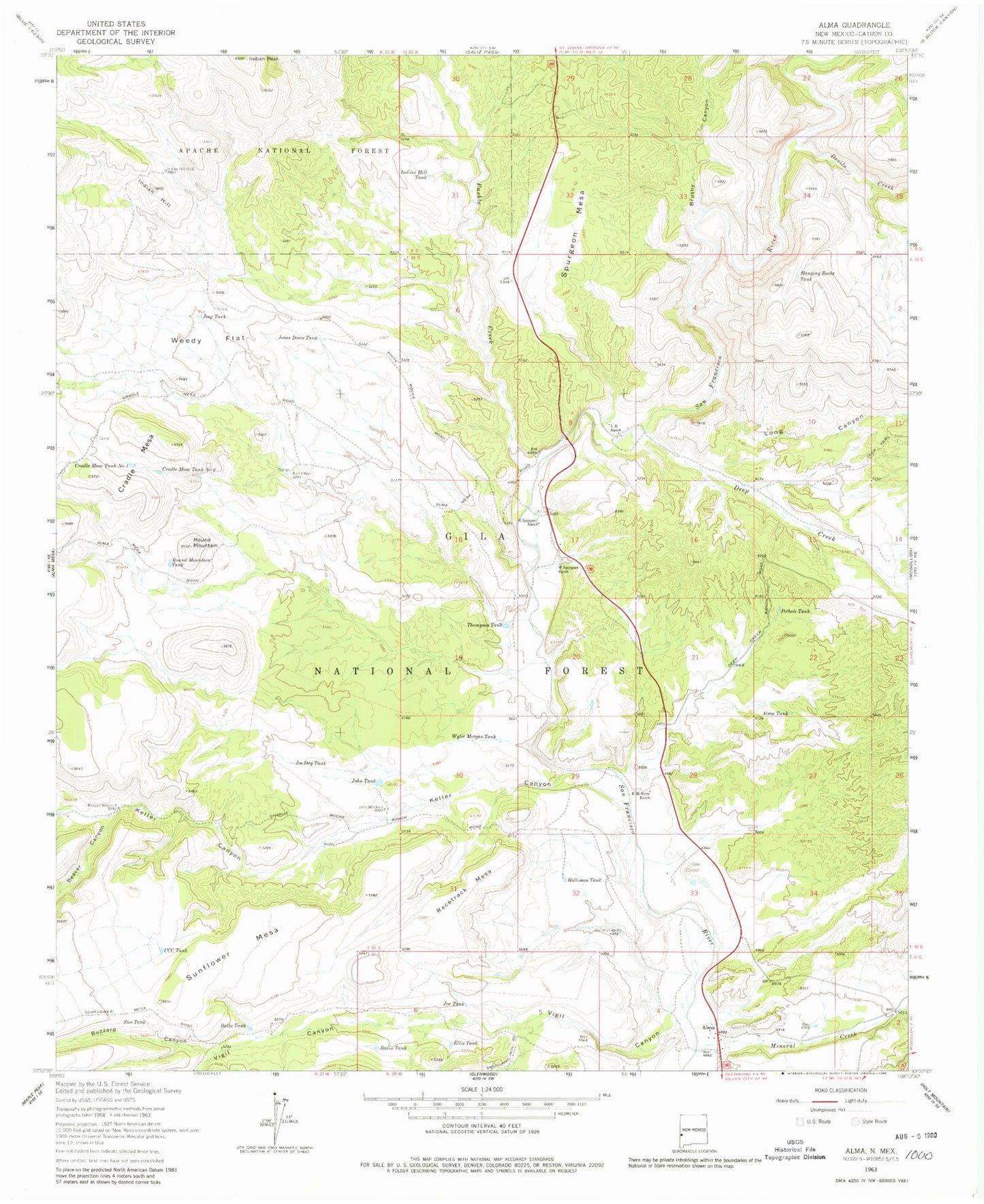
Classic USGS Alma New Mexico 7.5'x7.5' Topo Map
Couldn't load pickup availability
Historical USGS topographic quad map of Alma in the state of New Mexico. Map scale may vary for some years, but is generally around 1:24,000. Print size is approximately 24" x 27"
This quadrangle is in the following counties: Catron.
The map contains contour lines, roads, rivers, towns, and lakes. Printed on high-quality waterproof paper with UV fade-resistant inks, and shipped rolled.
Contains the following named places: Alma, Alma Cemetery, Alma Census Designated Place, Alma Flat Tank, Alma Post Office, Alma Tank, Alma Water Storage Tank, Balke Tank, Basin Tank, Beaver Canyon, Beaver Spring, Boot Hill Cemetery, Brushy Canyon, Burns Well, Buzzard Canyon, CCC Tank, Copper Creek Water Storage Tank, Cradle Mesa, Deep Creek, Devils Creek, Ditch Tank, E Spurgeon Ranch, Ellis Tank, Hanging Rocks Tank, Hells Here Tank, Hick Water Storage Tank, Hicks Pasture, Highway Tank, Hollimon Tank, Hollimon Well, Indian Hill, Indian Hill Tank, Indian Hill Well, Indian Peak, Jeep Tank, Joe Day Tank, Joe Tank, John Tank, John Windmill, Jones Draw Tank, Juniper Tank, Keller Canyon, L H Ranch, Leaky Tank, Little Round Mountain, Little Round Mountain Tank, Long Canyon, Long Canyon Water Storage Tank, McKeen Ranch, Mineral Creek, Morgan Windmill, New Tank, Pipeline Tank, Pothole Tank, Pueblo Corral, Pueblo Creek, Racetrack Mesa, Round Mountain, Section Five Tank, Section Thirty-six Tank, Section Twenty Tank, Section Two Tank, Spurgeon Mesa, Sun Tank, Sunflower Mesa, Thompson Tank, Twin Sister Corral, Twin Sister Tank Number One, Twin Sister Tank Number Two, Vigil Canyon, W Spurgeon Ranch, Weedy Flat, W-S Ranch, Wylie Morgan Tank