
MyTopo
Classic USGS Alpena Arkansas 7.5'x7.5' Topo Map
Couldn't load pickup availability
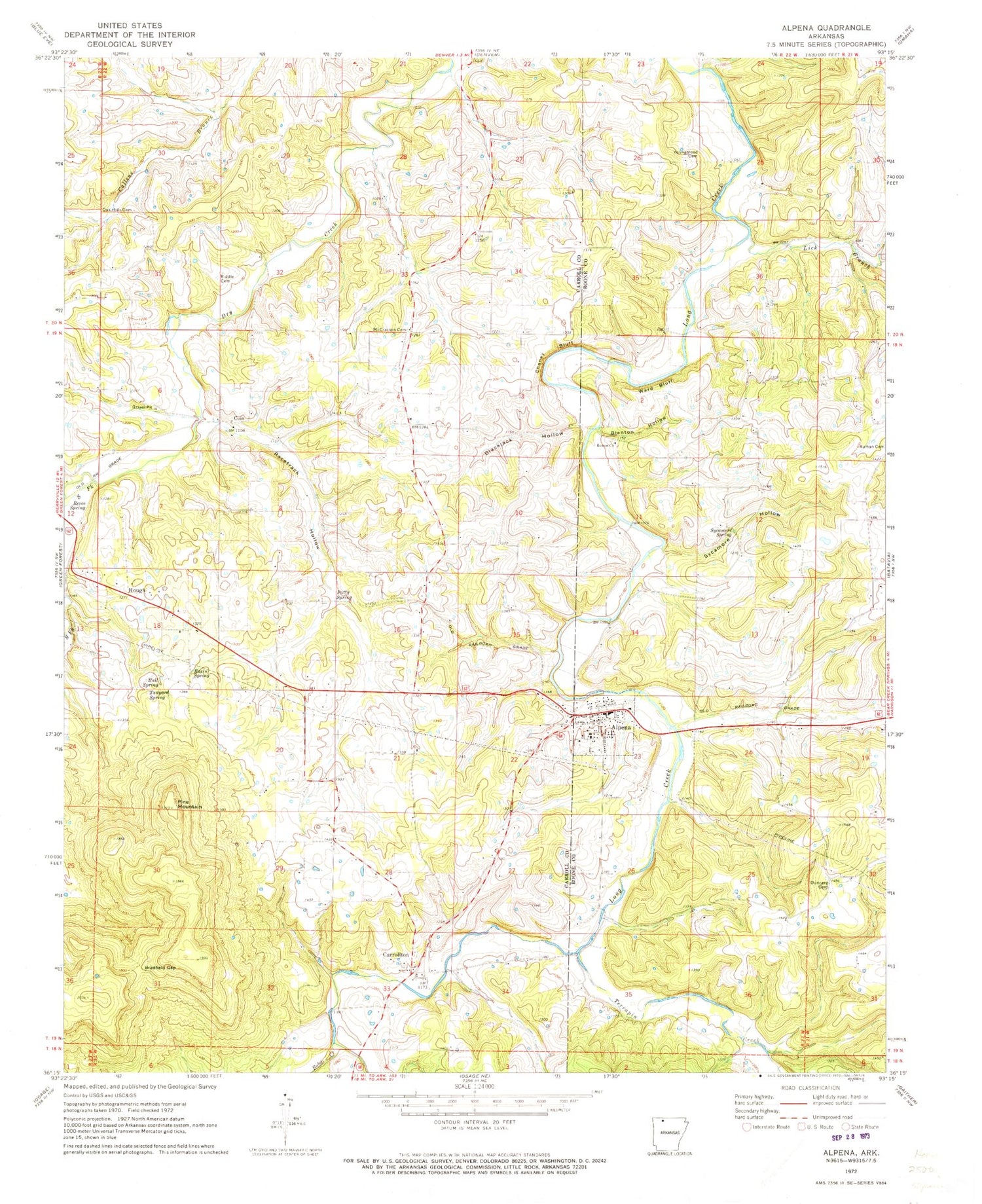
Historical USGS topographic quad map of Alpena in the state of Arkansas. Map scale may vary for some years, but is generally around 1:24,000. Print size is approximately 24" x 27"
This quadrangle is in the following counties: Boone, Carroll.
The map contains contour lines, roads, rivers, towns, and lakes. Printed on high-quality waterproof paper with UV fade-resistant inks, and shipped rolled.
Contains the following named places: Alpena, Alpena Elementary School, Alpena High School, Alpena Police Department, Alpena Post Office, Alpena Volunteer Fire Department, Basin Spring, Blackjack Hollow, Blanton Hollow, Blantons Mill, Bobo Creek, Bradfield Gap, Bull Spring, Carrollton, Carrollton Cemetery, Carrollton School, Chaney Bluff, Coin, Duncard Cemetery, Hanbys Mill, Hough, Lick Branch, McCracken Cemetery, Nunnally, Oak Hills Cemetery, Patty Spring, Pine Mountain, Racetrack Hollow, Reves Spring, Riddle Cemetery, Rock Quarry, Roscoe Church, Shaver, South Fork Dry Creek, Sycamore Hollow, Sycamore Spring, Tanyard Spring, Terrapin Creek, Town of Alpena, Township of Carrollton, Township of Coin, Ward Bluff, Youngblood Cemetery


