
MyTopo
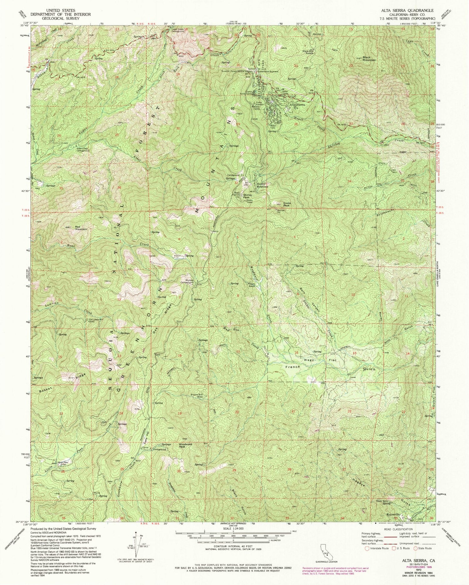
Classic USGS Alta Sierra California 7.5'x7.5' Topo Map
Couldn't load pickup availability
Historical USGS topographic quad map of Alta Sierra in the state of California. Typical map scale is 1:24,000, but may vary for certain years, if available. Print size: 24" x 27"
This quadrangle is in the following counties: Kern.
The map contains contour lines, roads, rivers, towns, and lakes. Printed on high-quality waterproof paper with UV fade-resistant inks, and shipped rolled.
Contains the following named places: Alder Creek, Alder Creek Campground, Alta Sierra, Barn Canyon, Basket Ridge, Black Mountain, Black Mountain Saddle, Browns Mill, Camp Kaweah, Camp Yenis Hante, Cedar Creek Campground, Cooks Peak, Dutch Flat, Evans Flat, Greenhorn Mountain County Park, Greenhorn Summit, Ice House Creek, Keyes Mine, Mud Hen Creek, Oak Ridge, Old Likely Mill, Pettit Place, Potato Patch, Red Mountain, Rhymes Campground, Rocky Gulch, Shirley Peak, Slick Rock Creek, Stable Creek, Summit Forest Service Station, Wagy Flat, Woodward Creek, Evans Flat Campground, Shirley Meadow SKi Area, Rutledge Ranch, Ranger Spring, Keyesville, Shirley Meadows, Woodward Peak, Shirley Meadow Campground, Summit Store (historical), Alta Sierra Census Designated Place


