MyTopo
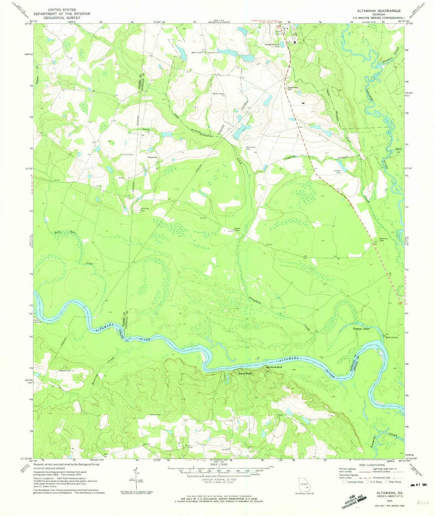
Classic USGS Altamaha Georgia 7.5'x7.5' Topo Map
Couldn't load pickup availability
Historical USGS topographic quad map of Altamaha in the state of Georgia. Map scale may vary for some years, but is generally around 1:24,000. Print size is approximately 24" x 27"
This quadrangle is in the following counties: Appling, Tattnall, Toombs.
The map contains contour lines, roads, rivers, towns, and lakes. Printed on high-quality waterproof paper with UV fade-resistant inks, and shipped rolled.
Contains the following named places: Altamaha, Battle Creek, Bells Mill Creek, Big Club House Pond, Big Club House Pond Dam, Cedar Grove Church, Cotton Patch Pond, Cotton Patch Pond Dam, Davis Landing, Downstream Twin Pond, Downstream Twin Pond Dam, Eason Bluff, Ebenezer Church, Harden Cemetery, Harris Cemetery, Highway 144 Fire Substation, Iron Mine Bluff, McArthur Cemetery, Moon Bluff, Pearson Chapel, Roaring Creek, Slaughter Creek, Stripling Cemetery, Thomas Creek, Tillman Cemetery, Upstream Twin Pond, Upstream Twin Pond Dam, Wallace Pond, Wallace Pond Dam, Widincamp Cemetery, Woods Cemetery, Yeoman Cemetery