MyTopo
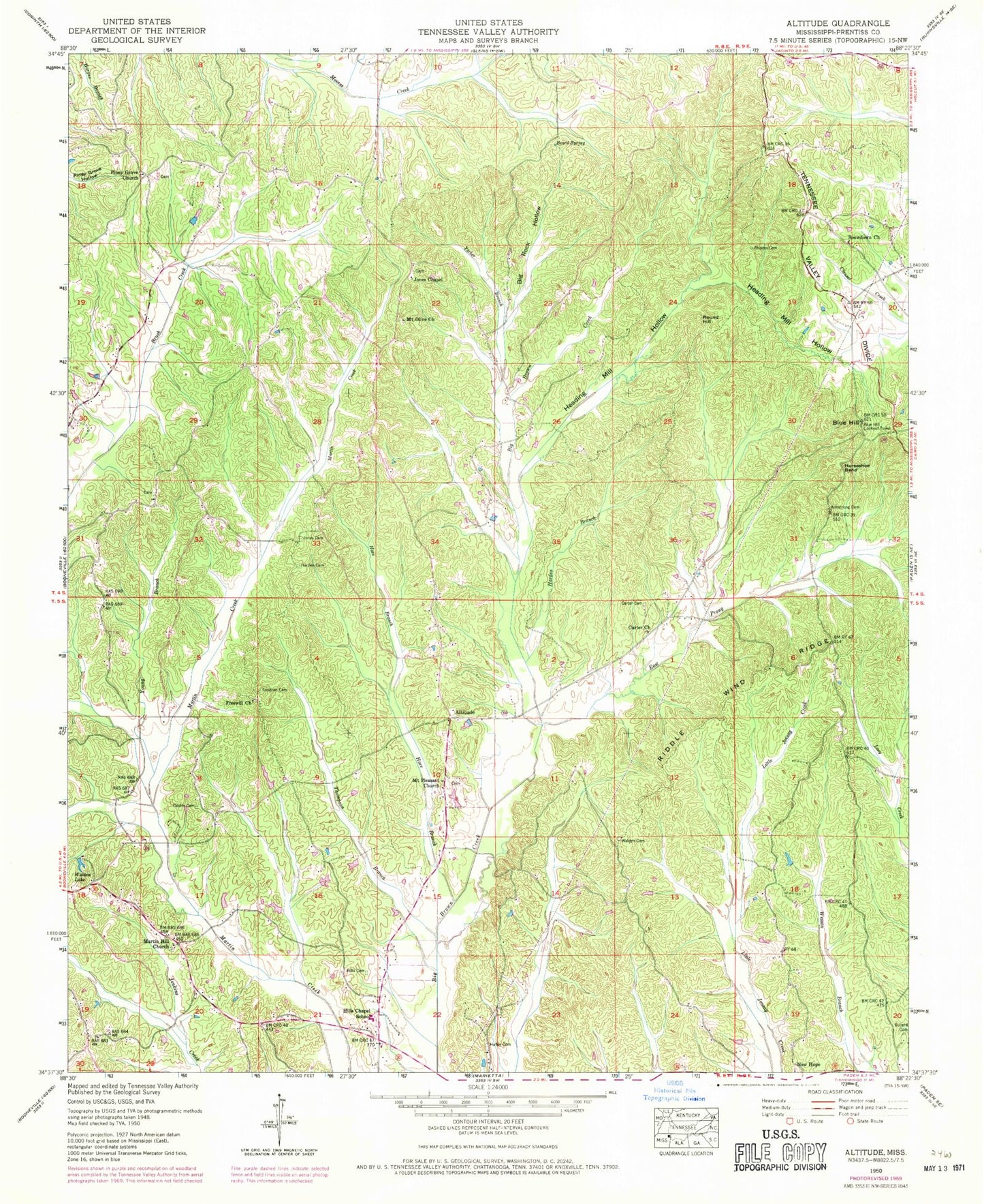
Classic USGS Altitude Mississippi 7.5'x7.5' Topo Map
Couldn't load pickup availability
Historical USGS topographic quad map of Altitude in the state of Mississippi. Map scale may vary for some years, but is generally around 1:24,000. Print size is approximately 24" x 27"
This quadrangle is in the following counties: Prentiss.
The map contains contour lines, roads, rivers, towns, and lakes. Printed on high-quality waterproof paper with UV fade-resistant inks, and shipped rolled.
Contains the following named places: Altitude, Altitude Volunteer Fire Department, Armstrong Cemetery, Beard Spring, Big Rock Hollow, Blue Hill, Blue Hill Lookout Tower, Buck Snort School, Bullard Cemetery, Carter Cemetery, Carter Church, Carters School, Dodds Cemetery, East Prong Big Brown Creek, Fondren Cemetery, Freewill Cemetery, Freewill Church, Goodard Lake Dam, Harden Branch, Harden Cemetery, Hare Branch, Heading Mill Hollow, Hills Chapel, Hills Chapel Church of Christ, Hills Chapel School, Holley Cemetery, Horseshoe Bend, Jones Cemetery, Jones Chapel, Jones Chapel Cemetery, Martin Hill, Martin Hill Cemetery, Martin Hill Church, Martin Hill School, Mount Olive Church, Mount Olive Church of God Cemetery, Mount Pleasant Cemetery, Mount Pleasant Church, New Candler Cemetery, New Hope, Northeast Mississippi Church of God and Christ, Piney Grove Church, Pitts Cemetery, Rhodes Cemetery, Riddle Wind Ridge, Round Hill, Shackelford Pond Dam, Smith Lake Dam, Snowdown Church, Snowdown Church of Christ Cemetery, Supervisor District 5, Thompson Branch, Walden Cemetery, Walden Lake, White Oak, Williams Cemetery, Wittis Creek, Yarber Branch, Yarbrough Lake Dam, Young Branch