
MyTopo
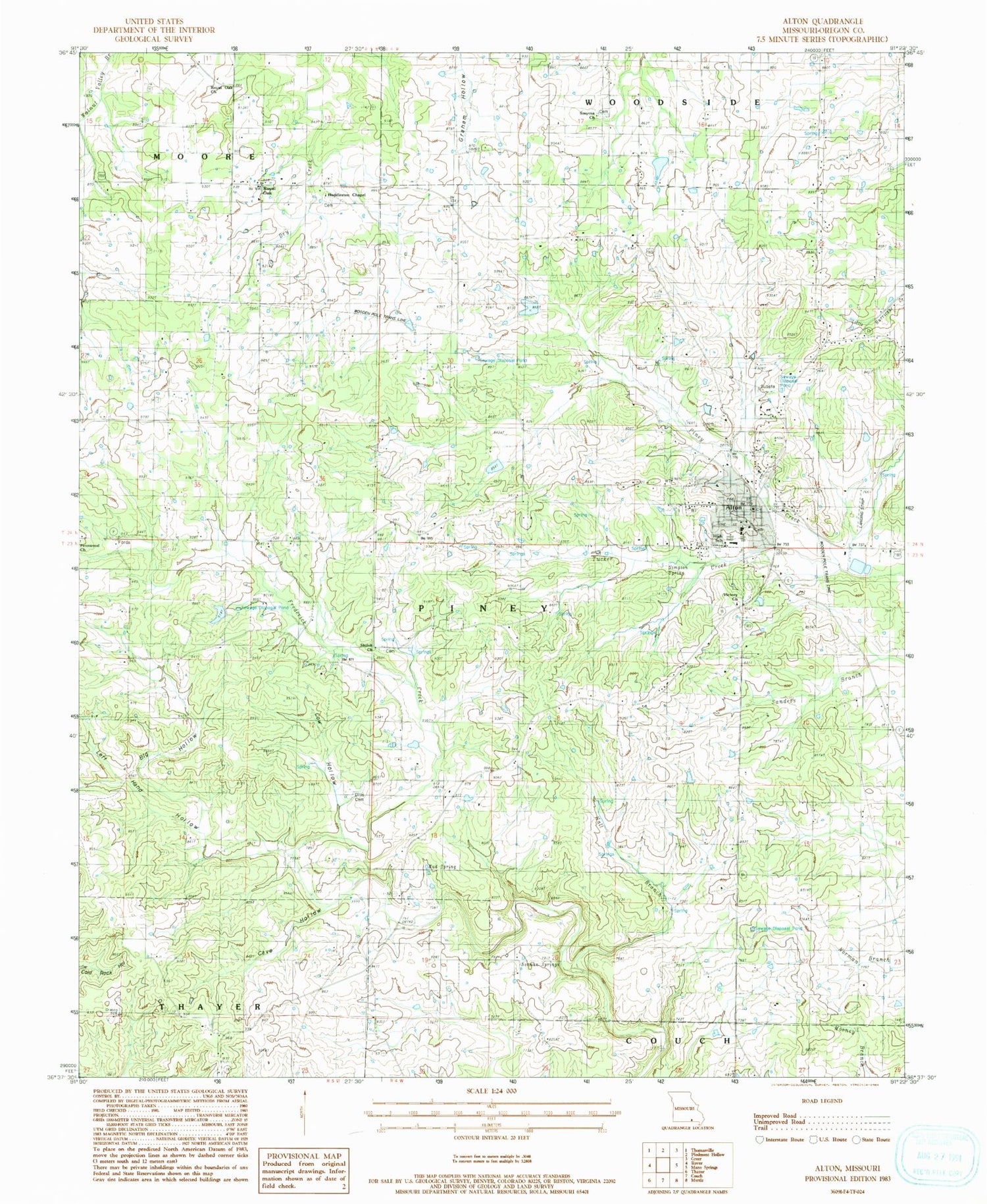
Classic USGS Alton Missouri 7.5'x7.5' Topo Map
Couldn't load pickup availability
Historical USGS topographic quad map of Alton in the state of Missouri. Typical map scale is 1:24,000, but may vary for certain years, if available. Print size: 24" x 27"
This quadrangle is in the following counties: Oregon.
The map contains contour lines, roads, rivers, towns, and lakes. Printed on high-quality waterproof paper with UV fade-resistant inks, and shipped rolled.
Contains the following named places: Alton, Big Hollow, Cave Hollow, Cow Hollow, Fairview School (historical), Hall Branch, Huddleston Church, Left Hand Hollow, Mud Spring, Norman Spring, Pinwood School, Royal Oak School, Shiloh School (historical), Simpson Spring, Smyrna School (historical), Tucker Creek, Pennwood Church, Climax Church (historical), Huddleston, Huddleston Graveyard, Huddleston Branch, Royal Oak, Woodside, Royal Oak Church, Smyrna Church, Smith Cemetery, Alton High School, Victory Church, Shiloh Church, Dills Cemetery, Culp Branch, Oregon County, Nuwer Lake Dam, Nuwer Lake, Verlotta Dam, Bennett Lake, Hix Lake Dam, Young Lake Dam, Township of Piney, City of Alton, Missouri Department of Conservation Forestry Ozark Regional Field Fire Office Alton, Alton Fire Department, Smyrna Cemetery, Oregon County Sheriff's Office, Alton Police Department


