MyTopo
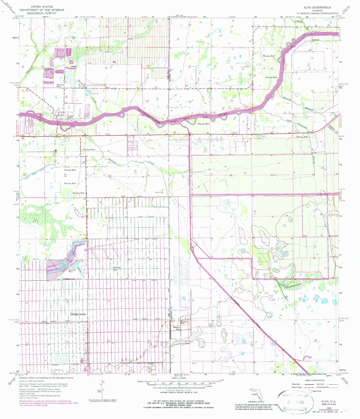
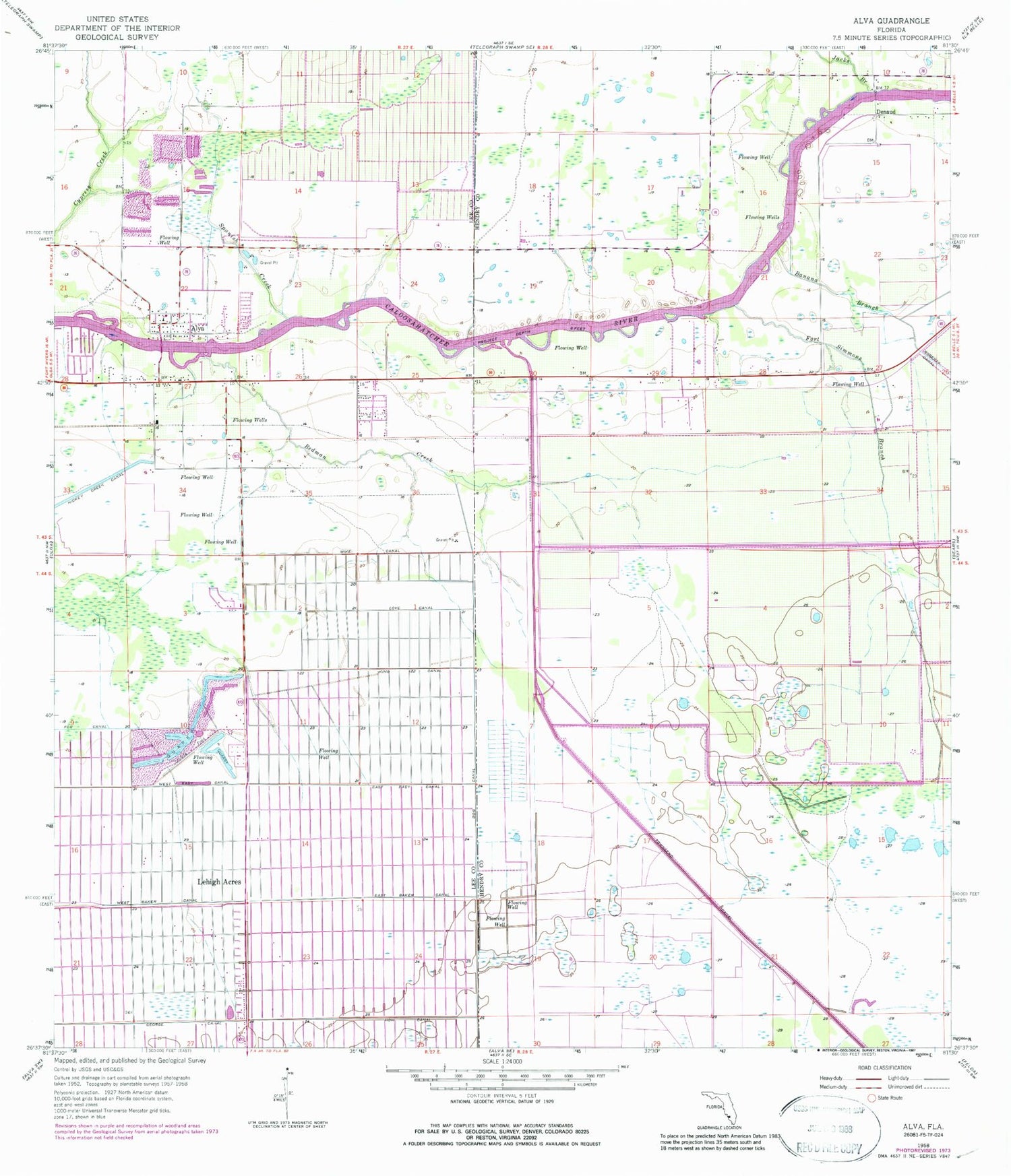
Classic USGS Alva Florida 7.5'x7.5' Topo Map
Couldn't load pickup availability
Historical USGS topographic quad map of Alva in the state of Florida. Map scale may vary for some years, but is generally around 1:24,000. Print size is approximately 24" x 27"
This quadrangle is in the following counties: Hendry, Lee.
The map contains contour lines, roads, rivers, towns, and lakes. Printed on high-quality waterproof paper with UV fade-resistant inks, and shipped rolled.
Contains the following named places: Alma Airport, Alva, Alva Elementary School, Alva Fire and Rescue Service District, Alva Post Office, Alva United Methodist Church, Banana Branch, Banana Branch Bridge, Bedman Creek, Charleston Park, Charleston Park Census Designated Place, Cotton Strip, Covenant Presbyterian Church, Denaud, Dog Canal, East Baker Canal, East Easy Canal, First Baptist Church of Alva, Fort Denaud, Fort Denaud Bridge, Fort Denaud Census Designated Place, Fort Simmons Branch, How Canal, Jacks Branch, King Canal, Lehigh Acres, Lehigh Acres Fire Control and Rescue District Station 101, Love Canal, Mike Canal, Oak Park Mobile Village, Spanish Creek, The Alva School, Townsend Canal, United Methodist Camp, Upper Room House of Prayer Pentecostal Church, William's Sky Manor Airport, ZIP Code: 33972