MyTopo
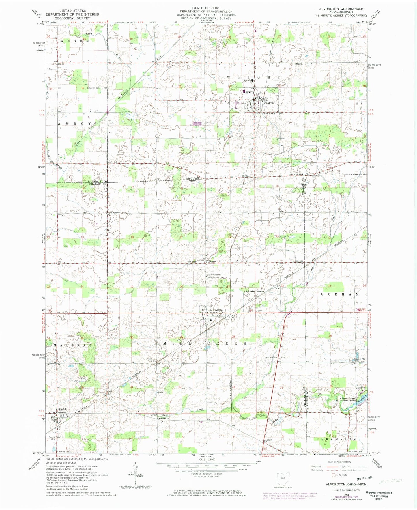
Classic USGS Alvordton Ohio 7.5'x7.5' Topo Map
Couldn't load pickup availability
Historical USGS topographic quad map of Alvordton in the states of Ohio, Michigan. Map scale may vary for some years, but is generally around 1:24,000. Print size is approximately 24" x 27"
This quadrangle is in the following counties: Fulton, Hillsdale, Williams.
The map contains contour lines, roads, rivers, towns, and lakes. Printed on high-quality waterproof paper with UV fade-resistant inks, and shipped rolled.
Contains the following named places: Alvordton, Alvordton - Millcreek Township Fire Department, Alvordton Census Designated Place, Alvordton Post Office, Barrett Cemetery, Bird Creek, Bradley School, Brehm Farms, Brick School, Church of Christ, Ebenezer Church, Franklin Junction, Gospel Tabernacle, Hamer, Kanayer School, Kunkle, Kunkle Cemetery, Kunkle Census Designated Place, Kunkle Family Farms, Kunkle Fire Department, Kunkle Post Office, Kunkle United Brethren in Christ Church, Laird Creek, Lippy School, Mill Creek Dairy, Mount Salem Cemetery, Newton Drain, North Elementary School, Olive Branch Cemetery, Olive Branch Church, Primrose, Primrose Cemetery, Salvation Camp, School Number 4, School Number 5, Stoner School, Township of Mill Creek, Union Church, Village of Alvordton, Village of Waldron, Waldron, Waldron Cemetery, Waldron District Library, Waldron Post Office, Waldron Schools, Waldron Station, Waldron Wesleyan Church, Walkup School, Walnut Grove Cemetery, West Fork Mill Creek, Wright - Waldron Fire and Ambulance Station 12, ZIP Codes: 43501, 43531, 49288