MyTopo
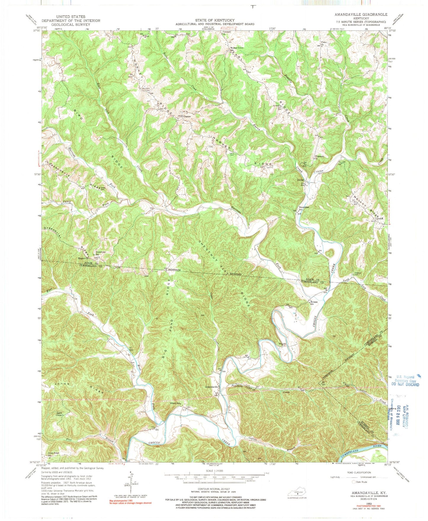
Classic USGS Amandaville Kentucky 7.5'x7.5' Topo Map
Couldn't load pickup availability
Historical USGS topographic quad map of Amandaville in the state of Kentucky. Map scale may vary for some years, but is generally around 1:24,000. Print size is approximately 24" x 27"
This quadrangle is in the following counties: Adair, Cumberland, Russell.
The map contains contour lines, roads, rivers, towns, and lakes. Printed on high-quality waterproof paper with UV fade-resistant inks, and shipped rolled.
Contains the following named places: Amandaville, Big Pond Ridge, Bird Ridge, Burns Creek, Casey Fork, Cedar Creek, Chance, Chestnut Flat Ridge, Collins Branch, Concord Church, Cundiff, Doe Creek, Earl Cemetery, Elliott School, Glens Fork Division, Greenbrier School, Hadleys Cemetery, Harrods Fork, Harvey Branch, Harvey Ridge, Hogard Church, Hopewell Baptist Church, Independence Ridge, Inroad, Jones Ridge, Jones Ridge School, Lewis Cemetery, Low Gap, McGinnis Cemetery, Morgan School, Pine Branch, Powells Creek, Puncheon Camp Creek, Republican School, Rock Lick Creek, Rowes Store, Sand Lick Creek, Spark Chapel, Stotts Cemetery, Union Church, Walnut Grove, Walnut Grove School, West Fork Crocus Creek