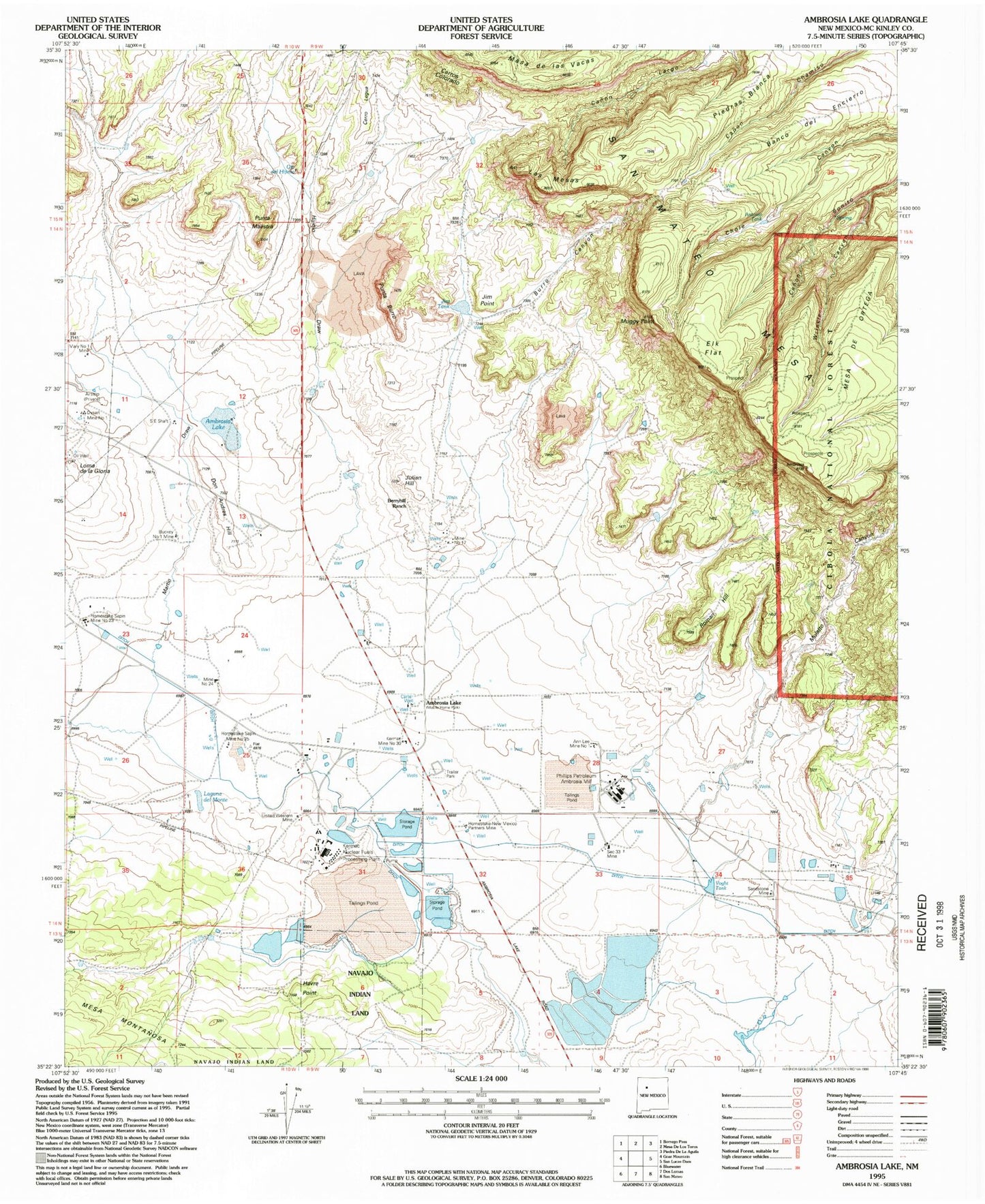
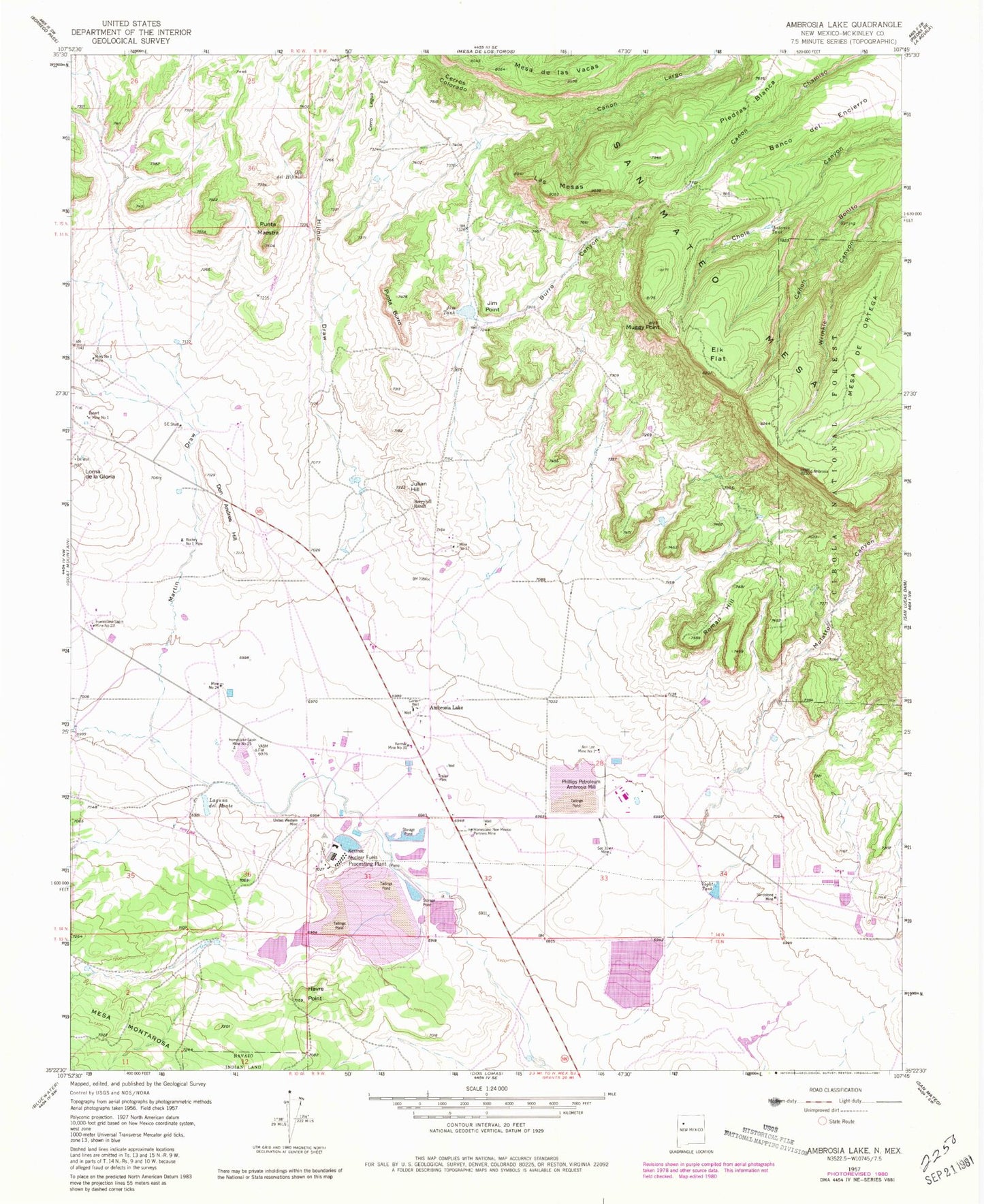
MyTopo
Classic USGS Ambrosia Lake New Mexico 7.5'x7.5' Topo Map
Couldn't load pickup availability
Historical USGS topographic quad map of Ambrosia Lake in the state of New Mexico. Map scale may vary for some years, but is generally around 1:24,000. Print size is approximately 24" x 27"
This quadrangle is in the following counties: McKinley.
The map contains contour lines, roads, rivers, towns, and lakes. Printed on high-quality waterproof paper with UV fade-resistant inks, and shipped rolled.
Contains the following named places: 10012 Water Well, Ambrosia Lake, Ann Lee Mine Number One, Antonio Tank, Banco del Encierro, Berryhill Ranch, Buckey Number 1 Mine, Burro Canyon, Carter Well, Cerro Legua, Cerros Colorado, Cliffside Mine, Don Andres Hill, Dysart Mine Number 1, Elizabeth Group, Elk Flat, Green Pick Twenty Uranium Deposit, Havre Point, Hijinio Draw, Homestake-New Mexico Partners Mine, Homestake-Sapin Mine Number 23, Homestake-Sapin Mine Number 25, Ike Number 1, Jim Point, Jim Tank, Julian Hill, Kermac Mine Number 30, Kermac Nuclear Fuels Processing Plant, Kerr McGee Storage Dam, Kerr-McGee Tailings Dam Pond Number One, Laguna del Monte, Las Mesas, Loma de la Gloria, Martin Draw, Mary Number 1 Mine, Mesa de las Vacas, Mesa de Ortega, Mine Number 17, Mine Number 24, Muggy Point, Ojo del Hijinio, Phillips Petroleum Ambrosia Mill, Phillips Water Well, Punta Burro, Punta Maestra, Roman Hill, Sandstone Mine, Section Thirty-three Mine, United Western Mine, Voght Tank, Wrinkle Canyon