MyTopo
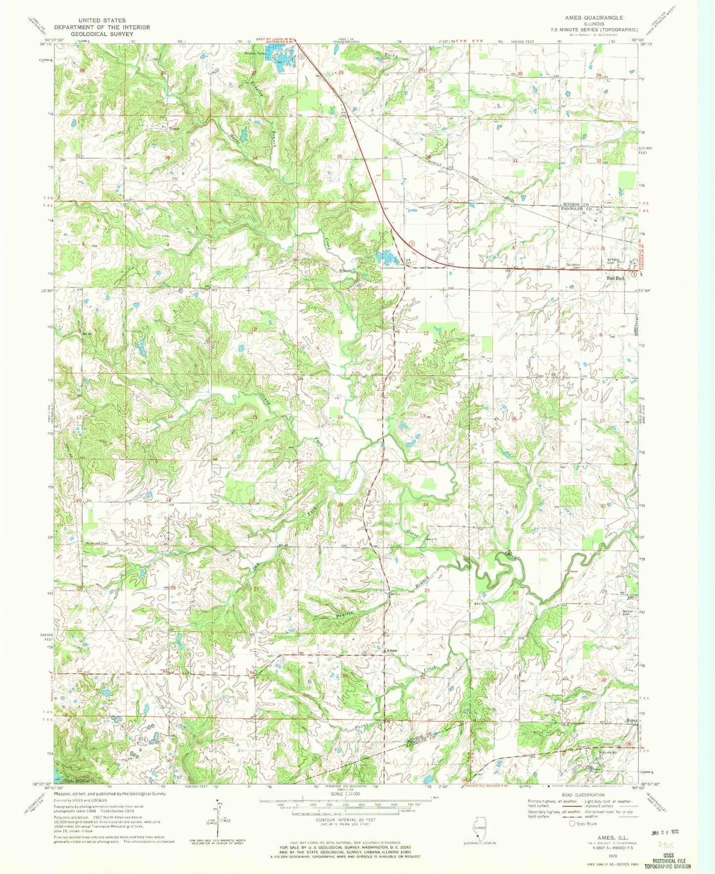
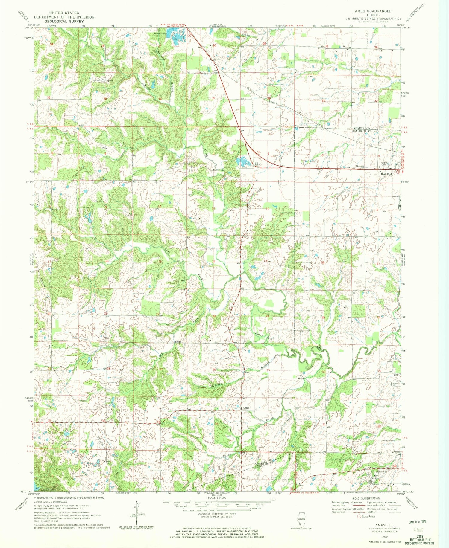
Classic USGS Ames Illinois 7.5'x7.5' Topo Map
Couldn't load pickup availability
Historical USGS topographic quad map of Ames in the state of Illinois. Map scale may vary for some years, but is generally around 1:24,000. Print size is approximately 24" x 27"
This quadrangle is in the following counties: Monroe, Randolph.
The map contains contour lines, roads, rivers, towns, and lakes. Printed on high-quality waterproof paper with UV fade-resistant inks, and shipped rolled.
Contains the following named places: Ames, Bradley Branch, Collier School, Dry Fork, Duclos RLA Airport, Earle School, Election Precinct 9, Illinois No Name Number 2020 Dam, Lake Emmett, Lake Emmett Dam, Lohrberg School, McBride School, McCuen School, Nelson Cemetery, O'Leary School, Our Lady Immaculata Airport, Paint Creek, Poe School, Prairie Branch, Rebenack Cemetery, Round Prairie School, Ruma Convent, Saint John the Baptist Catholic Cemetery, Saint Patrick School, Saint Peter Cemetery, South Fork Horse Creek, Tipton, Tiptown Church, Village of Ruma, Yankeetown School