MyTopo
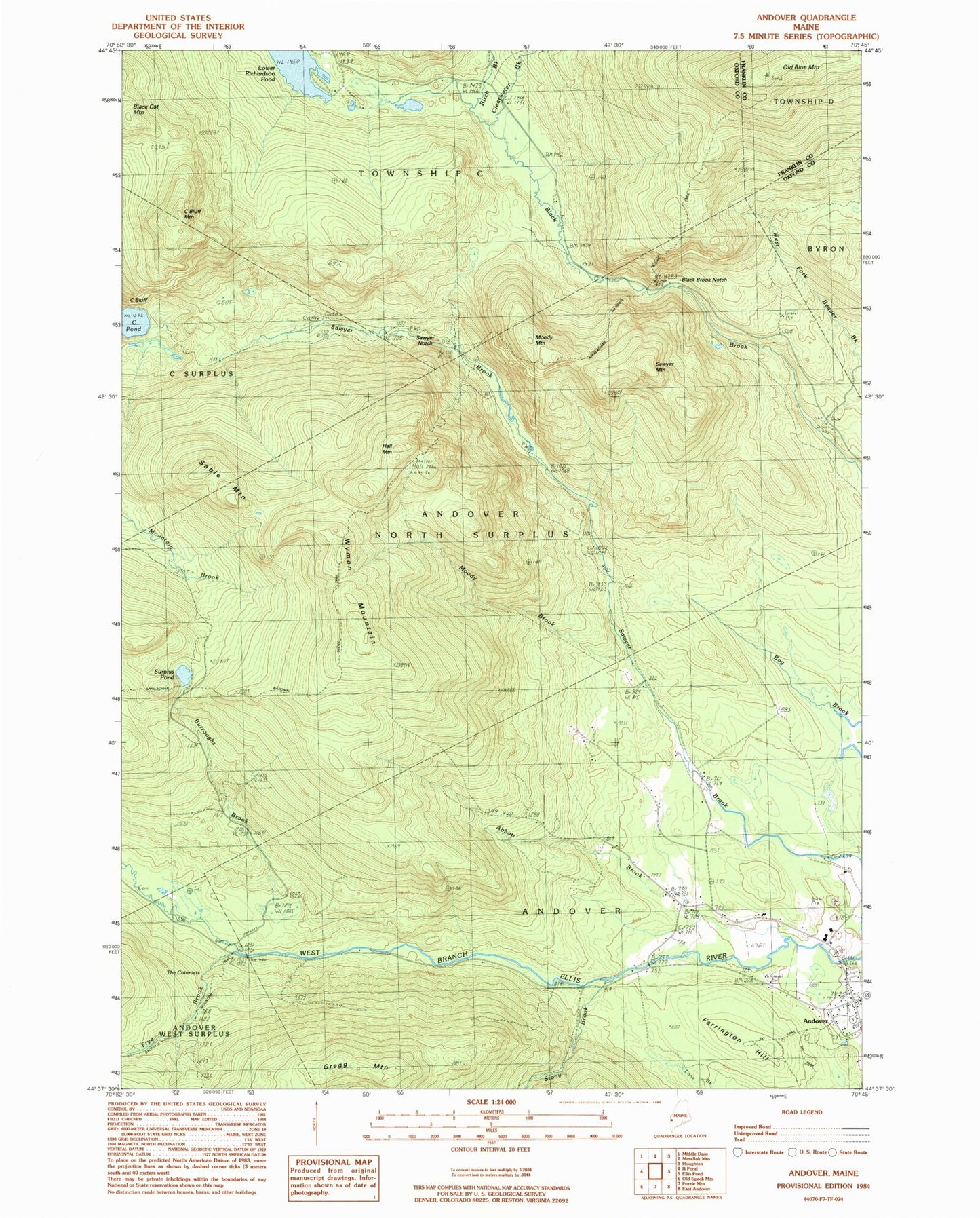
Classic USGS Andover Maine 7.5'x7.5' Topo Map
Couldn't load pickup availability
Historical USGS topographic quad map of Andover in the state of Maine. Typical map scale is 1:24,000, but may vary for certain years, if available. Print size: 24" x 27"
This quadrangle is in the following counties: Franklin, Oxford.
The map contains contour lines, roads, rivers, towns, and lakes. Printed on high-quality waterproof paper with UV fade-resistant inks, and shipped rolled.
Contains the following named places: Abbott Brook, Andover, Birch Brook, Black Brook Notch, Burroughs Brook, C Bluff, C Bluff Mountain, Clearwater Brook, Farrington Hill, Frye Brook, Gregg Mountain, Hall Mountain, Moody Brook, Moody Mountain, Old Blue Mountain, Sable Mountain, Sawyer Mountain, Sawyer Notch, Stony Brook, Surplus Pond, The Cataracts, Wyman Mountain, Andover Cemetery, Andover School, Andover Public Library, Calvary Congregational Church, Andover North Surplus Township, Andover Fire Department