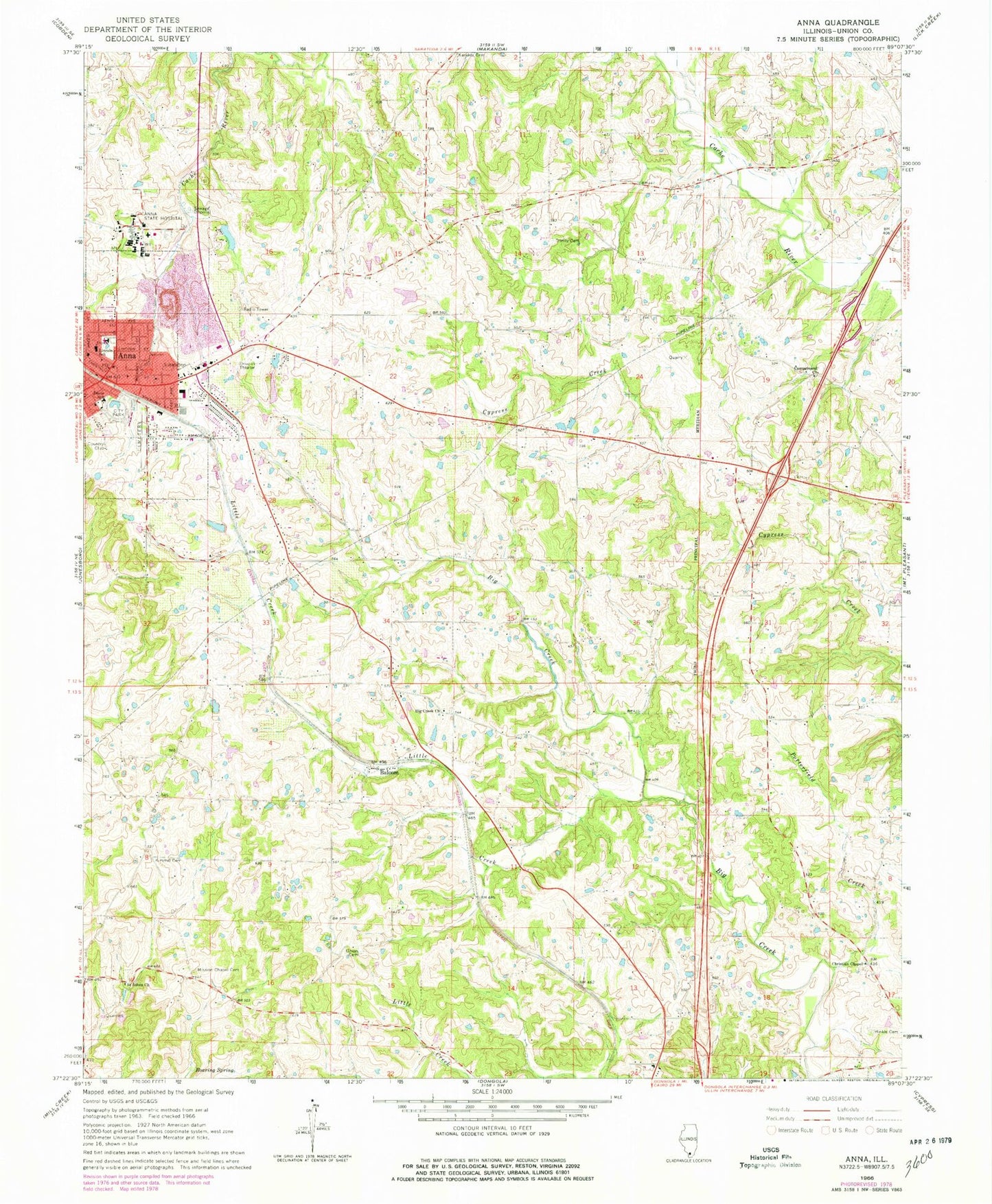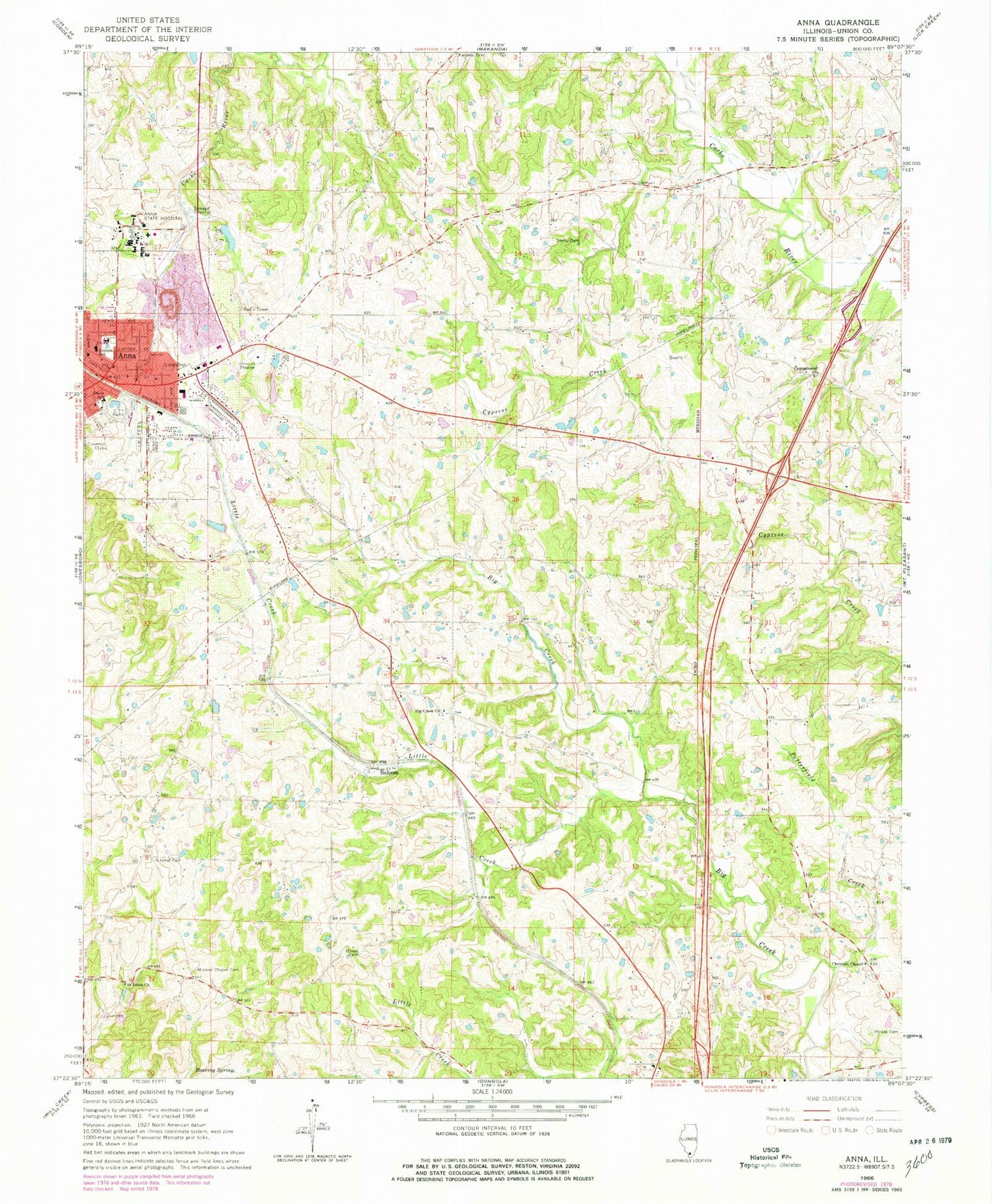
MyTopo
Classic USGS Anna Illinois 7.5'x7.5' Topo Map
Couldn't load pickup availability
Historical USGS topographic quad map of Anna in the state of Illinois. Map scale may vary for some years, but is generally around 1:24,000. Print size is approximately 24" x 27"
This quadrangle is in the following counties: Union.
The map contains contour lines, roads, rivers, towns, and lakes. Printed on high-quality waterproof paper with UV fade-resistant inks, and shipped rolled.
Contains the following named places: Anna, Anna District 2 Election Precinct, Anna District 3 Election Precinct, Anna District 4 Election Precinct, Anna District 5 Election Precinct, Anna District 6 Election Precinct, Anna District 7 Election Precinct, Anna Drive-In, Anna Fire and Rescue Department, Anna Heights Baptist Church, Anna Police Department, Anna Post Office, Balcom, Balcom Election Precinct, Barringer School, Big Creek Church, Campground Church, Center Hill School, Christian Chapel, Church of Christ, Church of the Nazarene, City of Anna, Clyde L Choate Mental Health and Development Center, Davie Elementary School, First Christian Church, First Presbyterian Church, Friendship School, Hess School, Hinkle Cemetery, Hoffner School, Illinois No Name Number 81 Dam, Joan Graves Edwards Heliport, Karaker Cemetery, Keil Airport, Kimmel Cemetery, Knupp School, Lincoln Elementary School, Little Creek, Little Creek School, McLane School, Miller School, Mission Chapel Cemetery, Murphy School, Nimmo School, Porterfield Creek, Roaring Spring, Saint Johns Church, Saint Marys Roman Catholic Church, Sitter School, Sivia School, Trinity Cemetery, Union Cemetery, Union County Country Club, Union County Hospital, Union School, United Methodist Church of Anna, ZIP Code: 62906