
MyTopo
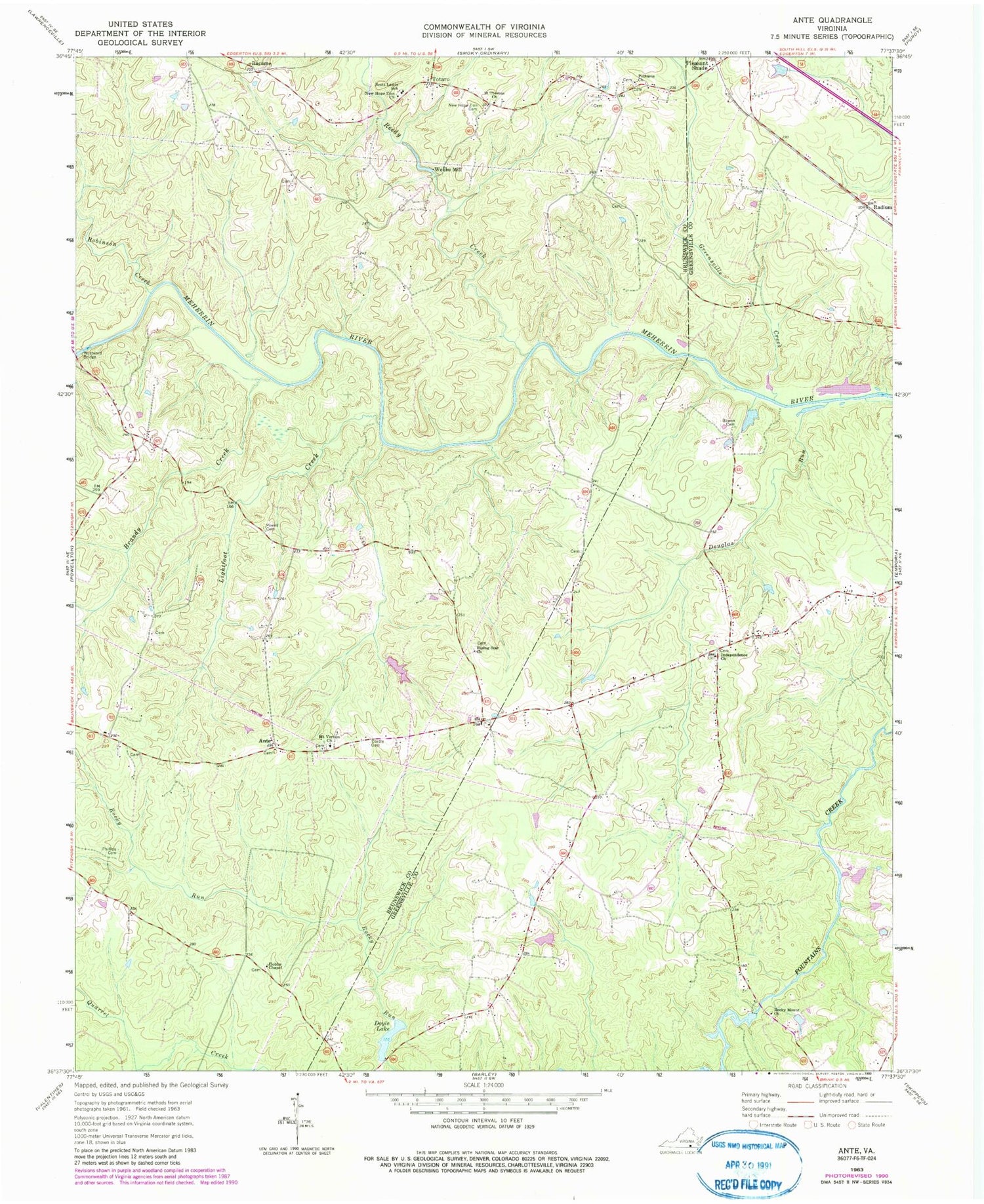
Classic USGS Ante Virginia 7.5'x7.5' Topo Map
Couldn't load pickup availability
Historical USGS topographic quad map of Ante in the state of Virginia. Typical map scale is 1:24,000, but may vary for certain years, if available. Print size: 24" x 27"
This quadrangle is in the following counties: Brunswick, Greensville.
The map contains contour lines, roads, rivers, towns, and lakes. Printed on high-quality waterproof paper with UV fade-resistant inks, and shipped rolled.
Contains the following named places: Bowen Cemetery, Brandy Creek, Cordle Cemetery, Douglas Run, Doyle Lake, Greensville Creek, Hobbs Chapel, Independence Church, Lightfoot Creek, New Hope Zion Cemetery, New Hope Zion Church, Pelhams Church, Phillips Cemetery, Powell Cemetery, Reedy Creek, Rising Star Church, Robinson Creek, Rocky Mount Church, Saint Thomas Church, Scott Lewis School, Westward Bridge, White Oak Creek, Ante, Racume, Radium, Totaro, Mount Vernon Church, Doyles Dam, Mitchells Dam, Mitchells Pond, Webbs Mill, Harris Crossroads, Millpond Creek, Goose Berry Farm, Hill Top Farm, Meadows Branch


