MyTopo
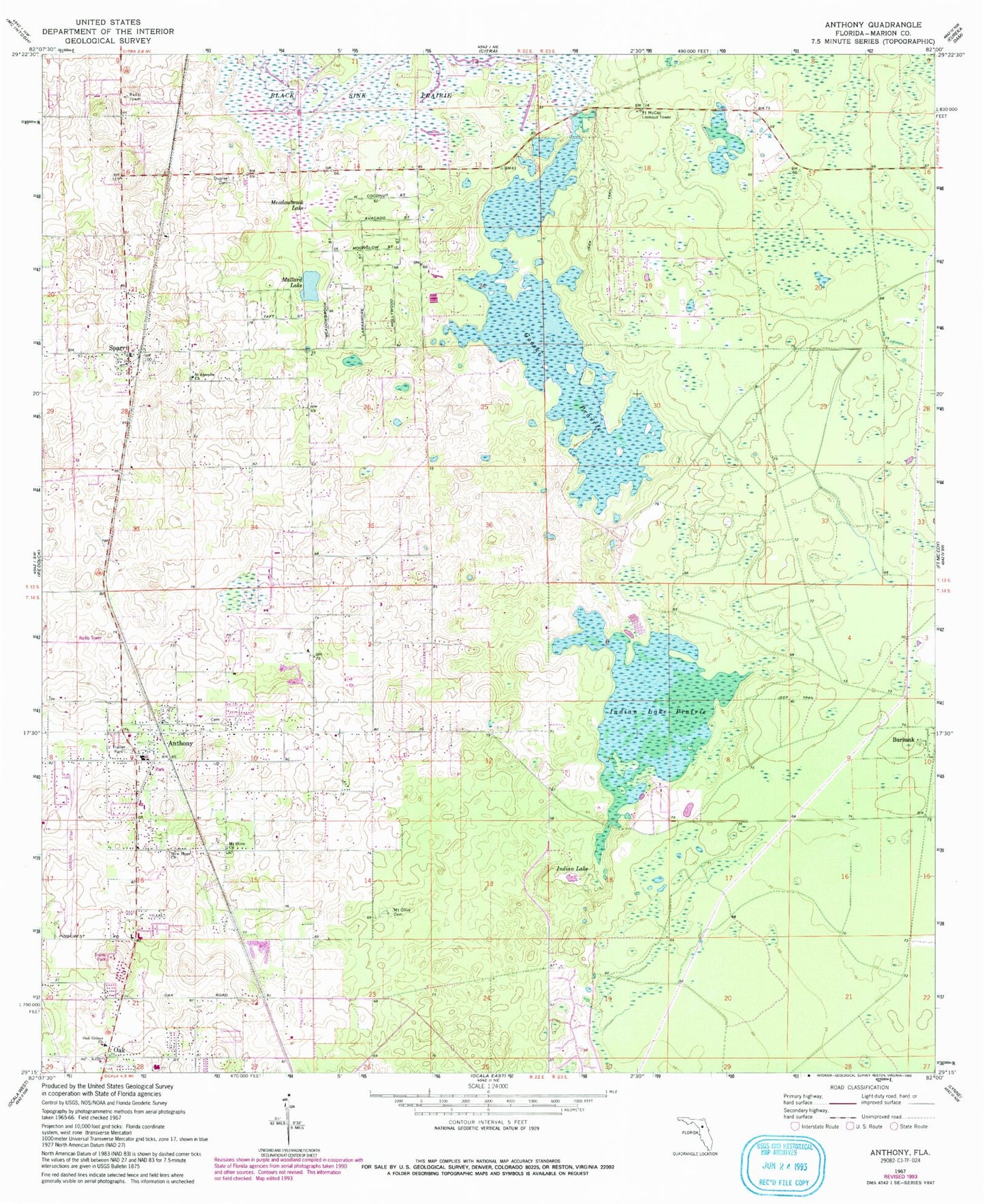
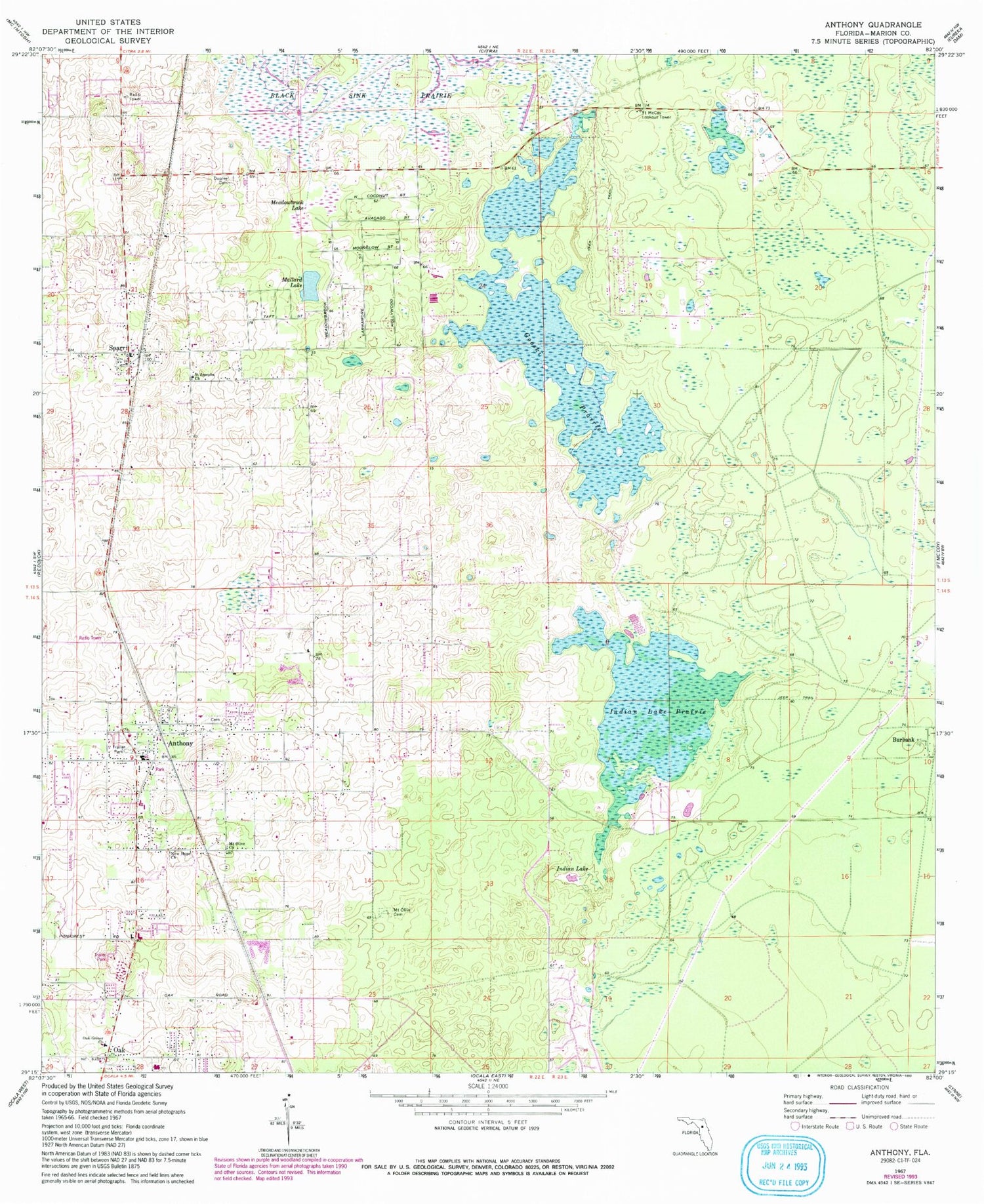
Classic USGS Anthony Florida 7.5'x7.5' Topo Map
Couldn't load pickup availability
Historical USGS topographic quad map of Anthony in the state of Florida. Map scale may vary for some years, but is generally around 1:24,000. Print size is approximately 24" x 27"
This quadrangle is in the following counties: Marion.
The map contains contour lines, roads, rivers, towns, and lakes. Printed on high-quality waterproof paper with UV fade-resistant inks, and shipped rolled.
Contains the following named places: Anthony, Anthony Baptist Church, Anthony Elementary School, Anthony Post Office, Anthony United Methodist Church, Antioch Missionary Baptist Church, Bread of Life Evangelical Church, Burbank, Church of Christ Anthony, Church Triumphant, Cyrs Mobile Home Park, Dupree Cemetery, Fort McCoy Lookout Tower, Fort McCoy-Anthony Division, Gooski Prairie, Greater Saint Joseph AME Church, Indian Lake, Indian Lake Prairie, Jumbolair Airport, Kingdom Hall of Jehovah's Witnesses, Mallard Lake, Marion County Fire Rescue Station 1 Anthony, Marion County Fire Rescue Station 19 Sparr, Meadowbrook Lake, Mount Olive Cemetery, Mount Olive Church, New Hope Missionary Baptist Church, Oak, Oak Mobile Home Park, Oak-Griner Baptist Church, Paniola Air Ranch Airport, Pine United Methodist Church, Sparr, Sparr Baptist Church, Sparr Elementary School, Sparr Post Office, Sparr United Methodist Church, Unity Baptist Church of Anthony, Victory Mobile Home Park, WMMZ-FM (Ocala), WWGO-FM (Silver Springs), Zion Hill Church of God in Christ, ZIP Codes: 32617, 34479