MyTopo
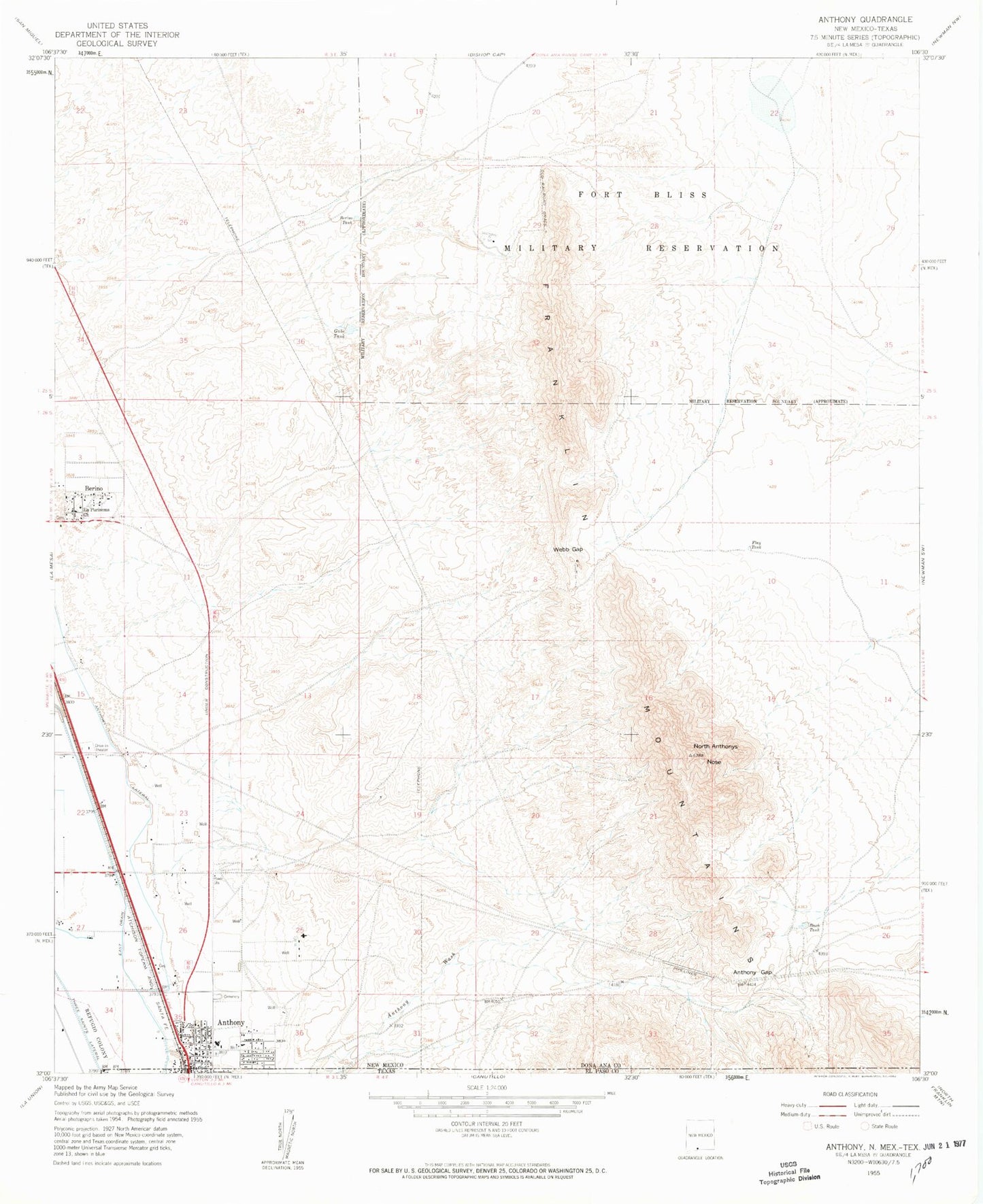
Classic USGS Anthony New Mexico 7.5'x7.5' Topo Map
Couldn't load pickup availability
Historical USGS topographic quad map of Anthony in the state of New Mexico. Map scale may vary for some years, but is generally around 1:24,000. Print size is approximately 24" x 27"
This quadrangle is in the following counties: Do��a Ana, El Paso.
The map contains contour lines, roads, rivers, towns, and lakes. Printed on high-quality waterproof paper with UV fade-resistant inks, and shipped rolled.
Contains the following named places: 10116 Water Well, A-1 Water Well, Anthony, Anthony Arroyo Watershed Site One Dam, Anthony Catholic Cemetery, Anthony Census Designated Place, Anthony Community Cemetery, Anthony Division, Anthony Elementary School, Anthony Gap, Anthony Lateral, Anthony Post Office, Anthony Volunteer Fire Department, Anthony Wash, Beech Tank, Berino, Berino Cemetery, Berino Census Designated Place, Berino Elementary School, Berino Post Office, Berino Tank, Berino Well, City of Anthony, Copiapo Mine, East Drain, First Baptist Church, First United Methodist Church, Flay Tank, Gabe Tank, Hacienda Acres, K 10 Water Well, K 20 Water Well, K 4 Water Well, K 8 Water Well, Kingdom Hall of Jehovah Witness, La Purisema Church, North Anthonys Nose, Number 2 Water Well, Old Berino Cemetery, River Valley Dairy, Saint Anthony's Catholic Cemetery, Story Cemetery, Upper Valley Baptist Church, Webb Gap