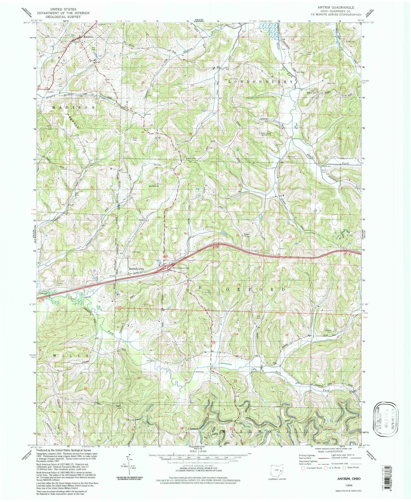
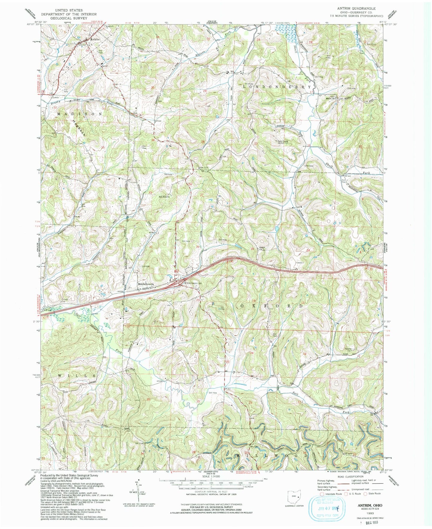
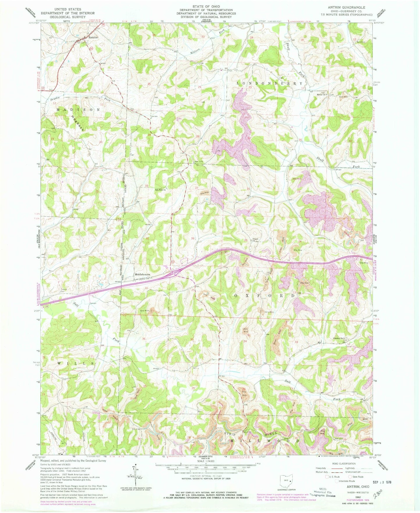
MyTopo
Classic USGS Antrim Ohio 7.5'x7.5' Topo Map
Couldn't load pickup availability
Historical USGS topographic quad map of Antrim in the state of Ohio. Map scale may vary for some years, but is generally around 1:24,000. Print size is approximately 24" x 27"
This quadrangle is in the following counties: Guernsey.
The map contains contour lines, roads, rivers, towns, and lakes. Printed on high-quality waterproof paper with UV fade-resistant inks, and shipped rolled.
Contains the following named places: Antrim, Antrim Community Volunteer Fire Department, Antrim Mennonite Church, Antrim Post Office, Antrim Presbyterian Cemetery, Blooming Grove School, Bond Cemetery, Carlisle Cemetery, Clark School, Fletcher Cemetery, Fletcher Church, Greenwood School, Hogback, Kansas School, Leatherwood School, McCoy Cemetery, Middlebourne, Middlebourne Post Office, Oxford Township School, Pisgah Cemetery, Pisgah Church of Christ, Pleasant Hill School, Pleasant Valley School, Rosedale School, S Bridge, Salt Fork Baptist Cemetery, Salt Fork Baptist Church, Sand Hill School, School Number 12, School Number 8, Township of Oxford, WOUC-FM (Cambridge), WOUC-TV (Cambridge)