MyTopo
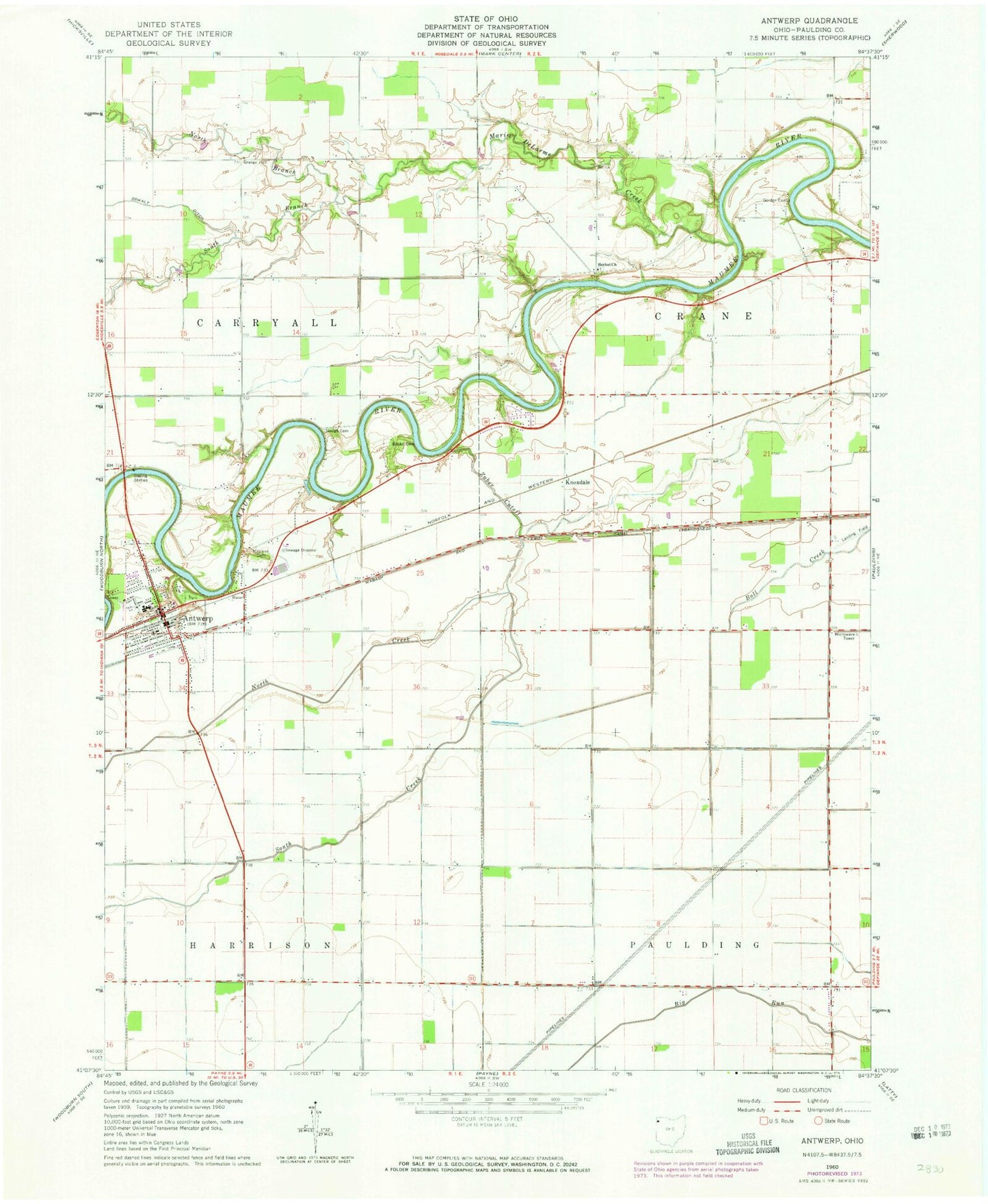
Classic USGS Antwerp Ohio 7.5'x7.5' Topo Map
Couldn't load pickup availability
Historical USGS topographic quad map of Antwerp in the state of Ohio. Map scale may vary for some years, but is generally around 1:24,000. Print size is approximately 24" x 27"
This quadrangle is in the following counties: Paulding.
The map contains contour lines, roads, rivers, towns, and lakes. Printed on high-quality waterproof paper with UV fade-resistant inks, and shipped rolled.
Contains the following named places: Antwerp, Antwerp Branch Library, Antwerp Community Park, Antwerp Elementary School, Antwerp Emergency Medical Services, Antwerp Fire Department, Antwerp High School, Antwerp Police Department, Antwerp Post Office, Antwerp Town Hall, Antwerp United Methodist Church, Arena, Arena Post Office, Armstrong School, Banks Cemetery, Bethel Church, Carryall Township Hall, Chester School, Clark School, Columbia School, Curtis School, Elmtree School, Erter School, Fairview Grange Hall, First Presbyterian Church, Forder Cemetery, Forder School, Gerkins School, Gordon Cemetery, Knoxdale, Knoxdale Post Office, Marie DeLarme Creek, Maumee Cemetery, Methodist Episcopal Cemetery, North Branch Marie DeLarme Creek, North Creek, Oswalt Ditch, Pugh School, Riverbend Mobile Home Park, Riverside Cemetery, Riverside Park, Saint Marys Catholic Church, Schilderink Dairy, School Number 1, School Number 3, School Number 4, School Number 8, School Number 9, Slough Cemetery, South Branch Marie DeLarme Creek, South Creek, Stinger School, Sunnyside School, Township of Carryall, Township of Crane, Village of Antwerp, Zuber Cutoff, ZIP Code: 45813