MyTopo
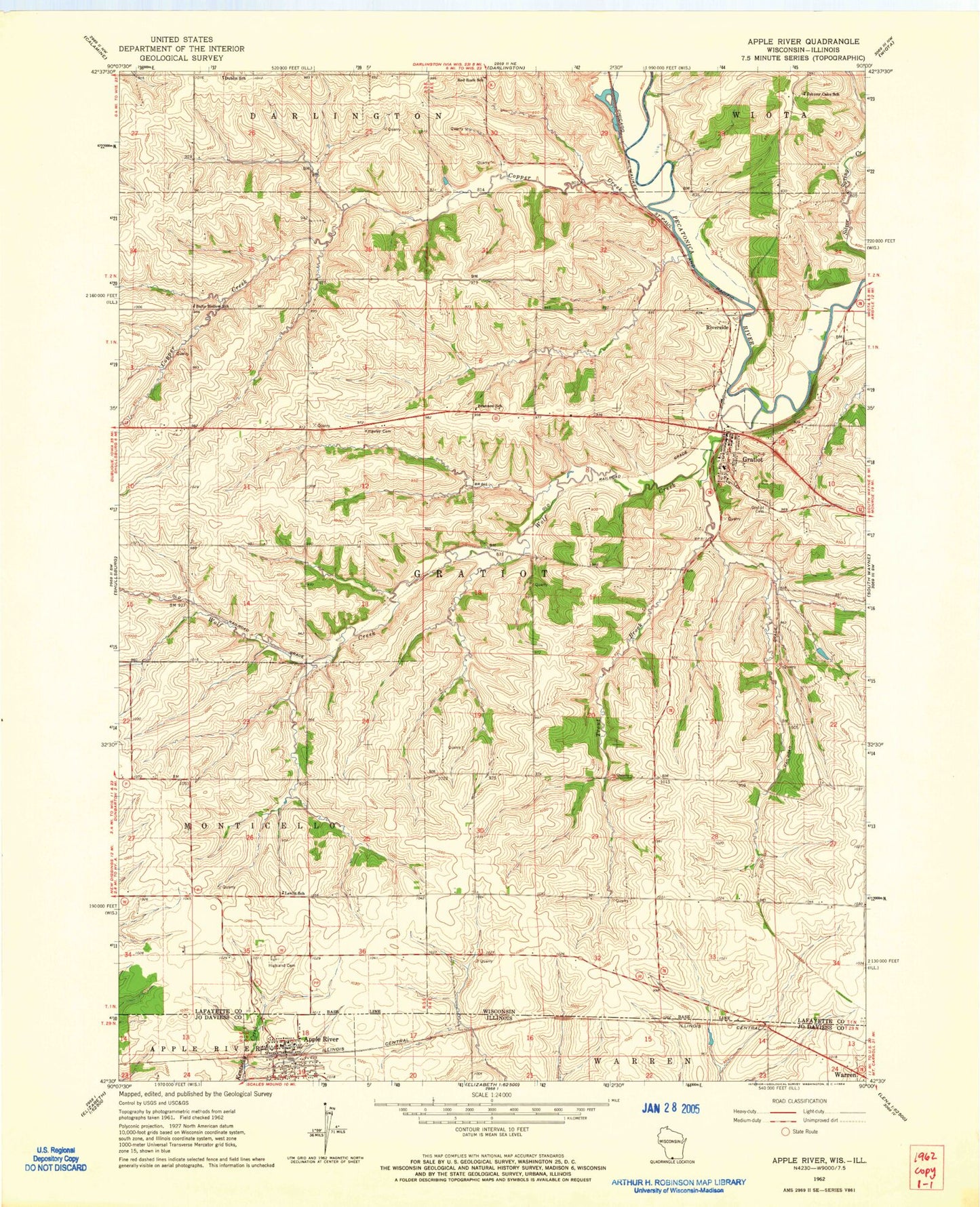
Classic USGS Apple River Illinois 7.5'x7.5' Topo Map
Couldn't load pickup availability
Historical USGS topographic quad map of Apple River in the states of Illinois, Wisconsin. Map scale may vary for some years, but is generally around 1:24,000. Print size is approximately 24" x 27"
This quadrangle is in the following counties: Jo Daviess, Lafayette.
The map contains contour lines, roads, rivers, towns, and lakes. Printed on high-quality waterproof paper with UV fade-resistant inks, and shipped rolled.
Contains the following named places: 0.37 Reservoir, 1 Reservoir, 53541, Apple River, Apple River Fire Department, Apple River Post Office, Apple River United Methodist Church, Black Hawk Middle School, Brannon School, Copper Creek, D and S Farms, Davis Farms, Dublin School, Ernst Dairy, Gill Brothers Dairy, Gratiot, Gratiot Cemetery, Gratiot Post Office, Gratiot Volunteer Fire Department, Hi View Farm, Johnny Cake School, Kingsley Cemetery, Levitt School, Metz Number 1 G9922 Dam, Metz Number 2 G9922 Dam, Monson Udder Farms, Red Rock School, Riverside, Robelia Dairy Farms, Saint Josephs Church, Salty Hollow School, Silent Hollow Farm, Spring Valley Dairy, Stietz Farms, Town of Gratiot, Trout Brook, Village of Apple River, Village of Gratiot, West Ella Highland Cemetery, Whitcomb Farms, Wolf Creek