
MyTopo
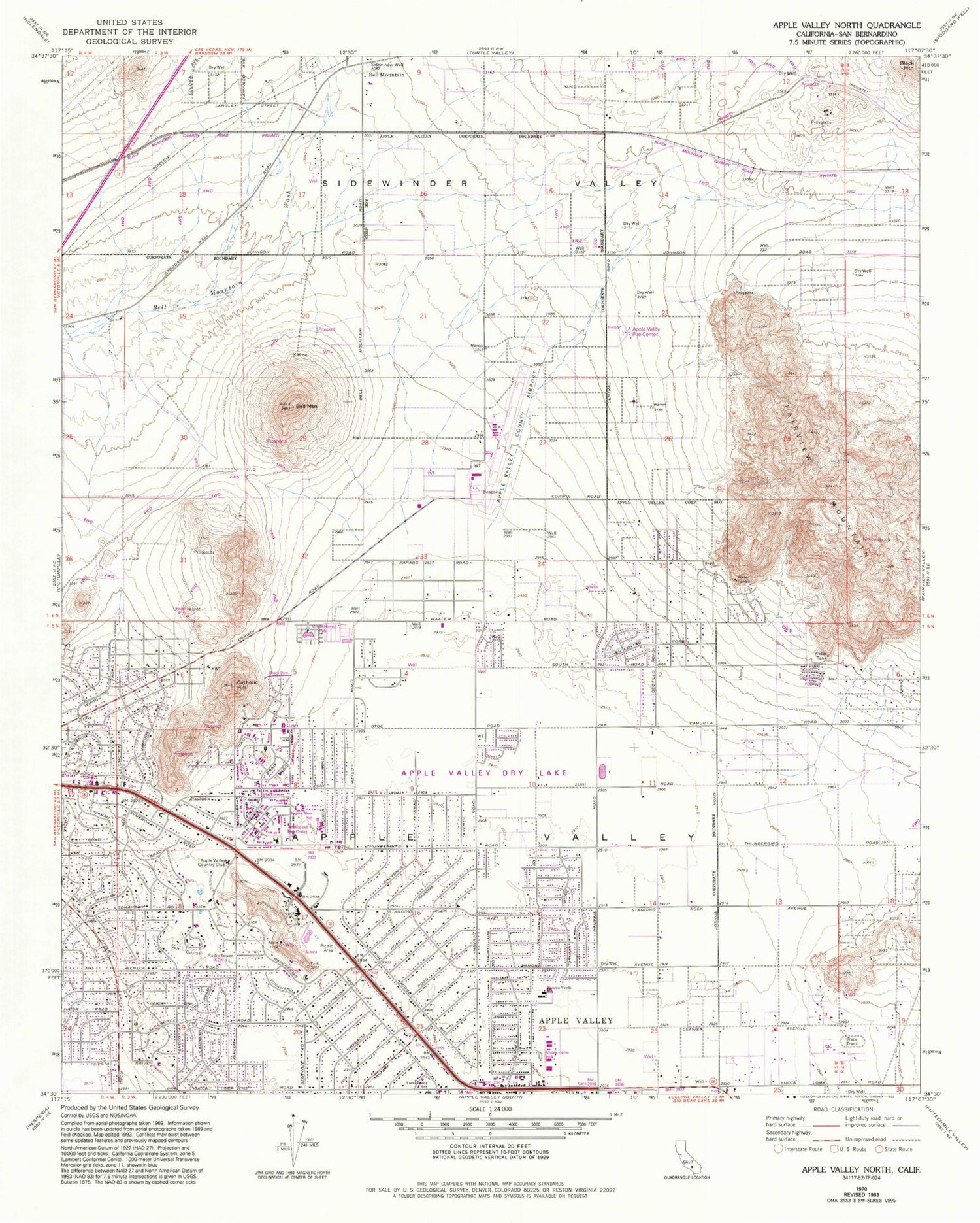
Classic USGS Apple Valley North California 7.5'x7.5' Topo Map
Couldn't load pickup availability
Historical USGS topographic quad map of Apple Valley North in the state of California. Typical map scale is 1:24,000, but may vary for certain years, if available. Print size: 24" x 27"
This quadrangle is in the following counties: San Bernardino.
The map contains contour lines, roads, rivers, towns, and lakes. Printed on high-quality waterproof paper with UV fade-resistant inks, and shipped rolled.
Contains the following named places: Bell Mountain, Bell Mountain, Catholic Hill, Fairview Mountain, Rancho Verde Elementary School, Sidewinder Valley, Sidewinder Well, William E Poole Heliport, Apple Valley Airport, Apple Valley Yacht Club, Apple Valley, KQKL-AM (Apple Valley), KITH-AM (Apple Valley), Apple Pond, Apple Valley Branch San Bernardino County Library, Apple Valley Dry Lake, Apple Valley Fire Center, Apple Valley Grange, Bass Hill, Desert Knolls Manor, Highway 18 Park, Little Bell Mountain, Mojave Mesa Elementary School, Pioneer Mountain, Saint Timothys Preparatory School, Vista Campana Middle School, Virginia Park, Town of Apple Valley, Victorville-Hesperia Division, Apple Valley Fire Protection District Station 331, Apple Valley Fire Protection District Station 333, Apple Valley Police Department, Sunset Hills Memorial Park


